I can't see property lines or other paid features even though I bought a Membership
Elite membership includes property lines for 50 states and a Premium Membership includes property lines for one or two states
Use the form below to search onX Maps
Use the form below to search onX Maps
Elite membership includes property lines for 50 states and a Premium Membership includes property lines for one or two states
Map Tools to study prospective hunting areas, examine property lines, and drop waypoints. Click here to watch the video overview
question, check out these useful resources: I can't see property lines or other paid features even though I bought a Membership
other Folders for nationwide Layers. If you can't see property lines or other paid features, click here. If a county, city
Participating properties will have a grid of green dots or green diagonal lines inside the property. Timber companies:
Lands Layer shows property owned by private individuals or corporations. Never cross onto private property without express
organize Markups for a specific year or hunt. Lines and Areas - Create lines and areas to draw hunting zones on the map or
Map Layers Menu. Participating properties will have a grid of red dots inside the property. Green triangles indicate access
When you add a property to a Folder, the app will create an Area Shape that outlines the property and add it to your saved
Choose a Markup Type (All Content, Waypoints, Areas, Tracks, Lines, or Routes), then click the "Select" button at the top of
Markup's Options. Edit: change a Markups’ colors, Line style, Line weight, and Waypoint icon. Remove from folder: remove
(Waypoints, Routes, Lines Shapes, and Tracks) into the onX Hunt App Exporting Markups (Waypoints, Routes, Lines, Shapes, and Tracks)
The onX Hunt Chip adds Private Lands, Government Lands, and Hunting Units to the map on your GPS, along with topography
Switching to another mapping program can be a painful experience if you don't want to lose your content, but onX Hunt gives
Markup's Options. Edit: change a Markup's colors, Line style, Line weight, and Waypoint icon. Add to folder: add a Markup
My Content Menu. Uploaded Markups (Waypoints, Routes, Lines, Shapes, and Tracks) must be in one of two formats: KML or
devices. Use Share Nearby to send Markups (Waypoints, Routes, Lines, Shapes, and Tracks) to another, nearby user, even when you're
Offline Maps allow you to use the onX Hunt App without cell service, but you must save maps to your mobile device before
Follow along with Jared Larsen as he showcases how to use the line distance tool to be more effective in the whitetail woods
Satellite imagery. Map Tools (mark Waypoints, draw Lines and Shapes). Tracker (record your path as you travel)
The Government Lands Layer shows property owned or managed by government agencies, like the US Forest Service, Bureau of
onX Hunt includes : Private property boundaries and owner information. Government land boundaries and managing agency
available offline. Aerial imagery, topography, and layers like property boundaries are downloaded to your mobile device, so when
location information to show you where you are in relation to property borders and other map features. Tips for setting up your
individual property owner, timber company, NGO (non-governmental organization), ranch, or other private property, and filter
Curious how to find property lines? See our definitive guide with FAQs on finding property lines, changing property lines, and using maps to determine property lines.
Turkeys For Tomorrow is funding research to find out why turkey populations are declining. See our interview with leading researcher Dr. Mike Chamberlain.
Put onX to work for you this season and experience what happens when you turn small tracts of land into big whitetail opportunities.
Have new hunting property and looking for ways to set it up for the best hunting experience? Here are five tips for setting up a new property with the onX Hunt App.
Turn any device into a parcel viewer with the onX Hunt App. Unlock land ownership maps data with our Private Land maps. When hunting, know where you stand.
Explore with onX Hunt Elite's exclusive map tools: Recent Imagery, Leaf Off Imagery, TerrainX, and Route Builder. Enhance your hunt with elite mapping tools.
onX Hunt is free for Basic memberships, $34.99 for Premium, $49.99 for Premium Two State, and $99.99 for Elite (50 states). Learn more about onX pricing and try today.
Win tickets to Trampled by Turtles at Pheasants Forever's Concert for Conservation, plus backstage passes, lodging, and Pheasant Fest access with onX Hunt!
onX Hunt is free for Basic memberships, $29.99 for Premium, $44.99 for Premium Two State, and $99.99 for Elite (50 states). Learn more about onX pricing and try today.
Looking for a hunting app with GPS tracker, waypoints, property lines, accurate land ownership maps, and works offline? Try onX Hunt! Free trial. Learn more.
Looking for a hunting app with GPS tracker, waypoints, property lines, accurate land ownership maps, and works offline? Try onX Hunt! Free trial. Learn more.
Looking for a hunting app ideal for turkey hunting? Try onX Hunt. See why millions of hunters trust onX. Free trial. Learn more.
The onX Hunt price is free for Basic memberships, $29.99 for Premium and $99.99 for Elite (50 states). Learn more about onX pricing and try today.
Find public & private hunting land in Indiana with the #1 hunting GPS Map App. View Zone & DNR Maps, land boundaries, aerial, topo, and more!
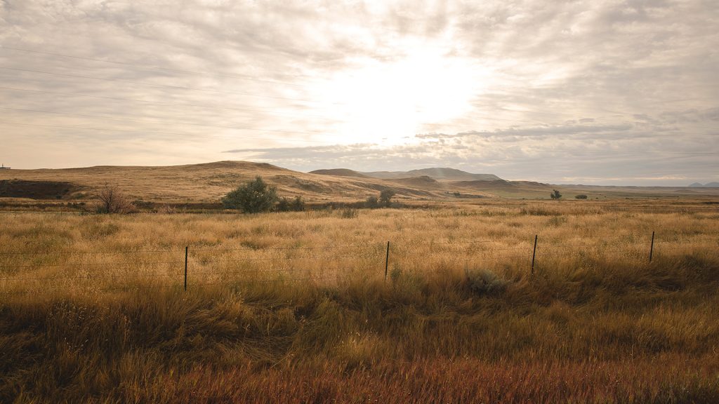
Find public and private hunting land in Montana with the #1 hunting GPS and map app. View BLM maps, landownership, aerial, topo, and more.
Find public & private hunting land in Wisconsin with the #1 hunting GPS Map App. View MFL maps, boundaries, ownership, topo, and more!
Find public and private hunting land in West Virginia with the #1 hunting GPS Map App. View DNR & WMA Maps, land boundaries, topo, and more!
Find public & private hunting land in Washington with the #1 hunting GPS Map App. View WDFW & GMU Maps, landownership, topo, and more.
Find public and private hunting land in Virginia with the #1 hunting GPS Map App. View WMA maps, land boundaries, aerial, topo, and more!
Find public & private hunting land in Vermont with the #1 hunting GPS Map App. View WMA & Zone Maps, land boundaries, aerial, topo, and more.
Find public & private hunting land in Utah with the #1 hunting GPS Map App. View DWR & CWMU Maps, landownership, aerial, topo, and more!
Find public & private hunting land in Texas with the #1 hunting GPS Map App. View TPWD Lands & WMA Maps, land boundaries, topo maps and more.
Find public & private hunting land in Tennessee with the #1 hunting GPS Map App. TWRA & WMA Maps, landownership, aerial, topo, and more.
Find public & private hunting land in South Dakota with the #1 hunting GPS Map App. View Unit Maps, landownership, aerial, topo, & more!
Find public & private hunting land in South Carolina with the #1 hunting GPS Map App. View WMA & Game Zone Maps, land boundaries, and more!