
The Ultimate Backcountry Navigation App – 60% off
Purpose-built for all your outdoor pursuits. Try 3D maps specifically tailored for hiking, backcountry skiing, mountain biking, or rock climbing.
Get 60% off for a limited time only! Our biggest sale of the year ends in:
Purpose-built for all your outdoor pursuits. Try 3D maps specifically tailored for hiking, backcountry skiing, mountain biking, or rock climbing.
Get 60% off for a limited time only! Our biggest sale of the year ends in:
Confidence & Clarity in the Backcountry

Offline on Purpose
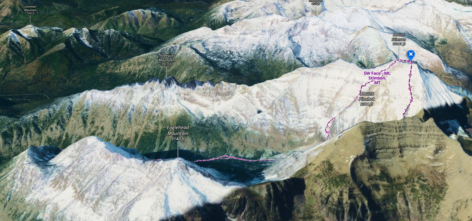
View and understand complex terrain clearly, with vivid, LiDAR-based topo, 3D maps, slope angle and slope aspect—just download to access offline for total in-field confidence.

Plan Smart with Conditions Layers
Evaluate terrain conditions more intuitively. If you’re skiing this winter, try out the ATES layer and the Avalanche Simulator, which provide vital clarity when making critical decisions before and during your tour. Learn More.

Easily Transition Base Maps
Switch between Snow Imagery, Recent Satellite Imagery, Hybrid, and Topo layers while planning your tour, ensuring you have the best possible view of the terrain ahead.

Never Get Lost
Always know exactly where you are and what’s ahead. Navigate confidently with precise GPS positioning, detailed offline terrain, and clearly market routes. Even when weather or plans change Learn More.
Discover Expert-curated Ski Tours, Hiking and MTB Routes
Access expert-built Routes, complete with clear decision points, detailed terrain insights, and reliable beta. Discover new objectives in Mount Rainier, Mount St. Helens, Mount Adams, Silverton, Vail Pass, and beyond. Learn More

Create & Save Custom Routes
Use the Route Builder tool to create, save, and share your own custom routes using trails and paths on the map with just a few clicks of a button.
Ready For Adventure?
We are building the best all-in-one mapping tool for the outdoor community, and we want you to be part of helping us make it everyone’s go-to map.
Premium
Plan your next ski tour, mountain bike ride, hike, or rock climb with hundreds of thousands of miles of trails and routes. Save unlimited Offline Maps, view the world in immersive 3D, build custom routes, see recent trail conditions reports, analyze avalanche terrain, and so much more.
$29.99 $12.00 for 12 Months
Elite
Get full access to all our best mapping features – all the features of a Premium membership, plus Elite-only features including private land boundaries + landowner names, Recent Imagery, and exclusive outdoor gear discounts. Get your eyes on the conditions on the ground before setting off on your adventure, and always be certain you’re in the right terrain.
$99.99 $40.00 for 12 Months
7-Day Trial
Get a free trial which includes full access to an Elite membership for seven days. During the free trial you will be able to access satellite, topo, and hybrid maps, see guidebook-quality Adventures, discover Featured Trails with trail descriptions and photos, save unlimited offline maps, Track trips, add Waypoints, and share trails and Markups with other Backcountry users.
Free
![]()
All The Data You Need in One Place
onX Backcountry puts all of the information you need to plan your next adventure in one App. Giving you essential information on trail networks, campsites, backcountry ski routes, and public land boundaries, allowing you to plan your excursions with confidence. Whether you’re hiking, backpacking, biking, climbing, skiing or simply enjoying nature, onX Backcountry is the essential companion that combines convenience, accuracy, and comprehensive knowledge in a single, user-friendly application. Click through the modes below to see how onX Backcountry maps are purpose-built for your specific outdoor activity.
Trusted by Outdoor Enthusiasts


What Our Members Are Saying
Nailed It
As essential as any piece of gear I take into the backcountry. Nuff said, highly recommended.
As essential as any piece of gear I take into the backcountry. Nuff said, highly recommended.
Exceptional mapping and information app
While in the backcountry, you need a good mapping and information app. This one does it all, extremely well. You have all you need right at your fingertips.
While in the backcountry, you need a good mapping and information app. This one does it all, extremely well. You have all you need right at your fingertips.
Truly fantastic app and great support team
onX support is top notch. If you’re a subscriber, and you’re stuck or have questions there is an easy way to get in touch with the support team; you get to speak to a real person who can walk you through your issues/…
Read more
onX support is top notch. If you’re a subscriber, and you’re stuck or have questions there is an easy way to get in touch with the support team; you get to speak to a real person who can walk you through your issues/questions.