

Free 1-Month onX Backcountry Elite Membership
onX Backcountry is the ultimate GPS navigation app, purpose-built for all your outdoor pursuits. Try 3D offline maps specifically tailored for hiking, backcountry skiing, mountain biking, or rock climbing.
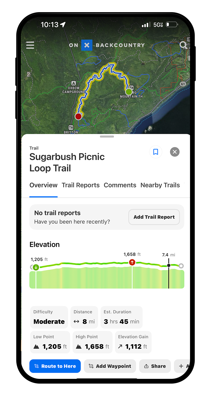
Hiking
onX Backcountry features an extensive database of hiking trails, offering users access to detailed information on trail lengths, difficulty levels, and elevation profiles. The app provides real-time GPS tracking and offline maps, ensuring hikers can navigate with confidence and always know exactly where they are on the map, even in areas without cell service. onX Backcountry helps adventurers discover new trails and plan their hiking adventures with a comprehensive understanding of what to expect on their journey.
Backcountry Skiing
The Snow Mode feature in onX Backcountry is specifically designed for backcountry skiing enthusiasts, providing critical information such as slope angles, avalanche forecasts, and guidebook quality backcountry routes. It enables skiers to assess the safety and suitability of ski routes with precision, thanks to real-time GPS tracking and offline map access for navigation in remote areas. This mode enhances the skiing experience by offering insights into terrain features, helping skiers make informed decisions for a safe and enjoyable adventure in the snow.

Mountain Biking
onX Backcountry’s dedicated section for mountain bike trails delivers a comprehensive guide to biking paths, featuring detailed descriptions of trail lengths, difficulty ratings, and elevation changes. It equips riders with GPS tracking capabilities and offline maps, ensuring seamless navigation through diverse terrains, from serene forest paths to challenging mountain trails. The app also incorporates MTB Project data, including reviews and photos, allowing bikers to explore and select trails that best match their skill level and adventure spirit, making it an essential tool for planning exhilarating mountain biking experiences.
Rock Climbing
onX Backcountry integrates Mountain Project data and offers an in-depth look at climbing routes with detailed information on location, difficulty, and type of climb (e.g., bouldering, sport, or traditional). The app provides climbers with offline access to maps and GPS tracking, ensuring they can find their way to the crag or boulder, even in remote areas without cell reception. Additionally, it integrates user reviews and photos, allowing climbers to gauge the quality and current conditions of routes, making onX Backcountry an invaluable tool for planning and executing climbing adventures safely and efficiently.