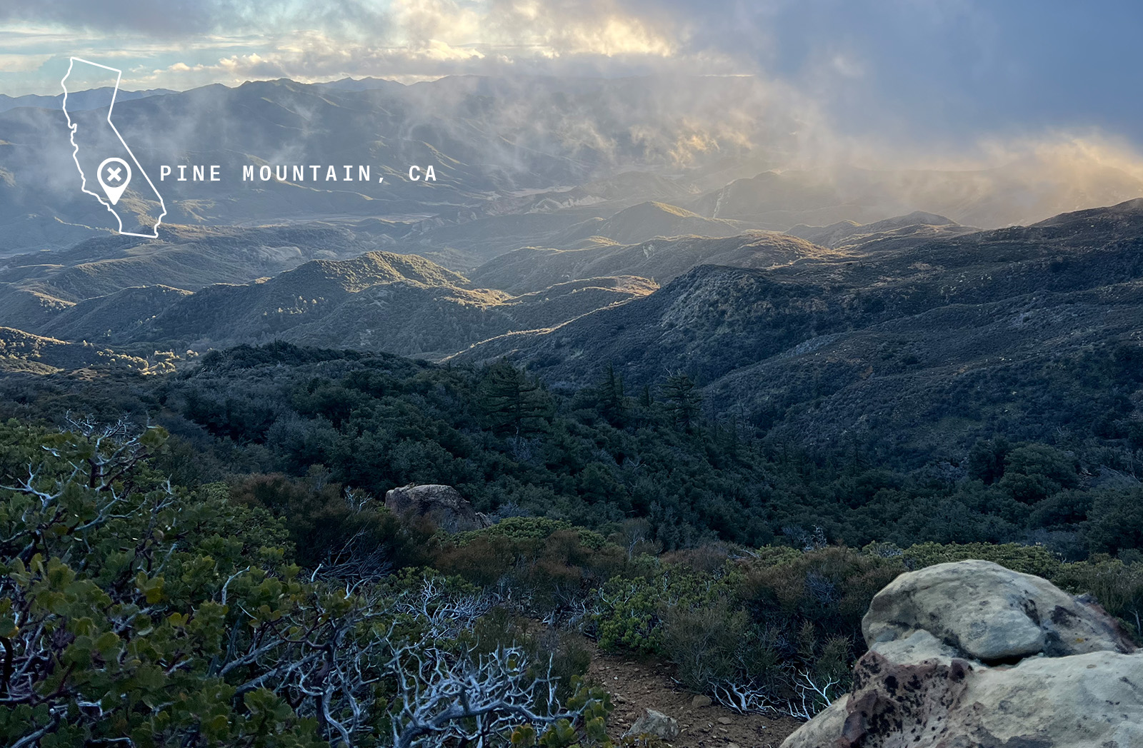
Uncovered Access in Los Padres National Forest
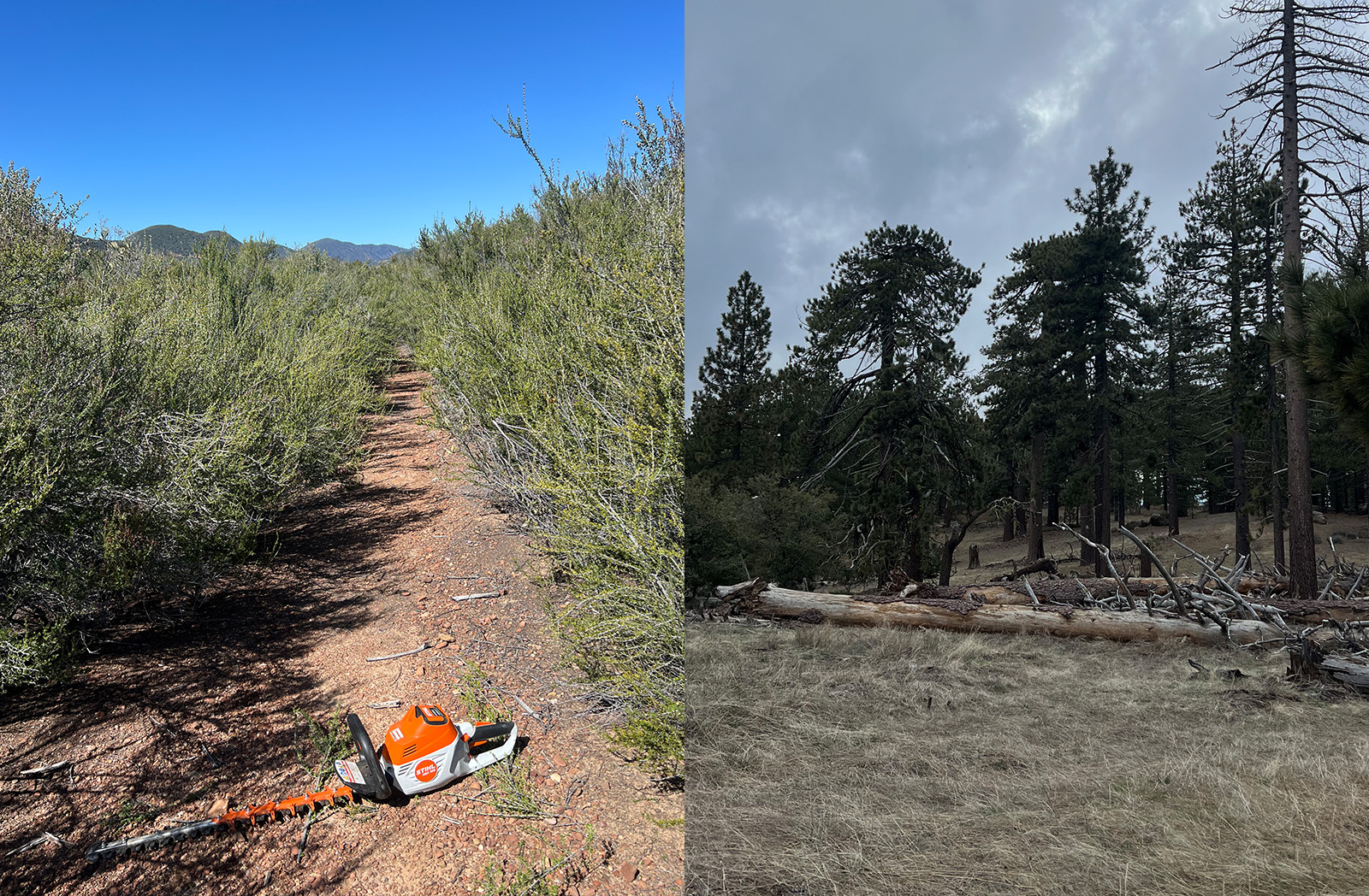
In 2022, the onX Access and Stewardship program awarded the Sage Trail Alliance an Adventure Forever Grant to work on two trails in the Los Padres National Forest—three hours north of Los Angeles, California. The trails, Chorro Grande and Boulder Canyon, were damaged by fires, floods, and wind in the years leading up to the grant. “They were impacted by high severity fire that left them in unusable condition,” reflects Dillon Osleger, the Executive Director of Sage Trail Alliance. Access to this zone was a harrowing journey of blown-down timber and troublesome navigation. Improving public access isn’t as singular as just putting more acres on the map, it’s also making sure the physical acres can be utilized. That’s what made this project so enticing—though the area was on public land, it was lost to time. With the help of staff and volunteers, Sage Trail Alliance set off for a few overnight stewardship campouts. Equipped with hand tools and a few chainsaws, they removed blowdowns and regraded trails.
The grant enabled the Sage Trail Alliance to help alleviate the backlog of maintenance the United States Forest Service faces. They operate on a volunteer service agreement which makes them a partner with the Los Padres National Forest in Region Five. In 2022, their region of work experienced 18 inches of rain in 24 hours. Previous to that in 2017 into 2018, the Thomas Fire devastated Santa Barbara County. These natural events took a toll on the trail and, by extension, the access to this area of the Los Padres. While the work is ongoing to maintain these trails, this push for restoration has unlocked some incredible backcountry experiences that are close to metro Los Angeles.
A Tale of Two Descents
“The trails are world-class,” Osleger proclaims. The trails are on opposite slopes of Pine Mountain. Boulder Canyon trail faces north and begins in a pine forest with loamy soil before diving down into Cuyama Valley which Osleger describes as a badlands area with a dried-up river bed. Agriculture here is dominated by pistachios and almonds. As you descend through the ecosystems, pine yields to canyon oak trees, followed by chaparral system, and terminates in a traditional shrubby lowland area. It’s a ripping trail on a bike, but is also an incredible hike or access for deer hunting. Its proximity to a Wilderness zone makes it an attractive spot for black-tail pursuits.
Chorro, on the opposite side of Pine Mountain and south-facing, has a feel akin to the Mammoth Lakes area. “The geology is so diverse that the riding feels as though it takes place in four different regions,” Osleger shares. It falls into chaparral, followed by a meadow with big grasses and rose hips.
Each trail can be shuttled using Pine Mountain Ridge Road, or if you’re chasing a big day, you can ascend these trails. You’ll be rewarded with a descent of 7,479 feet over 10 miles across both Chorro and Boulder Canyon trails. The riding is fast, but chunky. The rocks are often square-edged with lots of sandstone and limestone making for a pretty technical experience. Osleger recommends bikes with no less than 140 millimeters of travel. It’s backcountry riding at its finest, but, as always, be prepared for the terrain you’re getting into. That means bringing extra water, spare tubes, and sharing your trip plan with someone back home.
Depth Over Breadth
The trails in this area were used by the Chumash to access timber, hunting, and other resources from the forest. “The trails we ride are rarely built for recreational purposes,” Osleger notes. With the recent transformation of trails from function into fun, he takes a unique approach. His focus becomes on the depth of the trail rather than breadth. Diving in, he says, “When I look at a map, I see all the lines. I get what’s already there, but my interest is in the negative space—where things are missing. Nothing in the real world is negative space.” A trail, in the case of California, has been used by generations of people, for a myriad of reasons, and for millennia. He asks, “Why did people care enough to create that trail? Why did people maintain it after all those years?” To answer these questions, and to satisfy his geologist curiosity, Osleger tracks down as many maps as he can find. With publications dating back to the early 1800’s he’s able to assemble the story of the trail—a rich narrative that gives meaning beyond just serving as a means of travel.
Through this research and curiosity, he recovered the location of mortar bowls on the Chorro trail—tools the Chumash used to grind pine nuts and acorns 1,500 years ago. “You can see that these have been used so much longer than any of us have been, or will be, around. That’s what interests me. How do you tell people those things without just putting a bunch of signs up? How do you get that history into people’s hands? How do you get them to care about that?” The answer, well, it’s at the core of what onX stands for. “It starts with just getting them out there,” he says. Yet, the future of Pine Mountain is very uncertain.
There’s a Storm Brewing
According to a Forest Service release, “On May 8, 2020, Los Padres National Forest introduced a plan to protect areas of Pine Mountain and Reyes Peak on the boundary of the Ojai and Mt. Pinos Ranger Districts that are at extreme risk due to overstocking and the devastating impacts of disease and insect infestation.” This is to say that the Forest Service is considering a proposal to harvest timber from the ridge on Pine Mountain to Reyes Peak. It’s roughly a 755-acre parcel of sky island habitat that the forest service says will reduce fire load on the ground and in the canopy. In addition, the intent is to act as a fire break from nearby Ojai. A group called Protect Pine Mountain claims that the forest service skirted the NEPA process and that the project will be detrimental to habitat and traditional historic sites within the area. According to Osleger, the project is under an injunction but is slated to begin in the fall of 2024.
The way forward is likely a balance of interests, one that appeases the many land users that call this place special. Harvest and protection can seem always at odds, but engaging in the conversation and the place in meaningful ways is the best that we know how to navigate tumultuous times. It’s important, as part of the outdoor recreation community and as civic participants, that we visit the place in question, educate ourselves on the issue at hand, and engage when possible. Open comment periods have concluded for Pine Mountain, but we urge you to follow the Los Padres National Forest for further updates. And to Osleger’s earlier point, the best way to care about a place is to just—get out there.
Discover the onX Access and Stewardship Program
Read reports, browse stories, and get inspired.