Prepare for Ice Fishing Season With onX Fish
Anglers across the ice belt have long known that the best in their craft seem to have an advantage. They fish the best waters, at optimal times throughout the season, with the best means possible. They tend not to chase reports but instead make their own, always seemingly a few steps ahead of the crowds that descend upon community spots. They fish the big, popular waters, but also know small lakes nearby, and can turn on a dime to switch from species that don’t cooperate to ones that do. Often, these anglers are guides or tournament-junkies, who push the sport forward through innovative approaches or modifications on existing popular ones.
Yet, the one thing in common that all these anglers have in spades, is the uncanny ability to be in the right place at the right time. For years, these anglers would study lakes as a matter of habit, inquiring at regional fisheries offices, requesting abundance data, and generally being a student of the bodies of water they fish. It’s impossible to catch fish where they’re not, and the best plans fail miserably if intended species of target size simply aren’t in the system they’re fishing. onX Fish, a new app for the Midwest, aims to change all that, making smart anglers, even smarter.
Make a Plan: Find New Places To Ice Fish

Any angler worth their salt has consulted fisheries data—it’s simply what the best anglers for any species do. They understand these datapoints to be a key piece of the puzzle for even beginning to plan where to fish, winter, or summer. Depending on your locale, this data can be found in report formats, easily readable on a lake-by-lake basis. Yet, analog data viewed manually makes for tough reading, especially when having to compare against multiple lakes in a given area. onX Fish solves that problem, making fisheries surveys easily understandable and—better yet—making them infinitely searchable by species of interest.


Find New Ice Fishing Lakes
With current ice cover data, you can know where to go at a glance. Start using onX Fish Midwest today.
As anglers first log in, they’re taken to a general map area we’re all familiar with, complete with aerial photography backdrops and annotated place information. They can zoom in and out to areas of interest, noting their favorite lakes and nearby fishing spots that include lake acreage, survey year, and maximum depth. Lakes of interest can always be saved as “favorites” either to revisit or generally noted as a popular lake that’s of interest.
A deeper dive reveals a selection system for lakes and the species that inhabit them; onX calls this system “Filters.” Simply click on the button, and start selecting criteria you wish to search the zoom area for. For example, as ice-anglers, we may be interested in winter crappies for a meal. Select “crappies” as your species and “Keeper Potential,” along with any other requirements you may have for lake characteristics of interest. Keeper Potential identifies lakes where a substantial number of fish in traditional keeper ranges exist. Similarly, “Trophy Potential” identifies lakes where large members of species have been sampled. It’s important to note that this is not crowdsourced data, older historical suggestions, or reports from sports shops or guides; these are actual fish, held, measured, and recorded by fisheries biologists from their respective states. Finding a place to fish (that actually holds the fish you’re interested in catching) has never been easier.
Get to the Lake: Find Lake Access Points

Public access points are the superhighways of ice anglers everywhere, and knowing how to navigate to or from is of primary importance. That’s made even easier by the public access annotations on the map. Clicking on them reveals even more data, regarding the type of launch it is, down to the weather at that specific landing. From the App, anglers can use Apple or Google mapping by clicking on “Driving Directions” to navigate turn-by-turn on land to the access of interest.
Finding lakes is one thing, but the logistics of accessing them legally is another, especially in the winter on smaller, private water. onX Fish, like its big brother onX Hunt, has best-in-class public/private land ownership data, helping anglers determine how to access even private waters legally. Federal, state-owned, and tax-forfeit designated parcels that are directly adjacent to lakes offer prime potential for finding your next lake off-the-beaten-path.
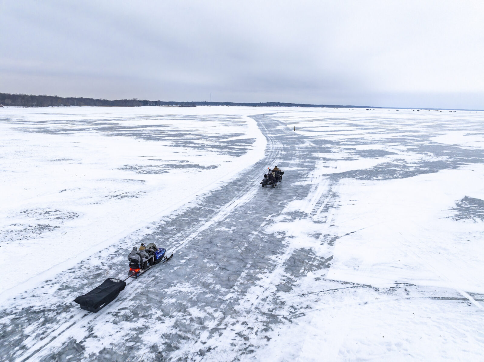
Of course, roads and trails of different kinds are listed on the map as well, just like in onX Hunt. For onX Fish users in the winter, snowmobile trails are clearly detailed on the map, offering those with sleds a prime way to access lakes that you’ve already selected. Trails, United States Forest Service roads, and many tracks are also detailed on the map, giving winter anglers all the navigation resources they need in a single app.
On the Lake: Recent Satellite Imagery, Bathymertry, Waypoints and More
Once you’ve selected new, promising water to fish and you’ve navigated your way onto that water body, it’s time to fish. As ice anglers, there’s no better tool than onX Fish to view everything you’ll need for a day of fishing. That’s true if you’re looking at your cell phone, running onX Fish on a tablet, or using Apple Carplay to connect to your vehicle’s in-dash screen. While out on the ice, you can make use of onX Fish and see your location from spot to spot.
Recent Imagery

In the name of safety, anglers can go into “Layers” to consult recent satellite imagery to view cracks, open-water locations, or last-to-freeze spots that could be problematic throughout the winter. A scrolling history of Recent Imagery allows anglers to view activity on the lake as well, down to plowed roads deemed safe and marked by resorts. Use the tracking feature to start your entry to the ice, ensuring you safe passage by means of re-tracing your steps on the way back. Up-to-date weather forecasts are in the weather tab at lower right corner, giving anglers an hour-by-hour update, complete with barometric pressure, moon phase, major/minor timing, and precipitation on map.
Fishing Hot Spots
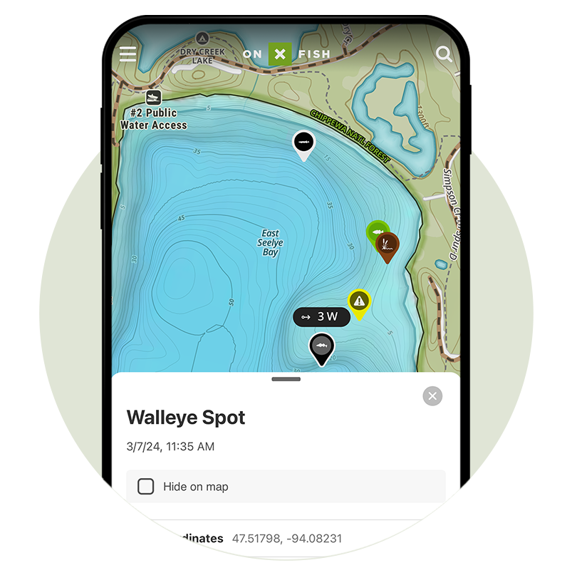
For some lakes, anglers may note blue dots that have general recommendations for time of year, popular species, and even ways to catch them. These are Fishing Hotspots datapoints, intended to give anglers a first pass of some likely locations of fish activity. Bathymetry suggests basins, steep drop-offs, points, inside-turns, and other likely locations of the fish species you’re interested in catching.
Waypoints

Once a likely location is determined or a fish is caught, store customized Waypoints to easily lead you back to the same spot, and document your catch. Photos can be attached to Waypoints within the app, and can be organized into folders for specific lakes, years, species, etc. Build a route for intended next-spots, and tie them into existing Waypoints to create a “milk run” to hit as part of plans you share with friends.
onX Fish will change the way you plan, access, and ultimately fish the lakes you know and love. More importantly, onX Fish gives anglers the confidence to find new water, be their own guide, and make their own reports—not chase them.


Plan Ahead With the onX Fish App
Start using onX Fish Midwest today.