Our curated map tools and layers are designed to help you have more success in the field, from Maine to Alabama, Michigan to Pennsylvania—and beyond.
We’re hunters, and so we design products for hunters. It’s pretty simple. We won’t send you into the field with a product that we don’t use ourselves—we’re our toughest critic when it comes to testing, trialing, and improving our tools. And while we’re headquartered in the mountain town of Missoula, Montana, many of our in-house staff originally hail from the eastern half of the country—a breadth of knowledge that means we’re always weighing the usefulness of Hunt App features for all manner of hunters.
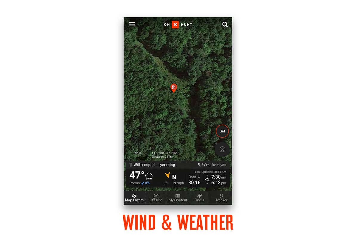
Wind & Weather
At onX, we believe in the power of weather to affect our hunt, so we’re proud to announce the arrival of our new Wind & Weather feature in the onX Hunt App. Enjoy live weather reports, weather forecasts, wind direction, sunrise/sunset times, and barometric pressure—all curated within the onX Hunt App to keep everything you need in one convenient place.
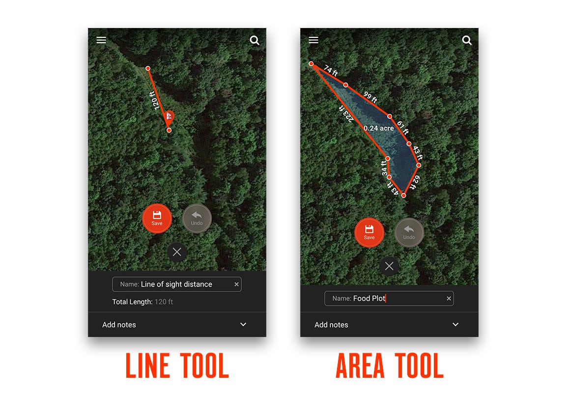
Map Tools: Line and Area Measurement, Tracker
Wondering how much seed to buy? Use onX’s Area Shape Tool to determine the acreage of your plot and the Line Distance Tool to measure distance point-to-point.
The Tracking feature in the onX Hunt App records your path as you travel. Turn Tracker on, and the blue location dot will turn red when Tracker is recording your path. Pause Tracker, and the dot will turn yellow, resuming its red color when you resume tracking. Once you’re finished, save your track for future reference—along with a visual representation of your path, the Tracker will record your time, distance traveled, and average speed.
Drop and Share Waypoints
Any hunter who places multiple trail cameras appreciates the ability to mark camera locations. Many of our onX staff deploy nearly a dozen cameras, and the ability to reference a Waypoint to see where you placed a trail cam can be helpful come September when you aren’t entirely sure where you put a couple of your experimental cameras.
Use Waypoints to mark your truck location (with hunting on the mind, it’s easy to forget just where you parked), tree stands, and even promising-looking wallows and fields.
Hunters can share Waypoints to onX and non-onX users via text, email, or any other messaging apps. The sharing feature is a great tool to allow family or friends to know the location of camp or a planned route in case of emergency.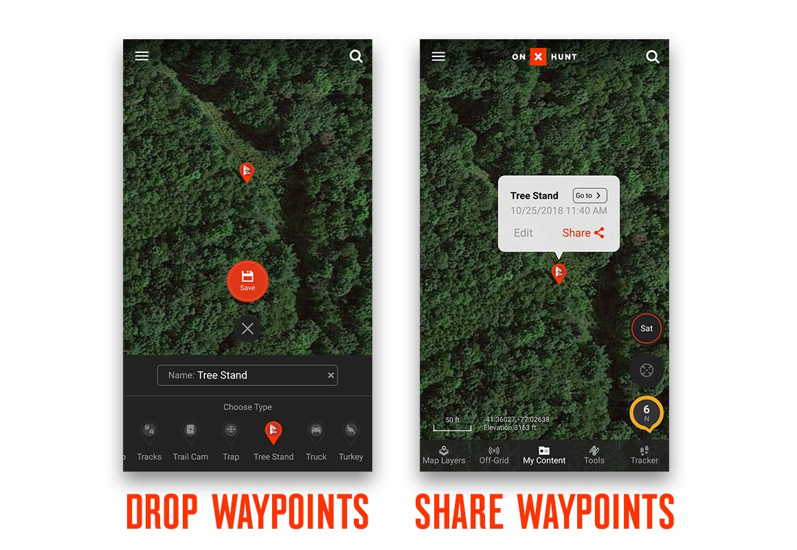
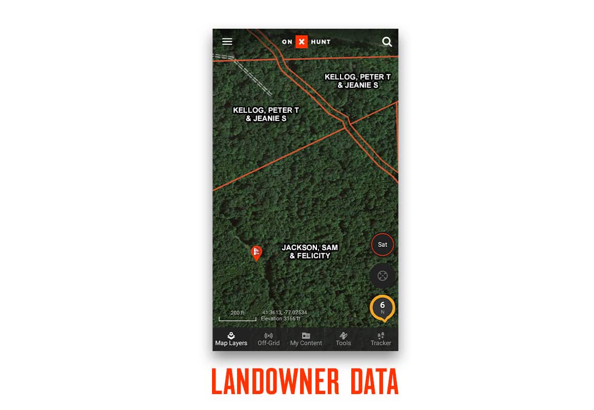
Private Land Ownership Data
One of the most utilized tools of the onX Hunt App is extensive private/public property boundaries. Our maps show clearly marked property boundaries, public and private landowner names, and more—giving you everything you need to stay legal and ethical. With more than 121 million private properties listed, gaining landowner permission may be one of the most obvious uses of onX. We have the most accurate and up-to-date property ownership available on the market, making it easier than ever to contact landowners to request hunting access.
When you see a stud buck munching on soybeans in late July, onX makes it incredibly easy to send the landowner a letter, stop by and knock on the door, or even look up landowner information in the Whitepages. The onX Hunt App also provides useful information such as acreage of the property and management unit details, making it easy to do your homework.
Conservation and Partner Layers
We’re proud to partner with a number of nationwide conservation associations. Through developing specialty layers, supporting various events and ongoing projects, and sharing marketing efforts, we embrace organizations that support wildlife conservation and public lands efforts. While we also partner with the Rocky Mountain Elk Foundation, Backcountry Hunters & Anglers, and other western groups, two of our purpose-built layers have special use for eastern hunters.
National Deer Association Chronic Wasting Disease Map Layer
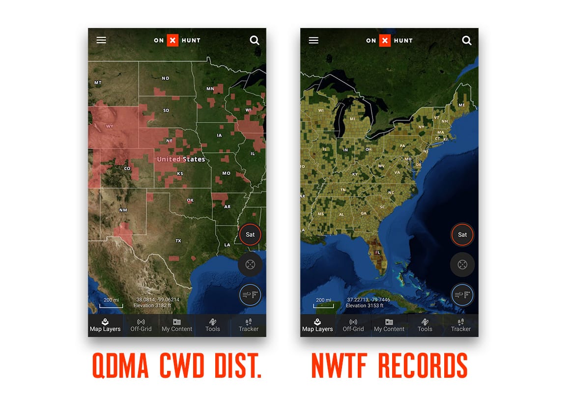
Built in collaboration with the National Deer Association (NDA), the Chronic Wasting Disease (CWD) Map Layer marks areas with known CWD presence. CWD is a transmissible neurological disease of deer and elk that produces small lesions in the brains of infected animals. It is characterized by loss of body condition, behavioral abnormalities, and death. CWD is classified as a transmissible spongiform encephalopathy (TSE) and is similar to mad cow disease in cattle and scrapie in sheep. Read more about CWD and how to hunt safely in a CWD area.
Besides impacting deer populations, many states and counties have check stations preventing you from transporting harvested meat. Additionally, the presence of CWD in a particular hunting unit may affect the regulations. If you plan on hunting in an area affected by CWD, be sure to check the local regulations for any restrictions and be prepared to submit a sample of your harvest for inspection.
The NDA CWD Map Layer is a free layer found in “Current Conditions” under “Hunt Map Layers” and includes information about:
- Each county where CWD has been detected, with red shading indicating areas where CWD has been documented.
- Where to find CWD management zones, surveillance areas, testing sites, and carcass disposal sites.
National Wild Turkey Federation Sub-Species Distribution Map Layer
Another nationwide partner layer well-suited to eastern and western hunters, the National Wild Turkey Federation (NWTF) Sub-Species Distribution Map Layer, is a favorite of both eastern and western hunters—and a great resource for traveling hunters looking to find locations to complete their turkey grand slams. NWTF was founded in 1973 and is committed to hunters’ rights and conservation. Recordkeeping began in 1982 and now contains more than 23,000 records in the database.
The NWTF Map Layer can be found under “Wildlife” in “Hunt Map Layers.”
onX may have been founded in the West, but we’re constantly evaluating how to provide hunters all around the country with the best possible tools to allow them to make the most of their time in the field. What’s your favorite use of the onX Hunt App?
header image: Sam Soholt