Best Off-Road GPS 2023: Top Systems for Dirt Bike, ATV, UTV & 4×4 Trails
Searching for the best GPS for off-roading can be a daunting task. What constitutes “best” for one, may not fulfill the needs of others. In other words, determining the best off-road GPS is a subjective matter. However, by deciding what feature(s) are most important, one can quickly narrow their search. Elements to consider are price, brand reputation, and specific features. Designed specifically to help outdoor enthusiasts navigate singletrack trails on their dirt bike, or two track roads and other OHV trails with their ADV motorcycle, ATV, UTV (Side By Side, RZR, or Can Am), or 4×4, off-road GPS is a navigation tool that will help you get the most out of every adventure.
This article presents a few options to those looking for the best off-road GPS setup for their needs, including the most robust off-road trail map GPS app on the market—onX Offroad.
What to Look for in an Off-road GPS
There are many considerations when choosing a GPS system that’s right for you. Whether you’re wheeling in a larger vehicle or hitting tight trails on dirt bikes, having a GPS system that fits your needs is essential. For most of us, the first question that comes to mind is cost. That’s a great question and we’ll help break that down in the sections below. At a glance, here are some key points to consider when looking for the best off-road GPS:
- Cost
- Battery Life (hardwired or portable?)
- Ruggedness
- Fixed mounted or can you take it with you on other adventures?
- Subscription required?
- Does your rig already have an in-dash screen? (ie. CarPlay or Android Auto)
- Is it reliable?
- Is it intuitive?
- Does the company offer support?
Standout GPS Systems for Off-roading
Garmin Tread XL – Overland Edition
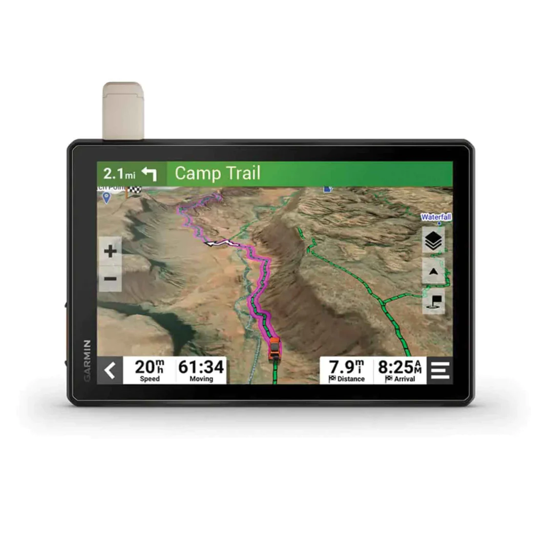
Garmin Tread XL Overland Edition GPS Navigator is a rugged all-terrain navigator with a 10″ ultra-bright display made for every overlanding expedition. Enjoy turn-by-turn trail navigation for traversing select unpaved roads and trails. Custom street routing in select areas takes into account the size and weight of your rig. The navigator includes preloaded topography, subscription-free BirdsEye Satellite Imagery, points of interest, and Ultimate Public Campgrounds, so you won’t need a signal to route to the best-established, wild, and dispersed campsites. With an active satellite subscription (not included), built-in inReach technology offers global satellite communication, 2-way text messaging, location sharing, and interactive SOS. Pair your device to the Tread app on your compatible smartphone to track up to 20 friends using the Group Ride Mobile feature and plan routes with the same maps and route preferences that you have on the Tread device.
Standout Features:
- Extra-large, extra-bright display
- Preloaded topography plus turn-by-turn trail navigation
- Includes points of interests and Ultimate Public Campgrounds locations
- Custom street routing
Physical size: 9.9″W x 7.8″H x 1.2″D (Two other sizes available)
Screen size: 8.5″W x 5.3″H; 10.1″ diagonal (Two other sizes available)
IP (Ingress Protection) Rating: MIL-STD-810 for drops, IP6X for dust
MSRP: $1,499.99 – $2,499.99
onX Offroad App

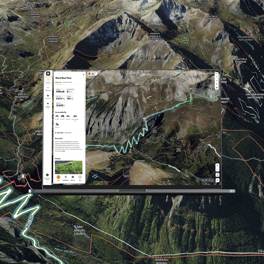
onX Offroad is the most trusted offroad GPS Navigation app. Go further, explore more, and be confident offroad—without needing a dedicated device. onX Offroad offers more than 550,000 miles of open roads & trails plus 985 million acres of public land through detailed interactive maps. If you’re looking for a larger screen, onX Offroad syncs between all your devices, allowing you to either operate on an ipad or tablet under the same subscription plan. onX Offroad users can tap anywhere on a map for more detailed info, such as trail open and closure dates, public land management, private land, and recreation point details for campsites, trailheads, and open OHV areas. Premium membership includes feature trails, unlimited saved offline maps, government lands, photo waypoints, 3D Maps (iOS only), and more. The onX Offroad app also offers an Elite Membership that gives users all premium features plus exclusive features like property boundaries, landowner names, and lot information. See more about onX Offroad.
Standout Features:
- Cost
- Private and Public land ownership Information
- Offline Use
- Customize Markups
- CarPlay and Android Auto
- Track, Save, and Share Trips
- View Maps in 3D
- Discounts on Partners
- Dirt and Snow Mode for each season
- Sync between devices
- User Friendly
MSRP: $34.99 for Premium $99.99 for Elite (per year)
Trail Tech Voyager Pro

Voyager Pro, The Connected Rider’s GPS. Trail Tech offers a variety of model specific and universal kits for complete vehicle integration. All kits include mounting hardware, tach sensor, and power connection. Temperature and wheel sensors vary by kit, see kit contents for details.
Standout Features:
- Powersports GPS with topo maps and sunlight readable touchscreen
- Group Ride technology enabled for real time buddy tracking
- Bluetooth phone audio and wireless headset control
- Vehicle integrated sensors with gauge screens and GPS speed
- Compatible with RAM Mounts and CalTopo.com GPX tools
- Compatible with POLARIS RIDECOMMAND® Group Ride
- Model-specific and universal vehicle kits
Physical size: 5.6″ W x 3.5″
Screen size: 4″ diagonal
IP (Ingress Protection) Rating: IP67 for drop
MSRP: $569.95 – $669.95
Magellan TRX7 CS PRO

The TRX7 CS Pro comes preloaded with over 160,000 designated OHV routes from forest and public lands and includes Magellan’s award-winning street navigation to get you from your starting point to the trail. Search trails using your TRX7 CS Pro or search for trails in a constantly growing crowdsourced track database on www.TRXTrailhead.com. Magellan’s trail database contains over 160,000 OHV routes and user-generated tracks created by fellow off-roaders. The community database is accessible by desktop, tablet, or mobile device. Crowd-sourced tracks contain personal observations so that you can search for them by location, track difficulty, rankings, and more.
Standout Features:
- Turn-by-Turn Trail and Street Navigation
- Built-in 8MP Camera with LED Flash
- Optional Gauge Overlay or Time-Lapse Modes for Adventure Video
- Pre-loaded with over 160,000 4WD, ATV, Motorcycle, and Snowmobile Trails in the USA
- Hi-res (10M) 2D Topo and 3D Basemap of the USA and Canada with Free Updates
- Track Recording and Community Publishing, Crowdsourced Track Database, and One-Touch Social Sharing
- Free Map and Software Updates
- RAM® Dual Mount
Physical size: 5.2″ x 8.3″ x .82″
Screen size: 7″ diagonal
IP (Ingress Protection) Rating: IP54 for drop
MSRP: $629.99
Garmin Montana® 700i
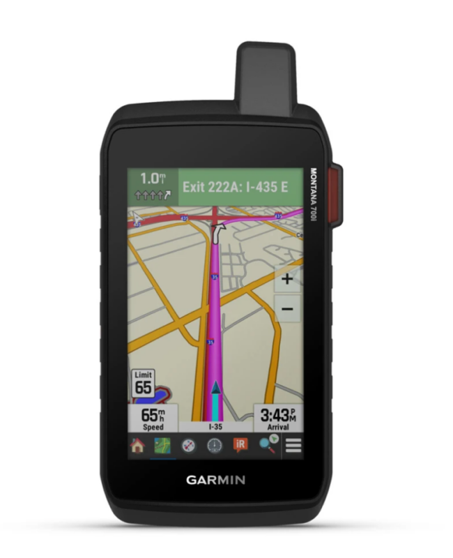
To keep adventurers in touch and on track, the Montana 700i handheld combines the flexibility of on- or off-road navigation with global messaging and interactive SOS via inReach satellite technology1.
Standout Features:
- Two Way Messaging
- Interactive SOS
- Global Connectivity
- Outdoor Maps +
- City Navigator Maps
- Topoactive Maps
- Public Land Boundaries
- Satellite Views
- ABC Sensors
- Active Weather
- Dog Tracking
- Wikiloc Trails
- Rugged by Design
- *Active satellite subscription required.
Physical size: 3.6″ x 7.2″ x 1.3″
Screen size: 2.55″W x 4.25″H
Waterproof Rating: IPX7
MSRP: $699.99
The onX Offroad App Alternative
Those who prefer to carry their personal smartphone or a rugged phone can quickly pair with the onX Offroad app for the most accurate and accessible trail map database on the market. With over 650,000 miles of mapped off-road trails and nearly 2,000 trail guides contributing route updates, pairing the onX Offroad mobile GPS app with your favorite device will add a new level of navigation accuracy. onX Offroad is the best off road GPS because modern phones are now capable of full GPS functionality and chances are, you’re bringing your phone with you on all of your adventures anyway. Why not have your mapping needs on your phone as well? Don’t forget, onX is now Apple CarPlay and Android Auto capable – simply plug and go! Another great advantage of having an app is that crucial information is updated with every release, giving onX Offroad users the most up to date trail data, land information and much more.
Find Campsites and Non-Ethanol Fuel Stations
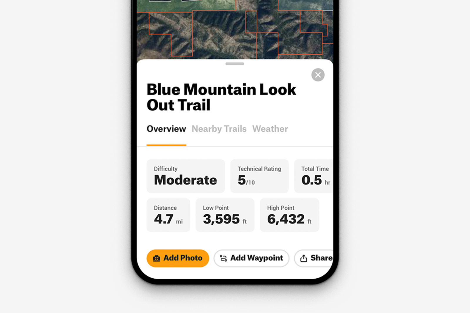
The onX Offroad Maps app includes over 500,000 recreation points, such as campgrounds and dispersed campsites, parking areas, trailheads, boat launches, and more.
Track Trips and Add Custom Waypoints
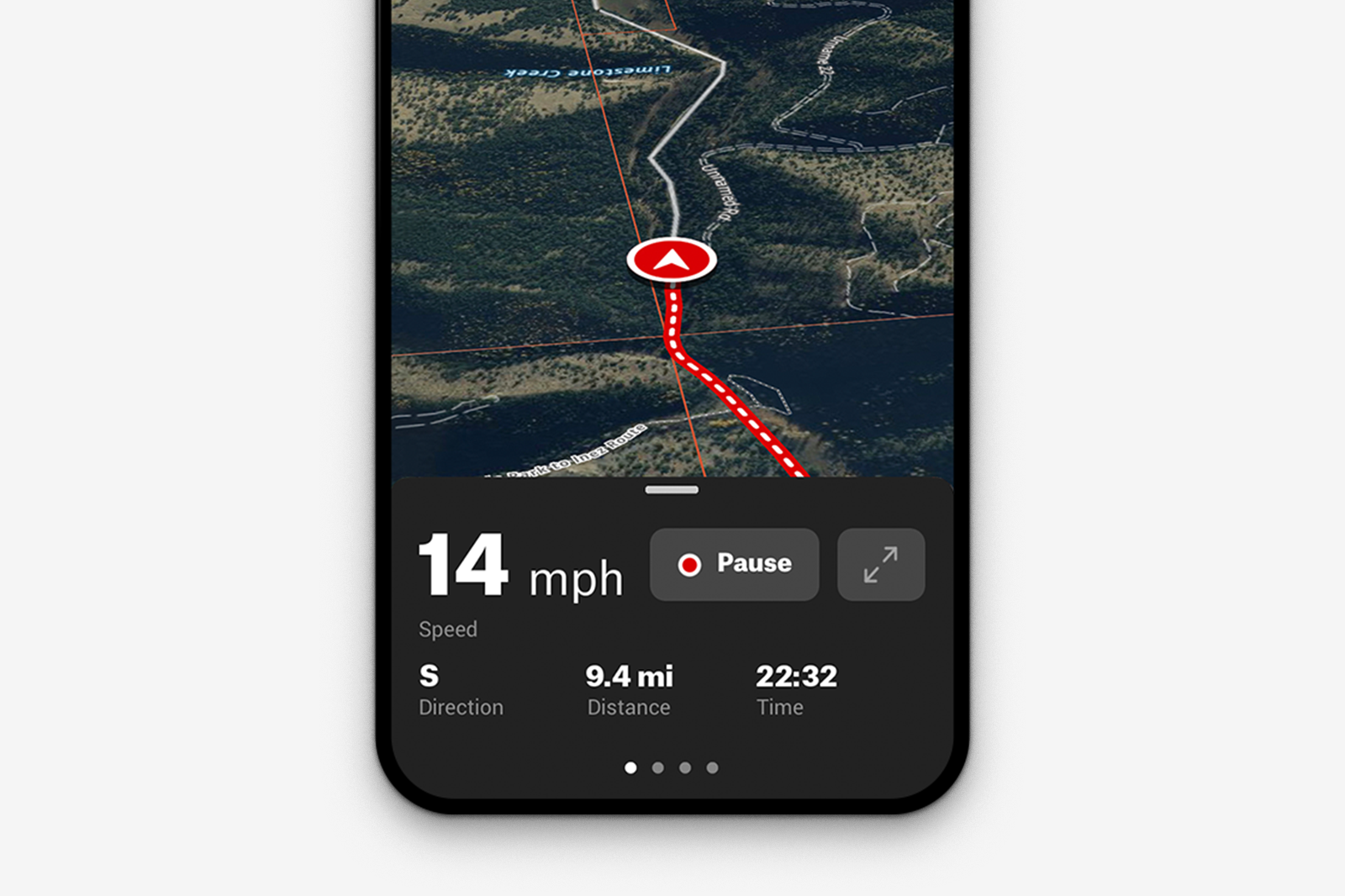
Use the Track feature to know where you’ve been and how to get back. Add Waypoints at campsites, obstacles, where you parked the trailer, and more. Tracks and waypoints can be edited, saved, and shared with friends.
Download Maps for Offline Use
Use your smartphone or rugged phone’s built-in GPS to access trail maps, even without cell service. Download unlimited maps for detailed trail and land info and your saved markups. You can still add waypoints and track trips without service.
3D and Satellite Maps*
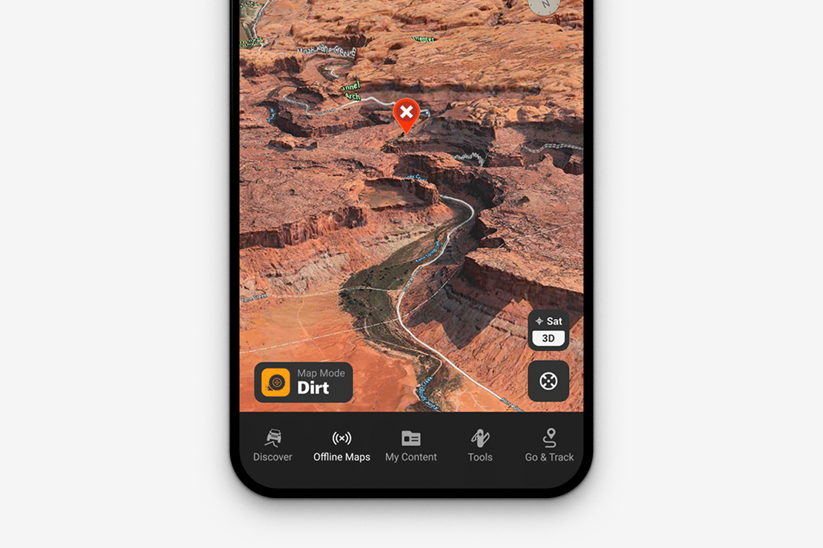
View your trail maps like never before in 3D and with the best quality satellite imagery. Or, switch to topo maps for elevation or a hybrid of Satellite and topo for the ultimate navigation tool. *Currently web version only
Sync Across Multiple Devices
Log in to your onX Offroad account on your computer to plan, and then open the app on your phone or tablet on the trail. All of your trail info is saved and syncs across devices so you can move from trail to home without losing anything.
