Ocotillo Wells SVRA
Total Miles
10.0
Technical Rating
Best Time
Spring, Summer, Fall, Winter
Trail Type
Full-Width Road
Accessible By
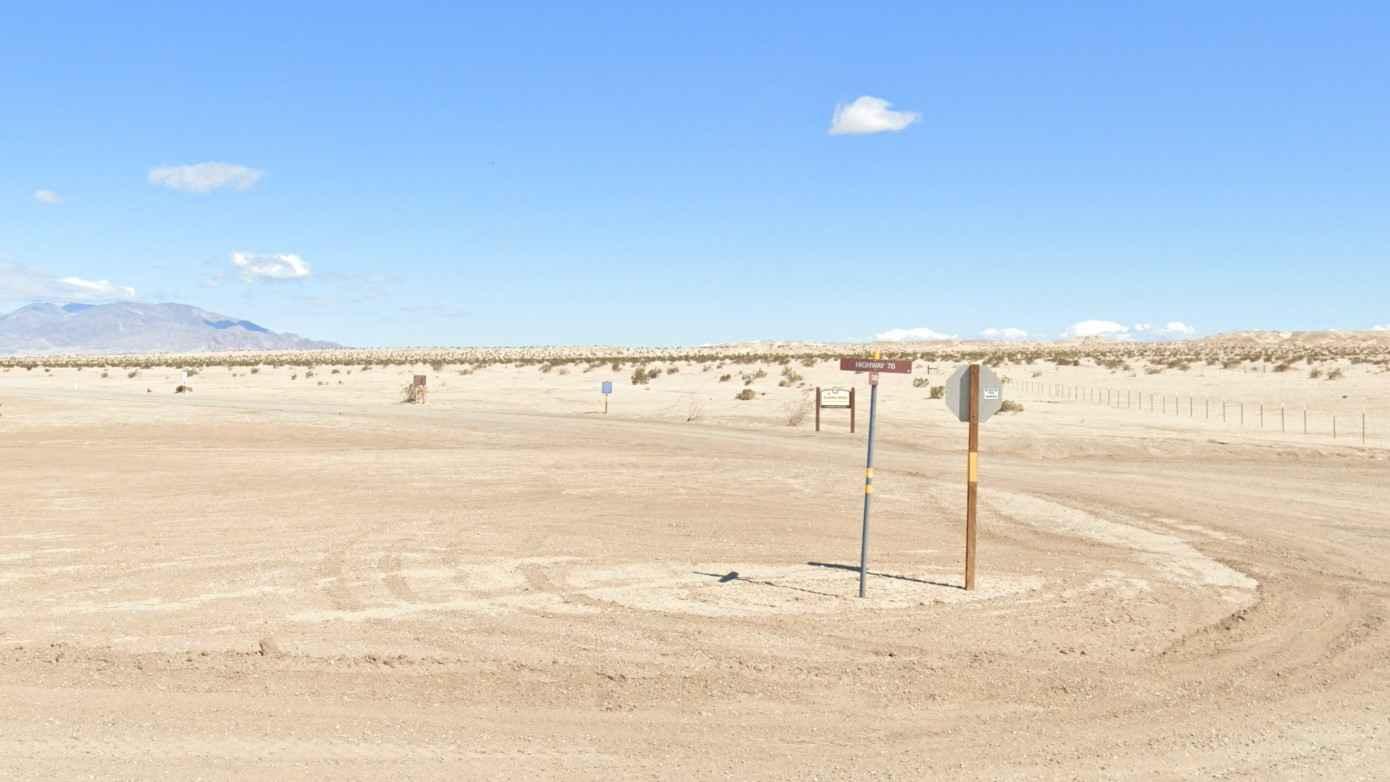
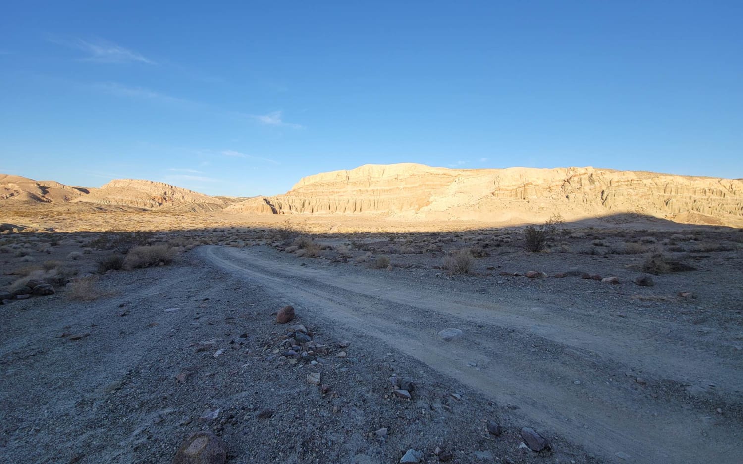
Trail Overview
Welcome to the Ocotillo Wells State Vehicle Recreational Area, the largest SVRA in California with more than 85,000 acres. OWSVRA is over 130 square miles with hundreds of miles of desert track open to all forms of off-highway vehicles. The SVRA borders the Anza-Borrego Desert State Park (600,000 acres of its own) with many of the trails transiting between both areas. Only street-legal vehicles are allowed in the ABDSP. This trail is a 10-mile point-to-point trail rated 3 of 10. As with most trails within the OWSVRA, the track is predominately sand and hard-packed desert soil. The trail is subject to blowing sand across the trail, particularly towards the eastern end. The trail takes you on a scenic ride from the southern border of Highway 78, crossing Poleline Road and ending at the Artesian Well. A large dispersed camping area is located at the western end of the trail, north of Highway 78. This area is suitable for anything up to large RVs. The area east of Poleline Road has travel (stay on trail) and camping restrictions (by Ranger permit only). Some key spots in the area include Blowsand Hill, Devil's Slide, Barrel Springs, Shell Reef, Gas Domes, and Pumpkin Patch. A favorite for night rides, Blowsand Hill is a huge wind-blown dune and a spectacle to see. Devil's Slide is a 200-foot granite and sand ascent. Keep your eyes open for the rumored ghosts who haunt the mines in this area. At Barrel Springs, discover an ecological oasis where wildlife thrives around moisture-seeping mesquite sand dunes, while at Shell Reef, explore a four million-year-old reef and go shelling in the desert. Check out the bizarre natural gas bubbles rising through muddy waters at the unique Gas Domes waterholes. Finally, watch out for the sandstone creations formed by the natural cementation around small objects that end up looking like pumpkins in the Pumpkin Patch. The Ocotillo Wells State Vehicular Recreation Area (OWSVRA) is administered by the Off-Highway Motor Vehicle Recreation Division of the California Department of Parks and Recreation, now commonly referred to as California State Parks. Travel within the OWSVRA is generally unrestricted, relying on the driver's sense of responsibility for protecting natural resources. There are no entrance or camping fees here, and open camping is permitted for up to 30 days per calendar year. All vehicles operated off-highway on public lands in California are required to be (1) street-licensed or (2) registered as an off-highway vehicle (OHV). Purchase of a California Nonresident permit is required: https://ohv.parks.ca.gov/?page_id=25669. Whether a beginner or an adrenaline junkie, you'll find something to your liking in the SVRA (hiking, dirt bike, ATV, UTV, dune buggies, or 4x4s). It is open to the public 7 days a week and 24 hours a day, go out and ride whenever you want. The off-road season is usually between the cooler months of October and May, so these months are usually the most crowded. Cell phone service is intermittent. Vehicle repair shops, telephones, groceries, hotels, motels, RV parks, and restaurants are available in the surrounding communities of Borrego Springs, Ocotillo Wells, and Salton City. Fuel is available in the communities of Borrego Springs and Salton City.
Photos of Ocotillo Wells SVRA

Difficulty
The trail consists of loose rocks, dirt, and sand with some slick rock surfaces and mud holes possible. No steps are higher than 12 inches. 4WD may be required, and aggressive tires are a plus.
History
Ocotillo Wells SRVA is great for off-road enthusiasts, families, overlanders, and any outdoor adventurer. You can spend a few hours or a few weeks here and still not see everything there is to offer. Please respect the environment and follow park regulations to help preserve this incredible landscape for future generations.
Status Reports

Popular Trails

McGee Canyon Road
Mendo-Lake Road
Iron Canyon Scenic Trail
Arrowhead North Loop
The onX Offroad Difference
onX Offroad combines trail photos, descriptions, difficulty ratings, width restrictions, seasonality, and more in a user-friendly interface. Available on all devices, with offline access and full compatibility with CarPlay and Android Auto. Discover what you’re missing today!