Tsilhqox Biny - Ts'il?os Provincial Park
Total Kilometers
296.3
Technical Rating
Best Time
Summer, Spring, Fall
Trail Type
Full-Width Road
Accessible By
Trail Overview
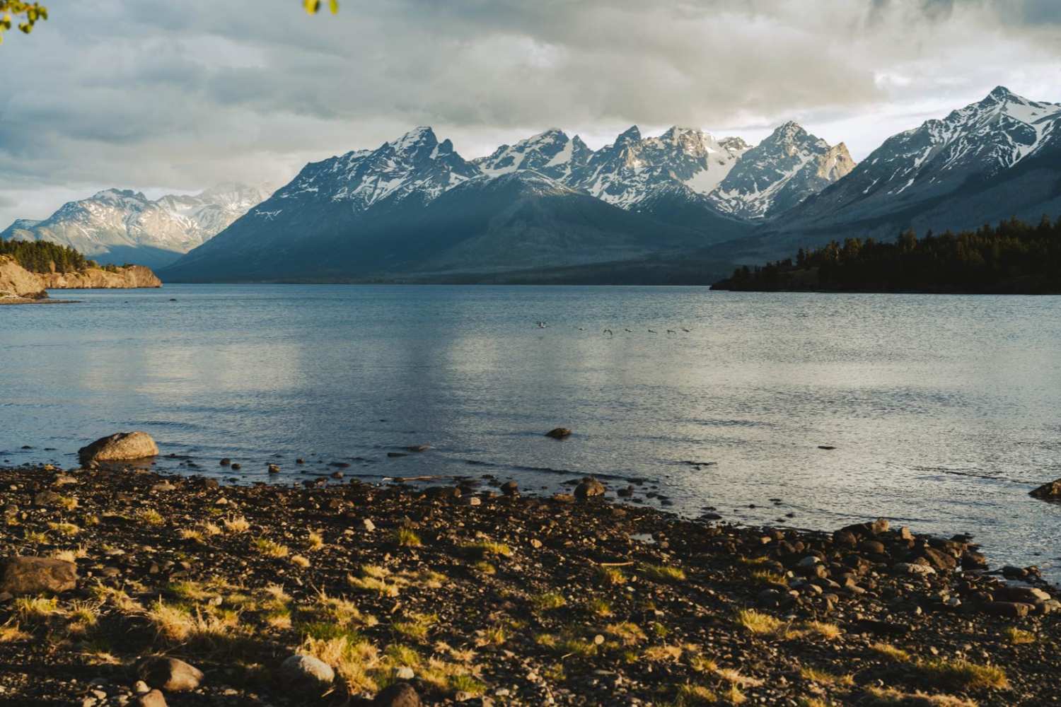
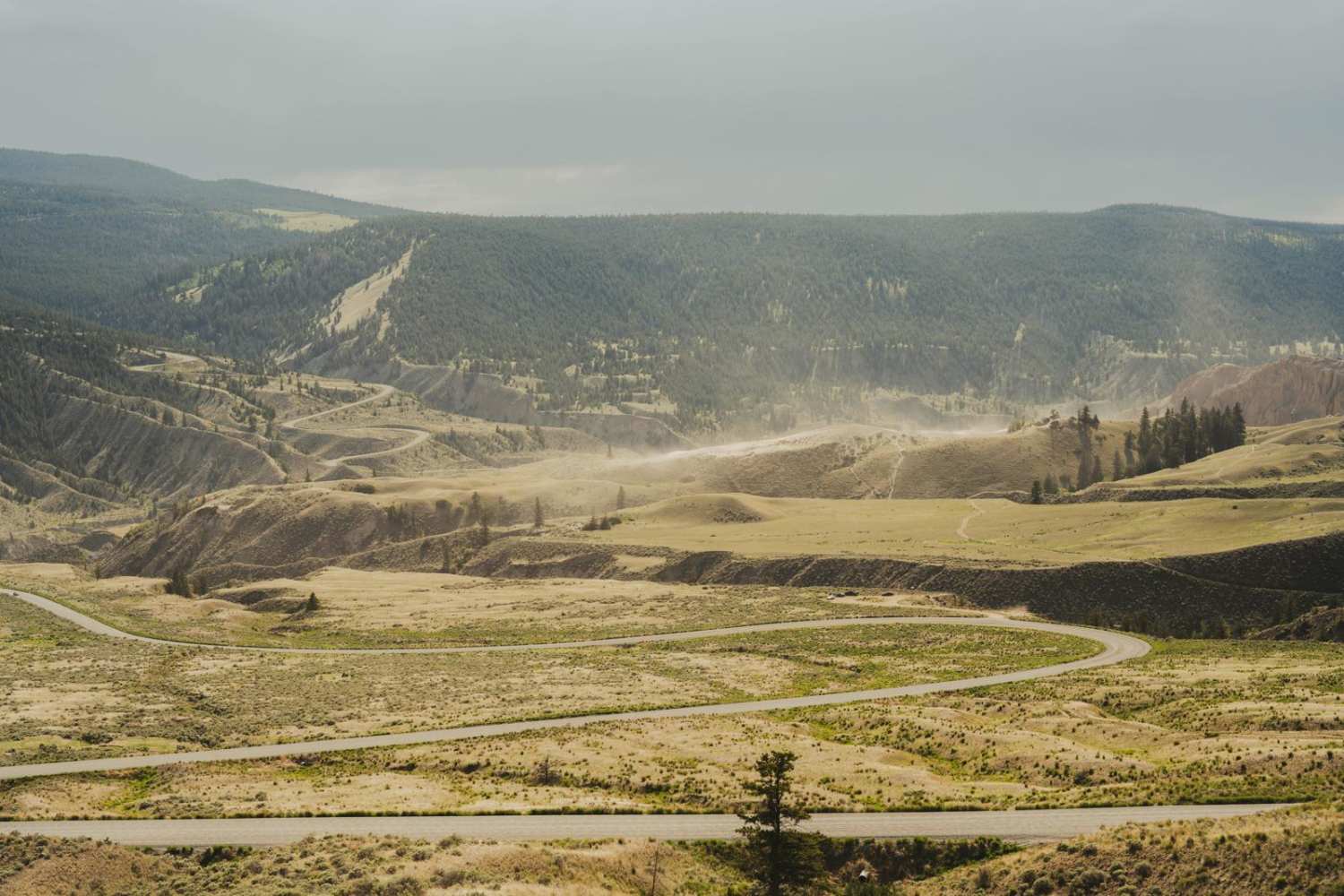
If you want to access the Tsilhqot'in Nation Title area for camping or related recreational activities, contact the Tsilhqot'in National Government to obtain permission in advance (tsilhqotin.ca). The trail to Tsilhqox Biny (Chilko Lake) in Ts'il?os Provincial Park provides a looped journey through British Columbia's Cariboo region, rich in history and surrounded by breathtaking scenery. Beginning in Williams Lake, you head onto Highway 20, then turn onto a forest road that leads through Farwell Canyon, passing by dunes and steppes with sparse forest. This first section is suitable for AWD/4x4 vehicles and offers a relatively easy drive with scenic views. Along the way, you might encounter wildlife, including free-roaming horses, and come across sites with historical significance. This trail balances off-road sections with a rich cultural backdrop, delivering an adventurous and immersive experience in the wilderness. As you approach Chilko Lake, the landscape opens up to offer sweeping views of the Chilcotin Plateau and vibrant volcanic mountains. Chilko Lake's turquoise-blue glacial waters are a sight to behold, and the surrounding area teems with wildlife, including grizzly bears, black bears, moose, and bald eagles. The second part of the journey, from Tsilhqox Biny (Chilko Lake) towards Tatla Lake, requires a high-clearance 4x4 vehicle due to tighter, muddier stretches through dense forests. This section is more challenging, especially after rainfall, but rewards with stunning views and a deep sense of wilderness. As you approach Choelquoit Lake, the trail becomes slightly wider. From Tatla Lake, you rejoin Highway 20 to return to Williams Lake, completing the loop. Alternatively, you can head to Bella Coola, continuing the journey.
Photos of Tsilhqox Biny - Ts'il?os Provincial Park
Difficulty
The trail to Tsilhqox Biny (Chilko Lake) in Ts'il?os Provincial Park varies in difficulty. The first part, through canyons, dunes, and steppe-like terrain with sparse forest, is suitable for AWD/4x4 vehicles and is generally an easy drive. The second part, from Chilko Lake towards Tatla Lake, is more challenging, requiring a high-clearance 4x4 vehicle. This section has tighter, muddier stretches and dense forest, making it especially difficult after rainfall. Make sure your vehicle is equipped for off-road conditions, and take extra gas due to the lack of refueling options along the trail. Be prepared for variable terrain and weather impacts.
History
The region has a unique history, with the Tsilhqot'in First Nations playing a significant role in resisting early European incursions during the 19th century gold rush. Despite these tensions, the area remained largely undisturbed for over a century, with the first road to Nemiah built in 1973. Today, the trail to Tsilhqox Biny (Chilko Lake) encompasses elements of this history, with remnants of old homesteads, ranchland, and occasional clearings along the way.
Tsilhqox Biny - Ts'il?os Provincial Park can be accessed by the following ride types:
- High-Clearance 4x4
- SUV
- SxS (60")
- ATV (50")
- Dirt Bike
Tsilhqox Biny - Ts'il?os Provincial Park Map
Popular Trails
Mayo Creek Forest Service Road

Coopers Hang Gliding
Proctor Lake Rd
Fresh Trail with a View
The onX Offroad Difference
onX Offroad combines trail photos, descriptions, difficulty ratings, width restrictions, seasonality, and more in a user-friendly interface. Available on all devices, with offline access and full compatibility with CarPlay and Android Auto. Discover what you’re missing today!
