Coal Creek 2133
Total Miles
17.0
Technical Rating
Best Time
Spring, Summer, Fall
Trail Type
High-Clearance 4x4 Trail
Accessible By
Trail Overview
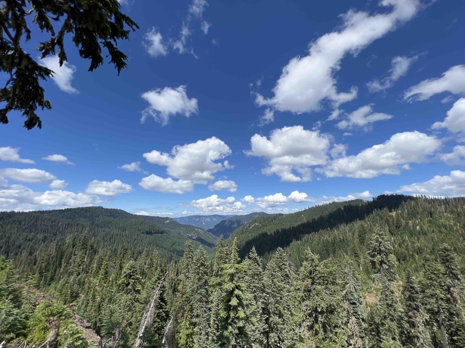
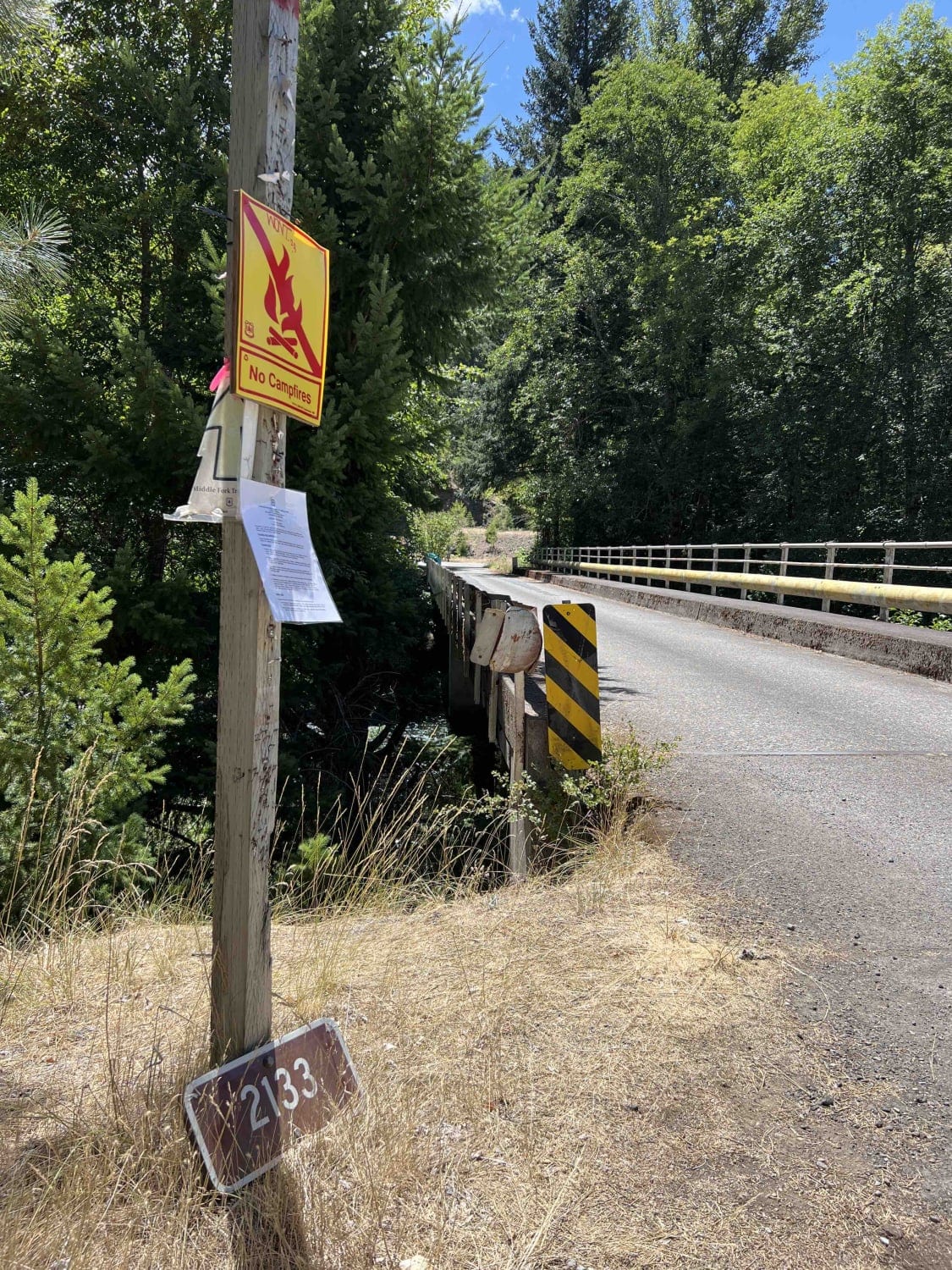
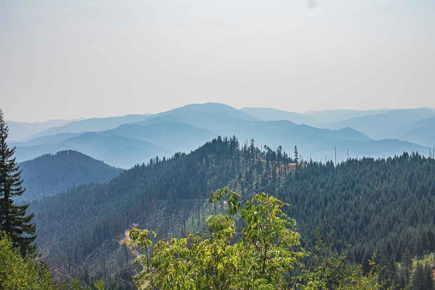
Coal Creek 2133 sits in the Calapooya Mountains which is located in the 1.7-million-acre Willamette National Forest. On this route, you will find stunning views of Diamond Peak, Cougar Mountain, and the Cascade Mountain Range located just south of Oakridge, Oregon. Here you start at the Middle Fork Willamette Trailhead, clearly marked with signs, before crossing the Middle Fork Willamette River bridge. This road isn't recommended for low-clearance vehicles as there are several obstacles in the road, downed trees, big potholes, and landslides with debris in the middle of the road with big ruts requiring 4x4. As you continue through the boulders and rockslides, you will come upon a charming little waterfall that's accessible right off the main road. Continuing up the trail, you will want to take a right on High Divide Road 5850 to get to the High Divide Trailhead, which has a big open parking area and signage with information on the hiking requirements. Weather in this area during the late spring through the fall will be mild and warm with some rain in the early spring and late fall. Snow covers these roads during late fall through early spring and the Forest Service closes the gates, which makes this area inaccessible. The most prominent wildlife seen in this area is chipmunk, blue-grouse, bald eagle, hawks, deer, woodpeckers, and rainbow trout in the streams. WNF has a pack it in and pack it out rule with regard to trash along with a tread lightly principle to protect habitats.
Photos of Coal Creek 2133
Difficulty
This road is only recommended for high-clearance, narrow vehicles. There are very large boulders and areas with major landslides which require 4x4 to maneuver around. Trees overhang the road and in some areas have less than 9 feet of clearance.
Status Reports
Coal Creek 2133 can be accessed by the following ride types:
- High-Clearance 4x4
- SxS (60")
- ATV (50")
- Dirt Bike
Coal Creek 2133 Map
Popular Trails

Niagara Road

Grassy Ranch - Single Creek
The onX Offroad Difference
onX Offroad combines trail photos, descriptions, difficulty ratings, width restrictions, seasonality, and more in a user-friendly interface. Available on all devices, with offline access and full compatibility with CarPlay and Android Auto. Discover what you’re missing today!