BLM Route 84
Total Miles
2.3
Technical Rating
Best Time
Fall, Spring
Trail Type
50" Trail
Accessible By
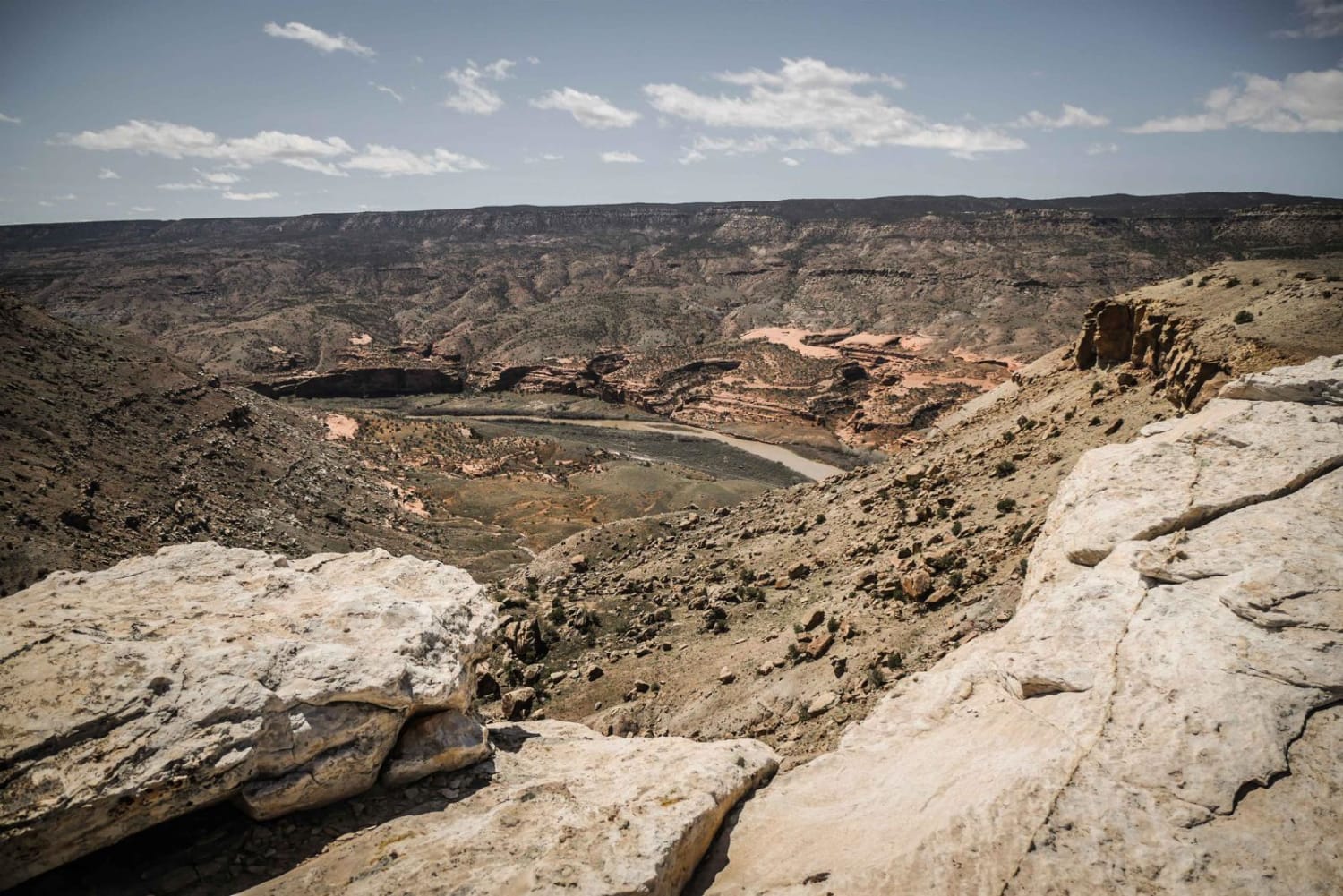
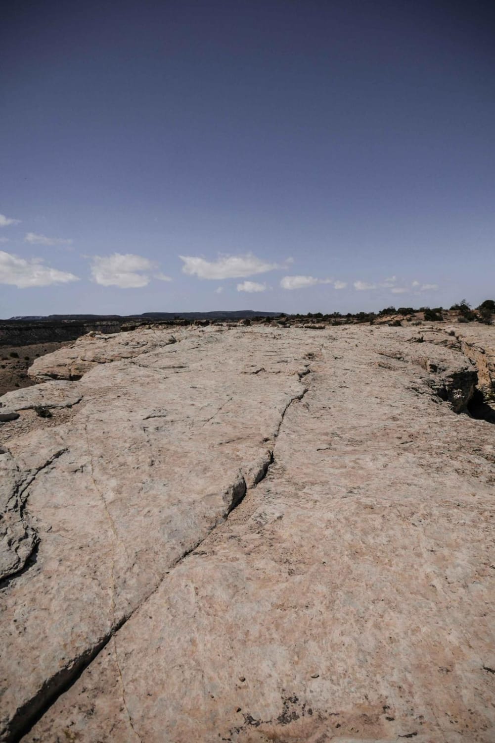
Trail Overview
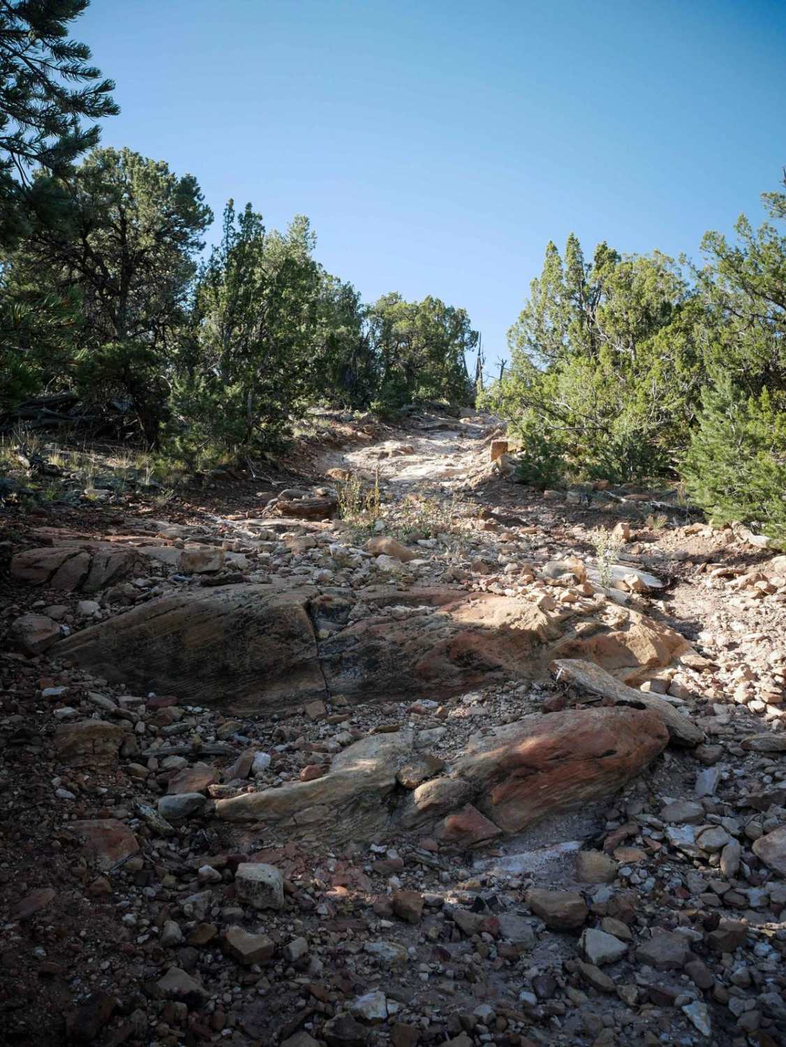
BLM Route 84 is a fun ATV trail with great views from the rim of a canyon looking down to the Gunnison River below. The canyon below is full of red sandstone rock on the sides, and is a stunning sight. From the Southeast end of the trail, the trail is unmarked, but starts off of Jeep Road 80. There is an incredible view right away over the canyon rim down to the river, and the trail starts on a white slab rock section along the canyon rim. The trail goes along the rim on the slab rock for a quick section, then turns into a dirt trail that is a decent width for 50" vehicles and not too narrow. It is slightly more narrow than a Jeep road. It is mostly smooth, and winds between the pinyon pine and rocky mesas. There are a couple rockier sections with a couple small rock ledges and loose rock, and one or two hill climbs that have loose rock. The whole trail is easy for any 50" vehicle, or dirt bike. There are several overlooks of the river to stop at throughout the trail. It crosses the Jeep Road BLM Route 80, and ends at another dirt road further in from the mesa. This end of the trail is marked with a trail sign for Route 84. This is one of several ATV trails in this trail system, and can make a fun loop with BLM Routes 89, 90, 92 and 80A that would take a couple hours.
Photos of BLM Route 84
Difficulty
Consistently easy trail with small loose rocks and no significant obstacles. Is probably a 3 difficulty for an ATV and a 2 for a dirt bike
Status Reports

Popular Trails
Pony Park Road - 433
Old Squaw Pass East

Miller Rock Road
The onX Offroad Difference
onX Offroad combines trail photos, descriptions, difficulty ratings, width restrictions, seasonality, and more in a user-friendly interface. Available on all devices, with offline access and full compatibility with CarPlay and Android Auto. Discover what you’re missing today!