12 North Loop
Total Kilometers
9.8
Technical Rating
Best Time
Spring, Summer, Fall, Winter
Trail Type
Full-Width Road
Accessible By
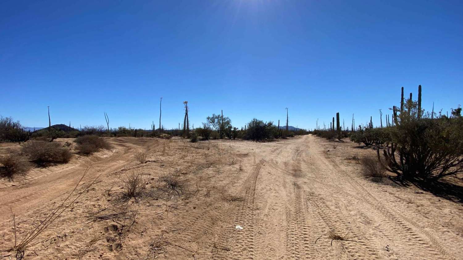
Trail Overview
From the west this trail begins off Highway 12, starting as an easy, well-maintained dirt road with soft, forgiving terrain. A few miles in, you'll make a right turn, and the road transitions into a more rugged, slightly rutted Baja 1000-style trail. Here, you'll navigate a few miles of 2-3 inches of soft sand--still smooth, with minimal obstacles. The real challenge begins when you take another right turn, heading back toward Highway 12. In this final stretch, the trail cuts through an arroyo, where sand deepens to 4-6 inches depending on the season, temperature, and moisture levels. Four-wheel-drive is essential here, with tires aired down for traction. It's wise to travel with a second vehicle, a winch, and other recovery gear, as conditions can quickly shift. After clearing the wash, the trail exits onto Highway 12, where you can continue on to explore the loop on the other side or head east toward the Bay of Los Angeles.
Photos of 12 North Loop

Difficulty
This trail earns its difficulty rating primarily from a lengthy, challenging arroyo section that spans over 2 miles of deep sand, with no bypass options. Sand depths range from 4-6 inches, but you'll encounter areas where it exceeds a foot, demanding skill and experience in deep-sand driving. Attempt this only if you're confident in your recovery abilities, as self-recovery is essential here. Airing down your tires and engaging four-wheel drive are absolute requirements to navigate this stretch successfully.
Status Reports
12 North Loop can be accessed by the following ride types:
- High-Clearance 4x4
- SUV
- SxS (60")
- ATV (50")
- Dirt Bike
12 North Loop Map
Popular Trails

Route to Ejido Benito Juarez

Road to Four Ranches
Arbolitos Cove

Around Cerro Anegado
The onX Offroad Difference
onX Offroad combines trail photos, descriptions, difficulty ratings, width restrictions, seasonality, and more in a user-friendly interface. Available on all devices, with offline access and full compatibility with CarPlay and Android Auto. Discover what you’re missing today!