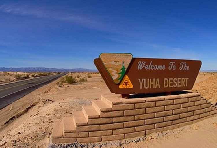
EC 311 Yuha Desert
Total Miles
3.3
Technical Rating
Best Time
Spring, Summer, Fall, Winter
Trail Type
Full-Width Road
Accessible By
Trail Overview
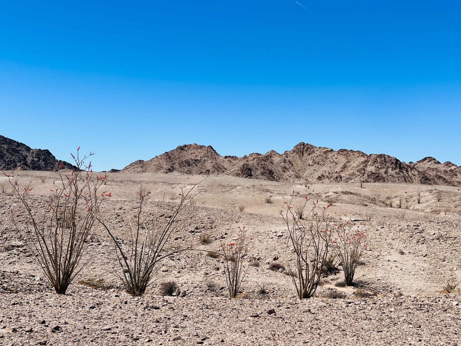
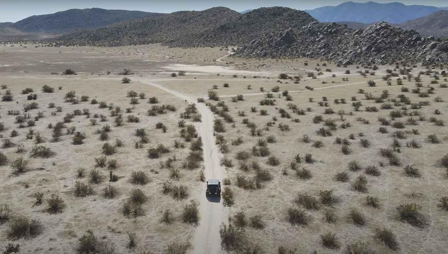
EC 311 Yuha Desert is a 3.3-mile point-to-point trail rated 3 of 10 in Imperial County. EC311 is a BLM-designated "Limited Use" trail and can only be used by street-legal vehicles. The trail can be accessed from Highway 98 on the south end or by traveling a short distance on EC 274. EC 311 is primarily a hard-packed desert crossing sandy washes and short climbs and descents. The highlight along EC 311 is the de Anza Overlook providing a scenic view of the Yuha Desert and basin. The overlook is located at 32deg 41.726' N, 115deg 54.116' W. Juan Bautista De Anza led two groups of Spanish explorers and settlers across this portion of the Colorado Desert from northern Mexico to San Francisco Bay. During each tortuous passage, the Spanish camped below here in Yuha Wash. The passage in 1774, which explored and pioneered the first overland route into upper California, consisted of only a small group of soldiers and two missionaries, Father Garces and Diaz. A second trip in 1775 brought settlers to the coast of California. Spain felt that its tenuous hold on the New World was threatened by Russian settlements to the north. The Spanish missions were struggling to survive and needed a reliable supply route to ensure military, political, and religious success. This expedition contained 240 people, including Captain De Anza, 38 soldiers, 15 muleteers, 136 colonists, several Indian guides, and Father Pedro Font as chronicler. There were over 800 head of livestock, which included pack mules, horses, and cattle. The settlers became founders of what would become San Francisco. The route discovered by De Anza was abandoned in the 1780s because of Quechan Indian hostilities. Portions of the route were used during the 1800s as part of the Gila and Overland Trails. Finally, it was also used by gold seekers and several stage lines. Along Highway 98 and at other access points to the Yuha, you'll see Limited Use Area signs. This means that motorized vehicle travel is allowed, but that it is limited to approved routes of travel. No cross-country travel is allowed, including off-road hill climbs and construction or use of three- and four-wheeler play loops. The area is accessible year-round but summer temperatures can exceed 115 degrees. Cell phone service is intermittent. All major services are located 23 miles east in El Centro.
Photos of EC 311 Yuha Desert

Difficulty
The trail consists of loose rocks, dirt, and sand with some slickrock surfaces and possible mud holes, but no steps higher than 12 inches. 4WD may be required, and aggressive tires are a plus.
History
The Yuha Desert is a section of the Sonoran Desert located in the Imperial Valley of California, south of Interstate 8, west of El Centro, and north of the international border. Unique aspects of the Yuha Desert include the Oyster Shell Beds, De Anza Historical Monument, Crucifixion Thorn Natural Area, and the Yuha geoglyph. It is the homeland of the Kamia, also spelled Kumeyaay, and may have been used by other Native American groups such as the Cahuilla, Quechan, and Cocopah Native American people. The Yuha Desert is a BLM area of critical environmental concern (ACEC). It is home to sensitive plants and animals as well as historic and prehistoric cultural sites. It is a limited-use area, meaning that travel is limited to designated routes of travel to protect these resources, so please observe all posted signs. An audio tour describing several points of interest in the area is available from BLM's El Centro Field Office. The Yuha Desert can be accessed from State Highway 98 and from the Dunaway Road exit off Interstate 8.
Status Reports
EC 311 Yuha Desert can be accessed by the following ride types:
- High-Clearance 4x4
- SUV
EC 311 Yuha Desert Map
Popular Trails

Dry Creek Knoll Side Spur - 3S110B
Ocotillo Out and Back 661
Blair Valley Loop
Mount Lively South Fork Mountain Road
The onX Offroad Difference
onX Offroad combines trail photos, descriptions, difficulty ratings, width restrictions, seasonality, and more in a user-friendly interface. Available on all devices, with offline access and full compatibility with CarPlay and Android Auto. Discover what you’re missing today!