551 ATV
Total Miles
1.3
Technical Rating
Best Time
Spring, Summer, Fall
Trail Type
50" Trail
Accessible By
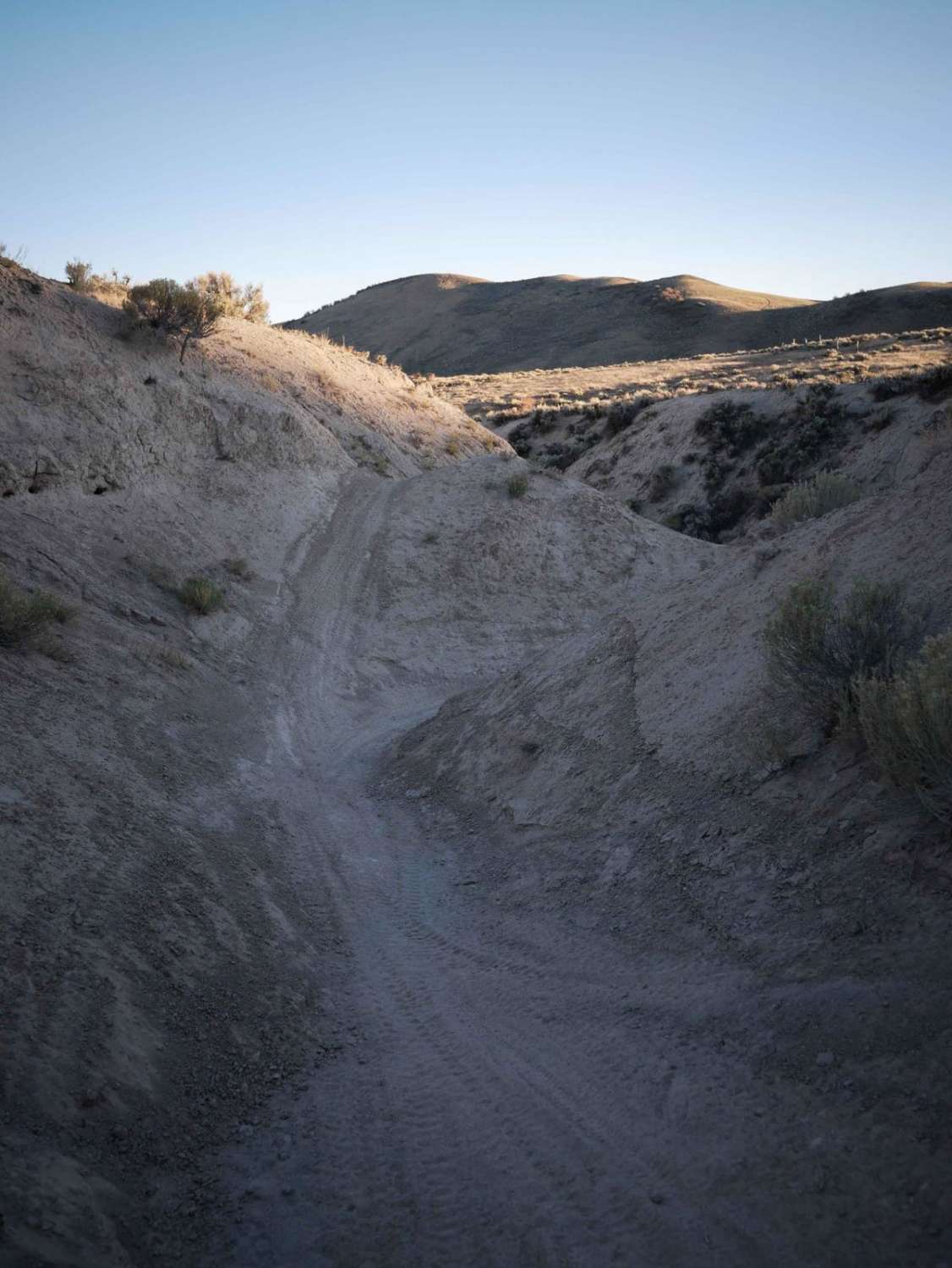
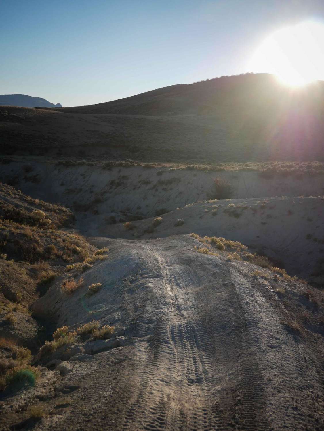
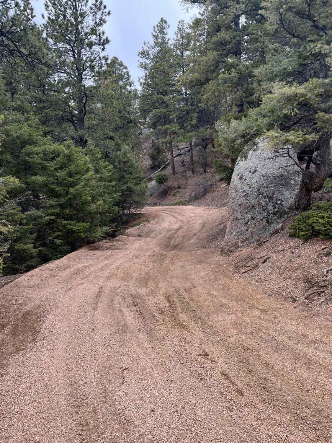
Trail Overview
This is a 50" trail through the Wolford Riding Area. The north end starts as a wide two-track through the flat sagebrush valley, with whoops and shallow ruts. It goes up and over the dirt hills, and then goes into a ravine that is like a v-bottom ditch between tall dirt walls. The trail follows the bottom of the ravine, which has big banked corners, and off-camber spots as it weaves below the dirt walls and around the corners. Dirt bikes can pop in and out of the ravine on the corners on a parallel single track, but ATVs will most likely stay at the bottom of the ravine. The trail climbs out of the ravine back onto the hillside and goes along a small ridgeline. The south end ends on County Road 22, a paved highway, so you'll most likely ride it as an out-and-back.
Photos of 551 ATV
Difficulty
This is an easy ATV trail that goes through ravines and hills with no obstacles, but it does have a few off-camber spots in the ravine as it makes tight corners in the gully between tall walls.
Status Reports

Popular Trails
Browns & Breakneck
Powerline East Road 318
The onX Offroad Difference
onX Offroad combines trail photos, descriptions, difficulty ratings, width restrictions, seasonality, and more in a user-friendly interface. Available on all devices, with offline access and full compatibility with CarPlay and Android Auto. Discover what you’re missing today!