6061A ATV
Total Miles
3.4
Technical Rating
Best Time
Spring, Summer, Fall, Winter
Trail Type
50" Trail
Accessible By
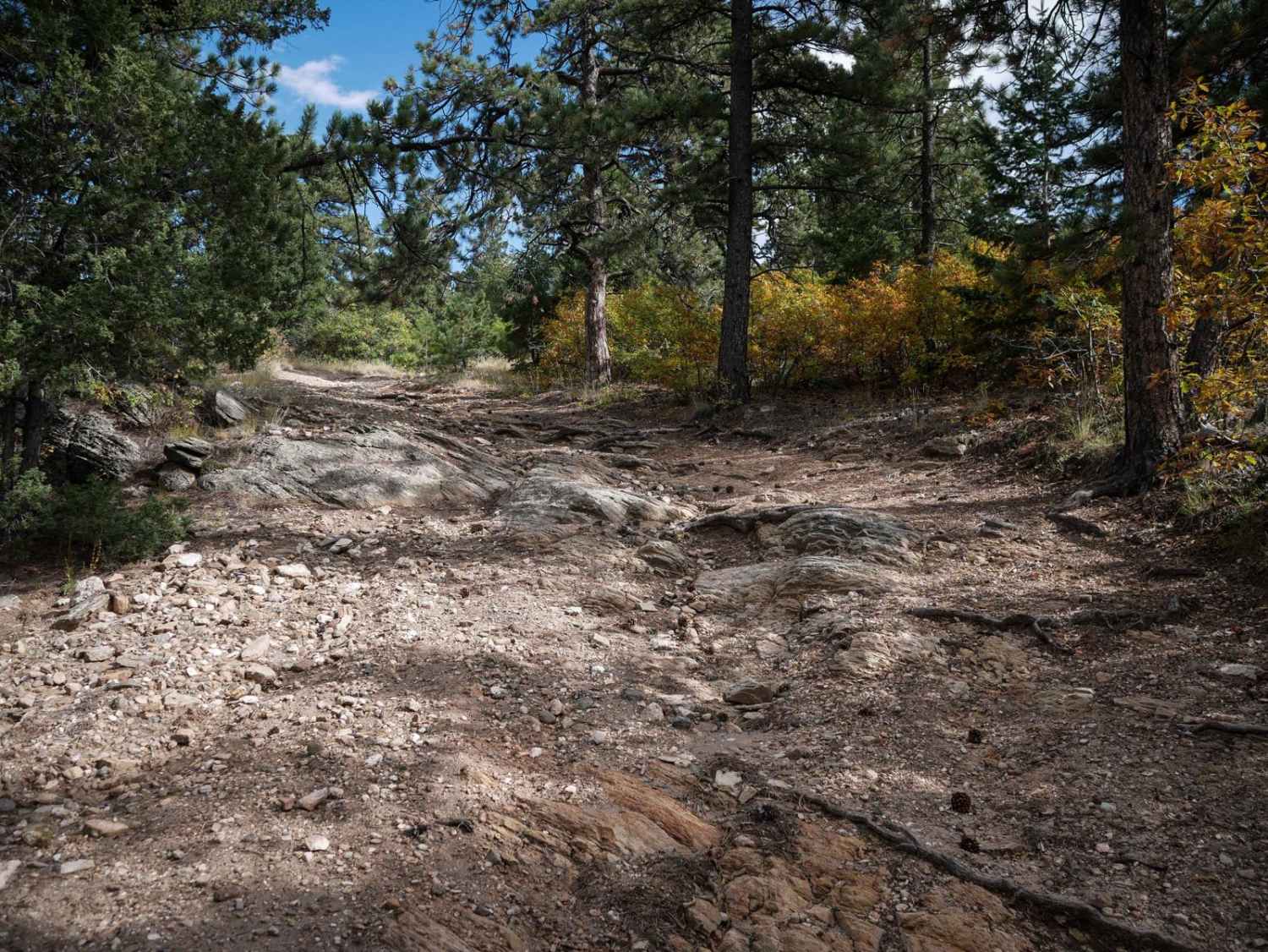
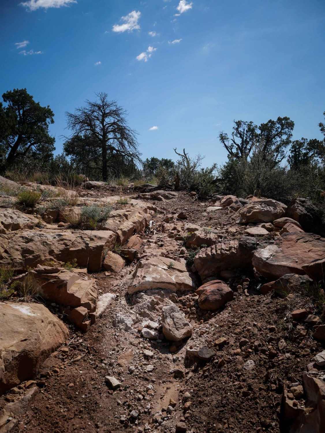
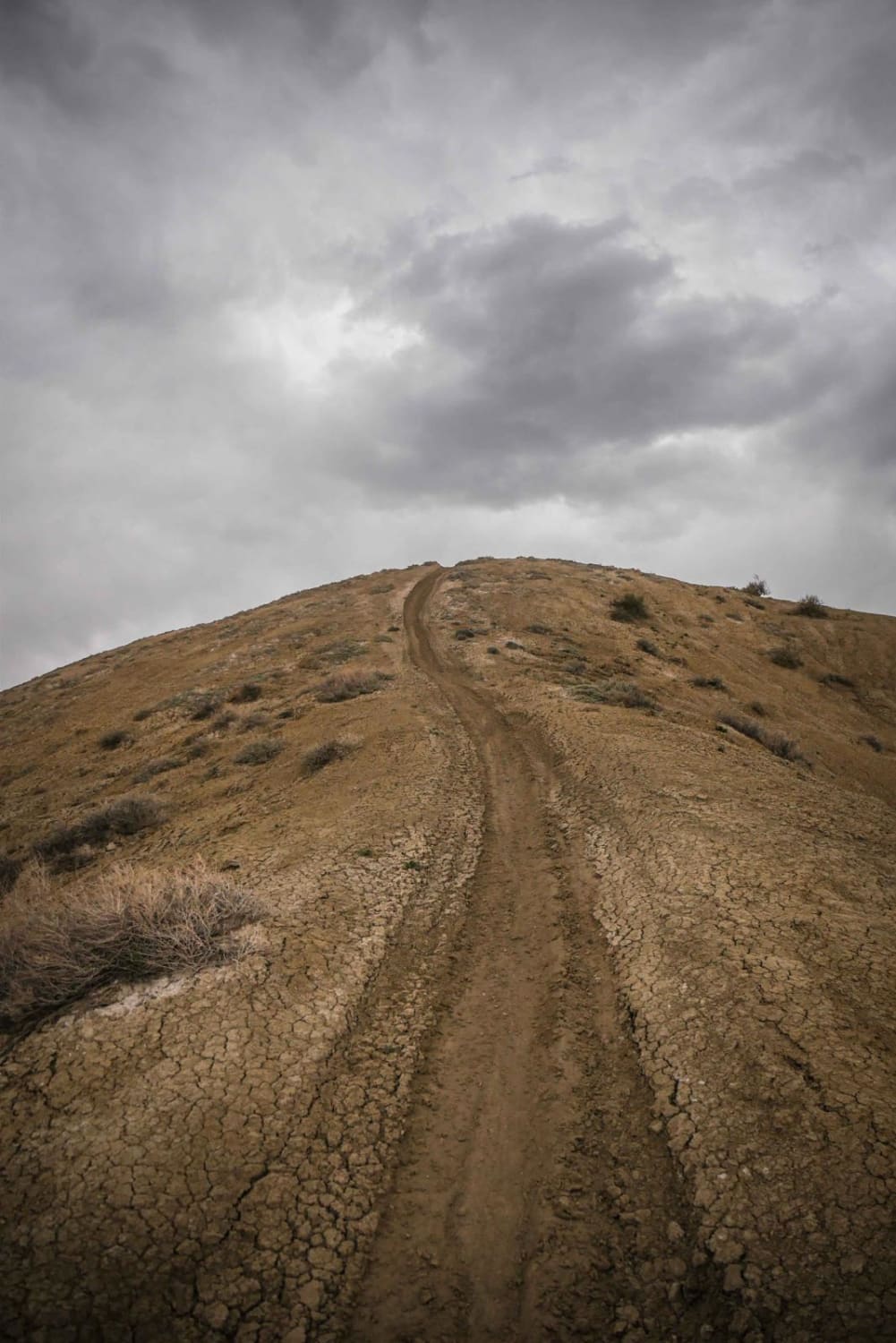
Trail Overview
The north end of this ATV trail starts at a metal pinch point for 50" vehicles on BLM Route 6040 and enters the pine forest on a wide path with lots of little loose rocks and roots. It starts climbing right away, on a steep long sustained climb with loose rocks on the surface, making it hard to maintain momentum. There are bigger rocks in the trail as it keeps climbing, but it levels out after about a half mile once you get up to the top of the grassy mountain top, with great views of the mountains. The descent down the other side of the mountain is also very rocky, full of little round rolling rocks and baby heads that ping you around. It curves around the mountainside on a shelfy path. The trail has ruts filled in with loose rocks. Then it becomes very tight and curvy between the pinyon pine trees, with a few sharper turns and switchbacks as it keeps steeply descending, and it's still rocky and rutted, with bigger embedded rocks as well. There are small ledges about a foot tall from the embedded rock as it descends. It flattens out as it goes into a scenic ravine with lots of big embedded boulders and goes along a cool rock wall. This will be slow going for any ATVs. It finally pops out onto the dirt road after losing 1,700 feet of elevation.
Photos of 6061A ATV

Difficulty
The majority of this trail you are either steeply climbing, or very steeply descending. The trail is covered in a layer of small loose rocks and baby heads the entire time, making it difficult to maintain momentum on the climbs, and not get pinged around on the descent. There are 1-foot tall ledges and embedded boulders that add to the difficulty. It would be pretty challenging for an ATV to pick its line through the boulders, but it is a bit easier on a dirt bike.
Status Reports
6061A ATV can be accessed by the following ride types:
- ATV (50")
- Dirt Bike
6061A ATV Map
Popular Trails
Right Hand Trail
South Elephant Ridge
The onX Offroad Difference
onX Offroad combines trail photos, descriptions, difficulty ratings, width restrictions, seasonality, and more in a user-friendly interface. Available on all devices, with offline access and full compatibility with CarPlay and Android Auto. Discover what you’re missing today!