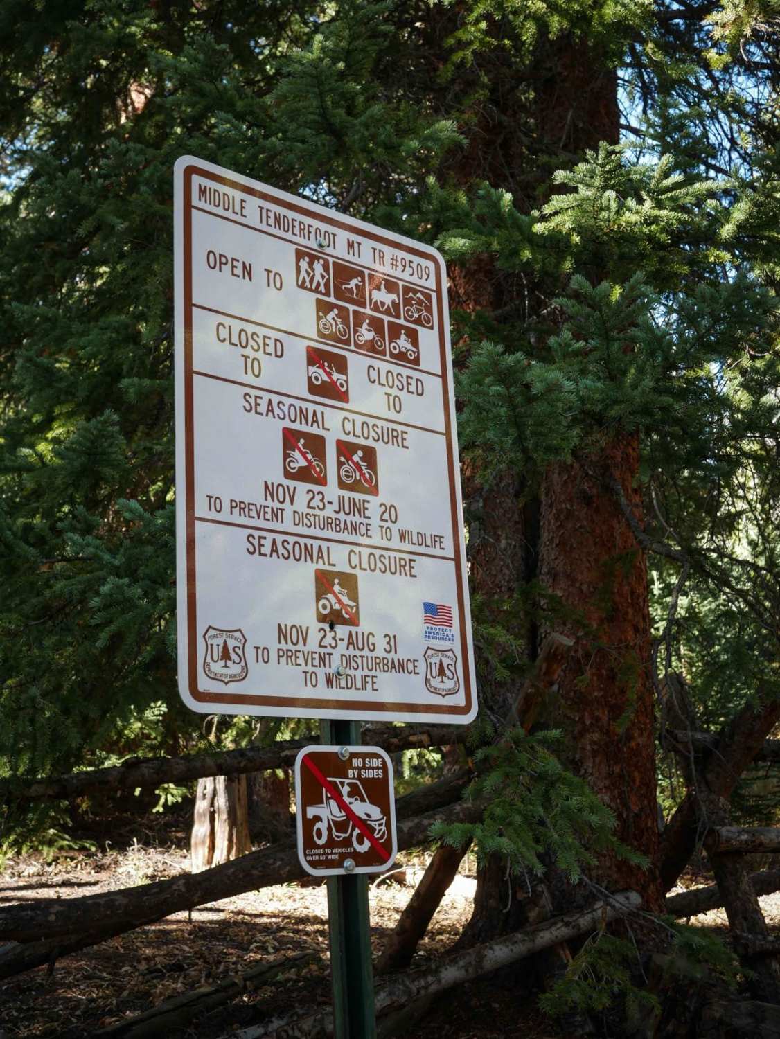
Middle Tenderfoot Mountain
Total Miles
2.5
Technical Rating
Best Time
Summer, Fall
Trail Type
50" Trail
Accessible By
Trail Overview
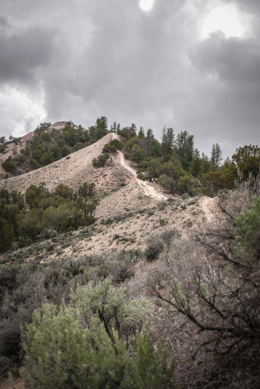
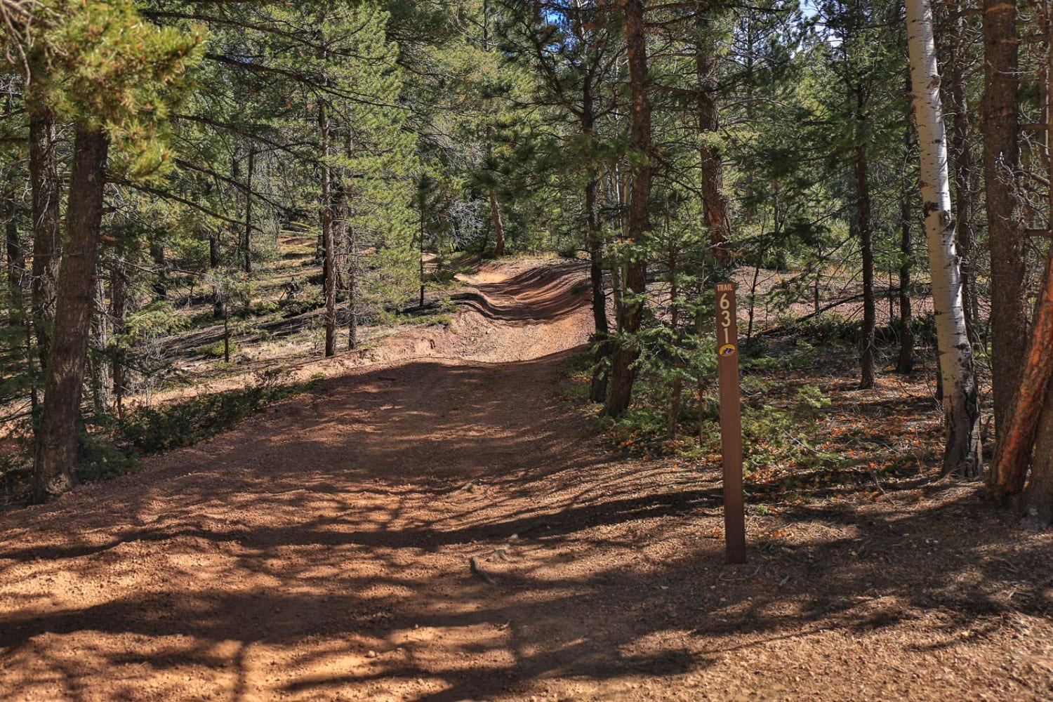
This trail descends through a series of big, wide, sweeping switchbacks from the summit of Tenderfoot Mountain. The trail is extensive at the top, like a two-track, but narrows slightly as it enters the trees. It loses 1,300 feet of elevation over 2.6 miles. It continues as a wide trail snaking through the trees, with easy curves, mostly flowy, smooth, and fast. There are a bit of shallow ruts and maybe a bit of loose rock here and there, but nothing complicated. Near the south end, it widens up to the width of the road, and after the intersection with Wide Open, it becomes a road designation. This is primarily an access trail to access the many single tracks in the area, including Tenderfoot Mountain, Monkey Butt, Wide Open, and Upper Wide Open. The south end of the road portion is very close to the staging area, so it's an excellent start to your ride to access all of the trails. This trail is open to motorcycles from 6/21 - 11/22 and ATVs that are 50" or less from 9/1 to 11/22.
Photos of Middle Tenderfoot Mountain

Difficulty
This is an easy trail that has sweeping gradual switchbacks, but no obstacles.
Status Reports

Popular Trails

West Jackson Creek Road to Hidden Valley Road

Derbishire Gulch Road - FS 143
Fern 3- Rampart Range
The onX Offroad Difference
onX Offroad combines trail photos, descriptions, difficulty ratings, width restrictions, seasonality, and more in a user-friendly interface. Available on all devices, with offline access and full compatibility with CarPlay and Android Auto. Discover what you’re missing today!