Smith Mountain
Total Miles
13.0
Technical Rating
Best Time
Summer
Trail Type
Full-Width Road
Accessible By
Trail Overview
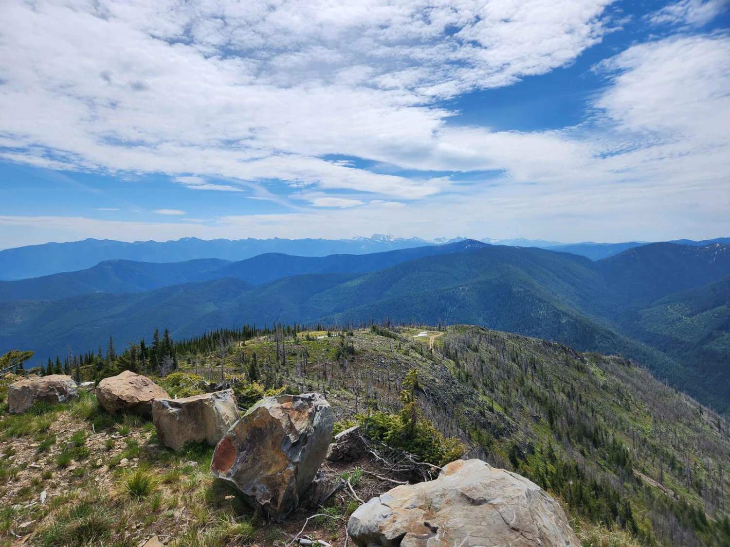
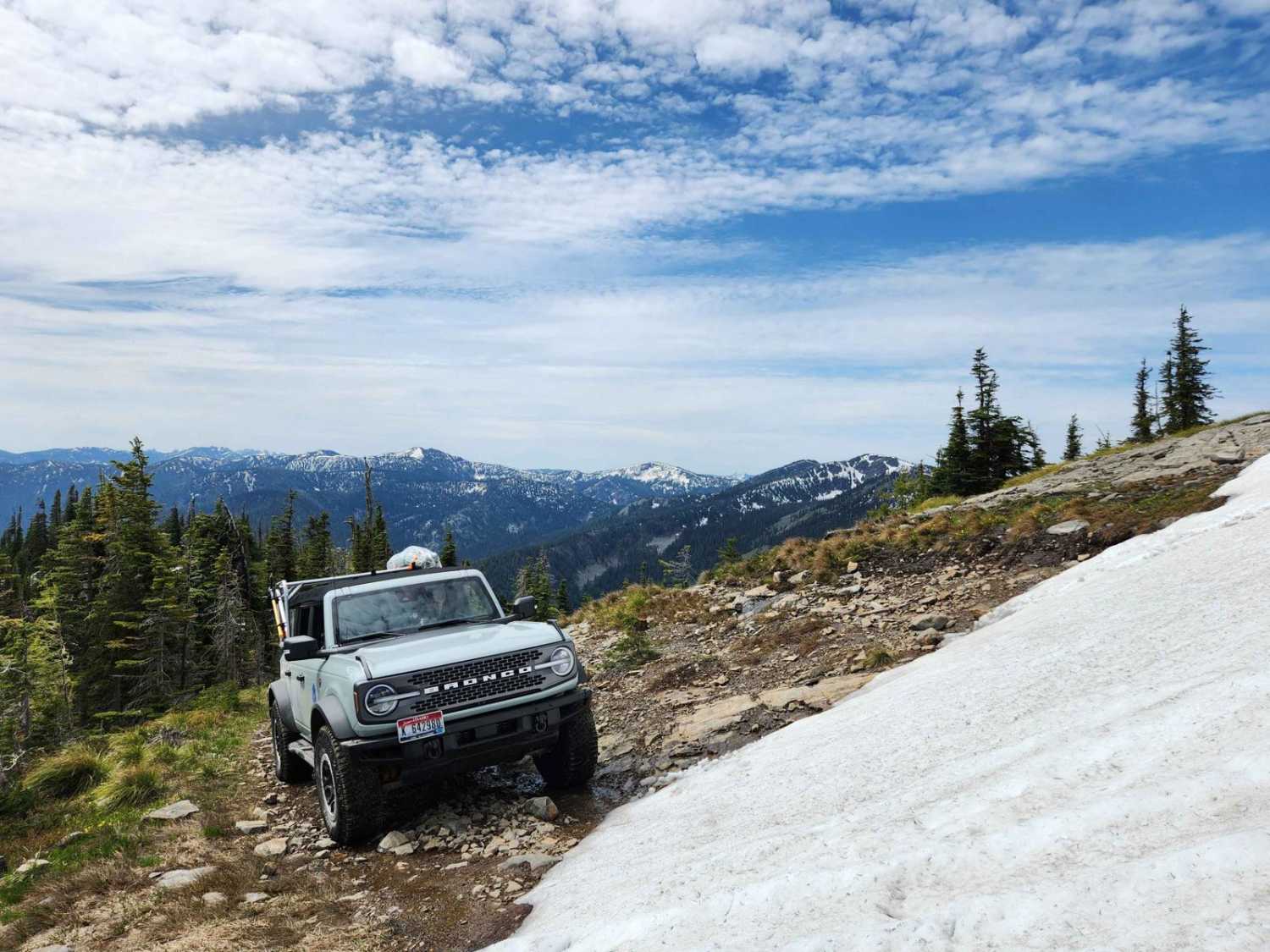
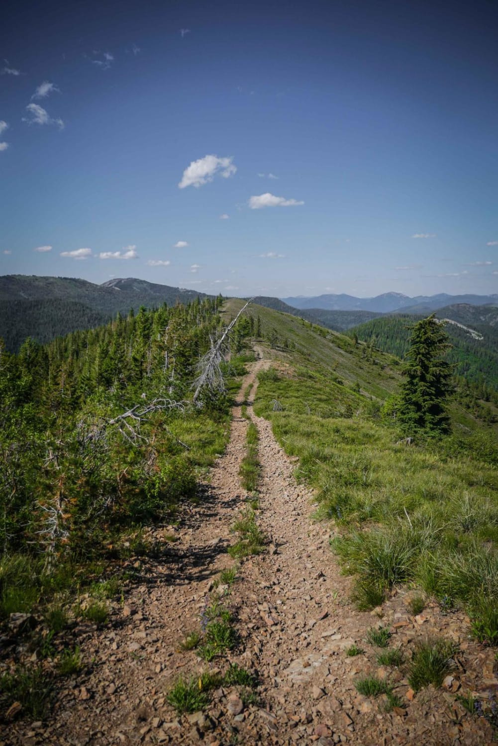
Smith Mountain trail terminates at the remains of a USFS fire lookout west of Troy, Montana. The route is extremely picturesque, offering broad panoramic views of the Cabinet and Purcell Mountains. Cell phone service is generally not accessible on this route. The area is abundant in pine trees, bear grass, and juniper, with some areas that have been logged or burnt in fires over the last decade. There are deer, elk, bobcat, black bear and grizzly bears-so come prepared and practice proper bear etiquette. The road is marked "no trailers" at the 5.1-mile mark and it would be challenging to turn around a trailer beyond that point. During spring runoff, it is typical to find water on, near, and running down the roadway. There are a few campsites along the roadway, they become sparse as you ascend the mountain towards the top. The trail is infrequently used, there are no FS vault toilets, and you may need to clear some deadfall from the roadway. The trail received some maintenance in 2023 and is generally in good condition with no overgrowth onto the trail. Trail and weather conditions may change drastically, be prepared for anything.
Photos of Smith Mountain
Difficulty
The road is generally rated a two, but for the last two miles it becomes increasingly steep and rough, with occasional off-camber and rutted surfaces.
Status Reports
Smith Mountain can be accessed by the following ride types:
- High-Clearance 4x4
- SUV
- SxS (60")
- ATV (50")
- Dirt Bike
Smith Mountain Map
Popular Trails

Pennal Gulch River Access

Potter Creek - FS 911
Dam Ridge ATV
The onX Offroad Difference
onX Offroad combines trail photos, descriptions, difficulty ratings, width restrictions, seasonality, and more in a user-friendly interface. Available on all devices, with offline access and full compatibility with CarPlay and Android Auto. Discover what you’re missing today!