Roses Creek - FS 210
Total Miles
8.8
Technical Rating
Best Time
Spring, Summer, Fall
Trail Type
Full-Width Road
Accessible By
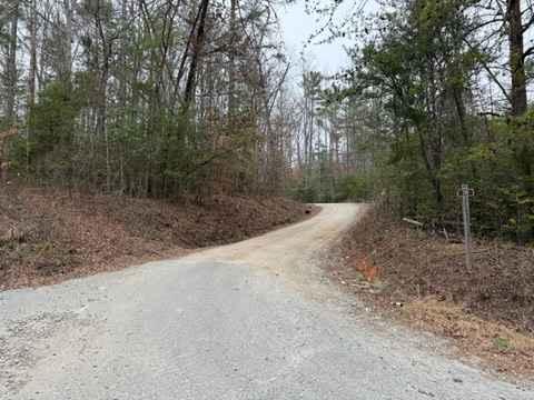
Trail Overview
This Forest Service road through Pisgah National Forest offers access to stunning views, Table Rock, and the North Carolina Outward Bound School. The trail begins in a small town, passing through some private property before transitioning into a narrow shelf road with hard-packed gravel. Along the way, you'll encounter steep drop-offs, views of Rose's Creek, and evidence of significant storm damage from Hurricane Helene. As the trail winds through the landscape, it generally follows Roses Creek, which can be seen from various vantage points along the route. Certain sections feature picturesque waterfalls and rushing rapids, while frequent overlooks provide breathtaking views of the surrounding forest and mountains. Towards the end of the trail, where the terrain levels out, several campsites appear along the route. These sites vary in size, accommodating anywhere from one or two vehicles to larger spots that can fit four or five. While many campsites offer scenic views, fire pits, and a serene atmosphere, some may pose challenges in finding level ground--particularly for tent camping.
Photos of Roses Creek - FS 210

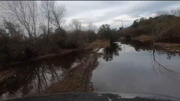
Difficulty
The trail is relatively easy, with the most challenging sections consisting of small ruts caused by hurricane damage. These ruts are no more than a few inches deep and can mostly be avoided with careful navigation. While the trail is generally narrow, frequent pull-offs allow for easy passing of other vehicles. One potential obstacle to be aware of is fallen trees and branches scattered along the road, most have been moved but winds and storms could blow debris into the road.
Status Reports

Popular Trails

Roseboro Road - FS 981

Mortimer Piedmont - FS 982
Ocean Pearl Road - The Gauntlet

Cape Hatteras 34 to 38 Avon Beach
The onX Offroad Difference
onX Offroad combines trail photos, descriptions, difficulty ratings, width restrictions, seasonality, and more in a user-friendly interface. Available on all devices, with offline access and full compatibility with CarPlay and Android Auto. Discover what you’re missing today!