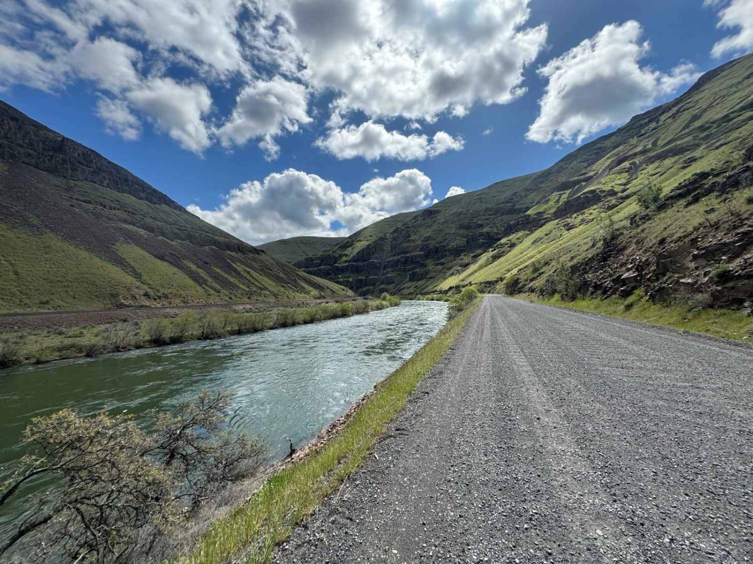
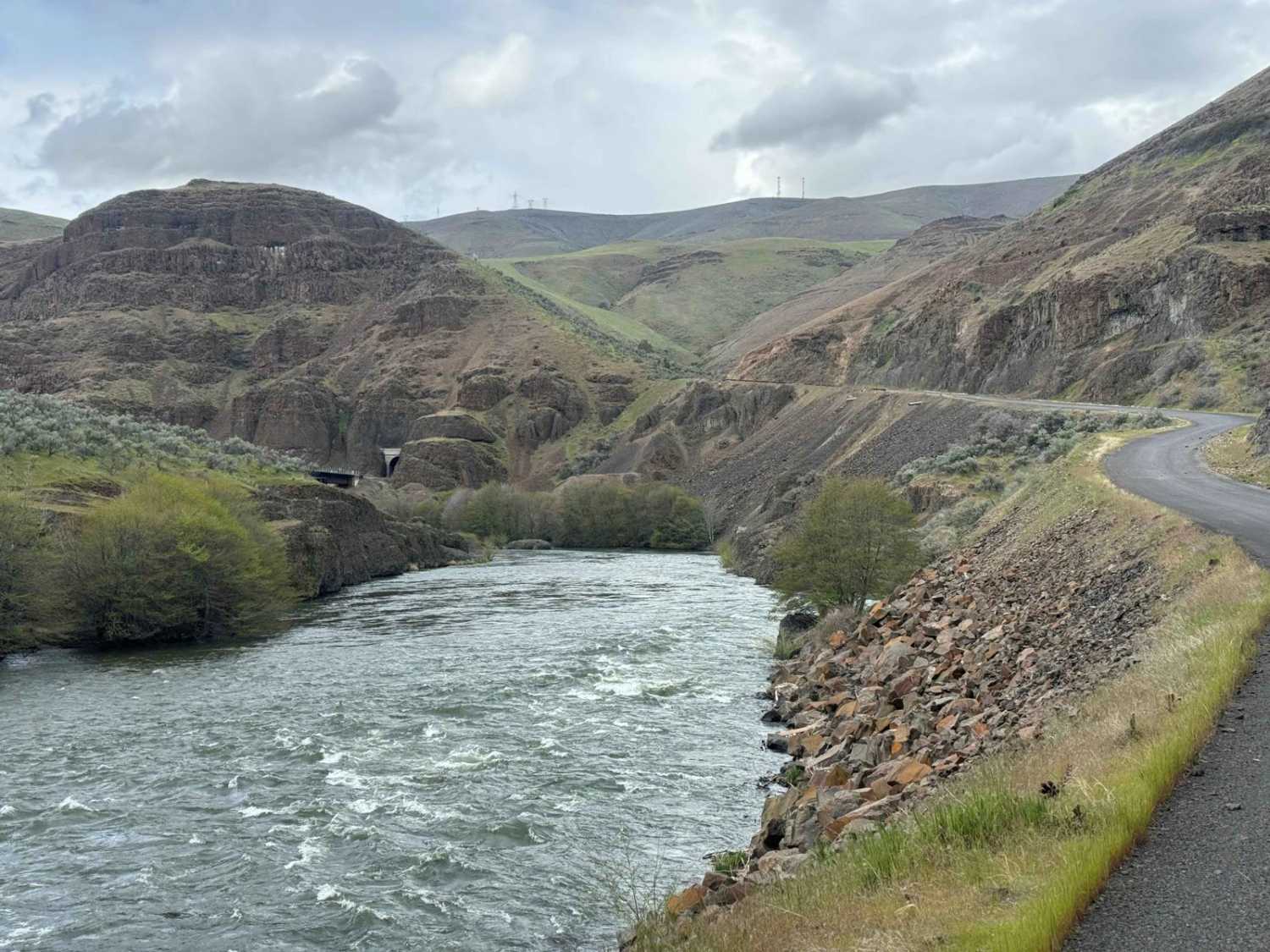
Lower Deschutes River Access Road
Total Miles
17.8
Technical Rating
Best Time
Spring, Summer, Fall, Winter
Trail Type
Full-Width Road
Accessible By
Trail Overview
Take your time and enjoy the rugged beauty as you travel down this deep rimrock-lined canyon section of the Deschutes River, a designated Federal Wild and Scenic River. This road ends 17 miles down the canyon, but this trip is more about the journey than the destination. The road is mostly gravel that is wide and smooth but has sections of washboard and potholes that you'll want to take slow and easy, especially if driving a car. Be sure to stop at any of the many primitive campgrounds that provide day-use river access and some with boat launches. Just remember a permit is required to boat the lower Deschutes River. The campgrounds are primitive and first-come, first-served, and provide fire rings, picnic tables, and group pit toilets. If camping, be aware of the seasonal open fire restriction from June 1 through October 15 and plan to use propane stoves and shielded lanterns. If you are an experienced multi-day hiker, you can hike the Deschutes Railbed trail that begins at Mack's Canyon Campground (end of the road) and ends at the Columbia River. Remember to Tread Lightly and treat other users as you would like to be treated.
Photos of Lower Deschutes River Access Road
Difficulty
This is a maintained wide gravel road with potholes and washboard sections. It's easily traveled with any street-legal vehicle.
History
This gravel road travels along the Deschutes River which is designated as an Oregon Scenic Waterway and a Federal Wild and Scenic River.
Lower Deschutes River Access Road can be accessed by the following ride types:
- High-Clearance 4x4
- SUV
Lower Deschutes River Access Road Map
Popular Trails

Lookout Point Trail
Green Mountain Gravel Pits

Camp Kettle Creek Road Trail
The onX Offroad Difference
onX Offroad combines trail photos, descriptions, difficulty ratings, width restrictions, seasonality, and more in a user-friendly interface. Available on all devices, with offline access and full compatibility with CarPlay and Android Auto. Discover what you’re missing today!