North Fork Trask River Road
Total Miles
3.5
Technical Rating
Best Time
Spring, Summer, Fall, Winter
Trail Type
Full-Width Road
Accessible By
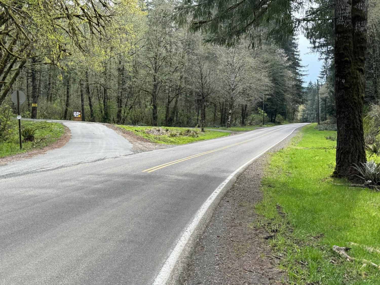
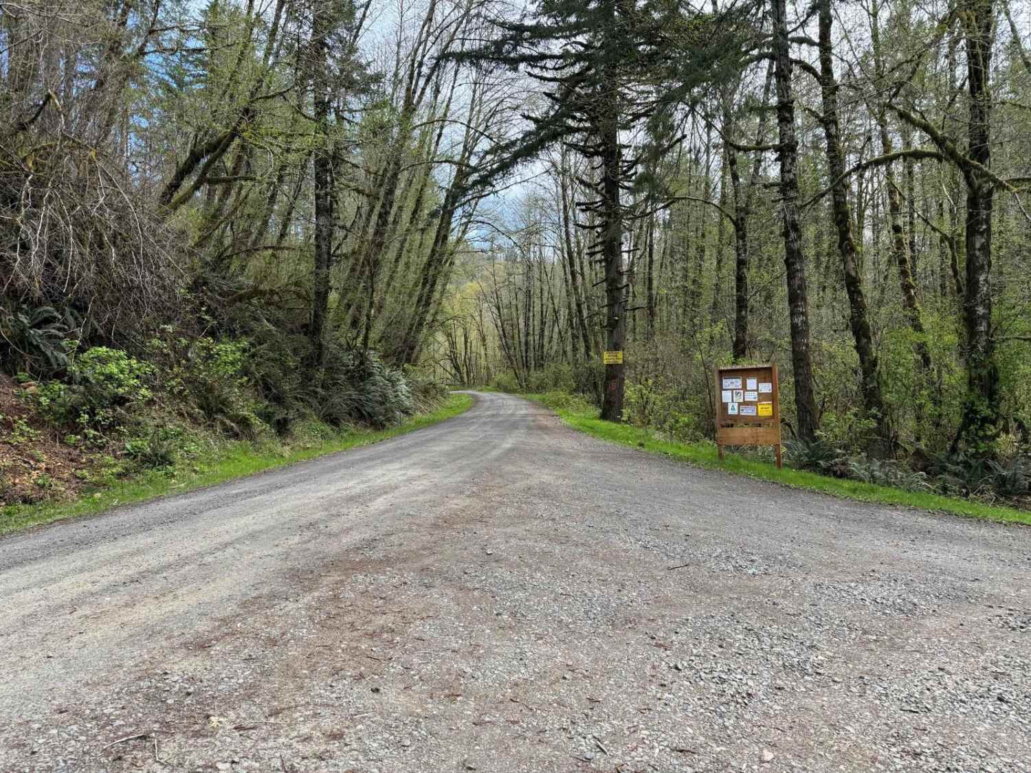
Trail Overview
This is one of the main arteries leading deep into the Tillamook State Forest from the Trask River Road. Follow it up the North Fork Trask River and on to Yamhill if you wish, passing Barney Reservoir along the way. As you leave the pavement behind, you'll soon be traveling along the riverbank where you'll be rewarded with spectacular views of the crystal-clear water and the rugged riverbed. The road surface is wide and mostly gravel with some sections of potholes. This route provides ample opportunities to view the river from the road and plenty of spots to access the river on foot. At the 2-mile mark, there's a designated campsite large enough for multiple tents or even RVs. It's equipped with a firepit but not a table. At about 3.5 miles, the route starts heading away from the river and at this point meets up with Gobblers Knob Road. If continuing towards Yamhill, be sure to take the left fork. If you wish to go up to Gobblers Knob, take the right fork.
Photos of North Fork Trask River Road
Difficulty
The road is wide and mostly smooth with sections of potholes and possibly washboard. Just keep a lookout for oncoming vehicles and park completely off the road when exploring on foot.
Status Reports
North Fork Trask River Road can be accessed by the following ride types:
- High-Clearance 4x4
- SUV
- SxS (60")
- ATV (50")
- Dirt Bike
North Fork Trask River Road Map
Popular Trails
Annie's Desert Romp
Myrtle Park Ice Cave
Spencer Wells
The onX Offroad Difference
onX Offroad combines trail photos, descriptions, difficulty ratings, width restrictions, seasonality, and more in a user-friendly interface. Available on all devices, with offline access and full compatibility with CarPlay and Android Auto. Discover what you’re missing today!