Beef Basin Road Loop - San Juan County B104
Total Miles
12.0
Technical Rating
Best Time
Spring, Summer, Fall
Trail Type
Full-Width Road
Accessible By
Trail Overview
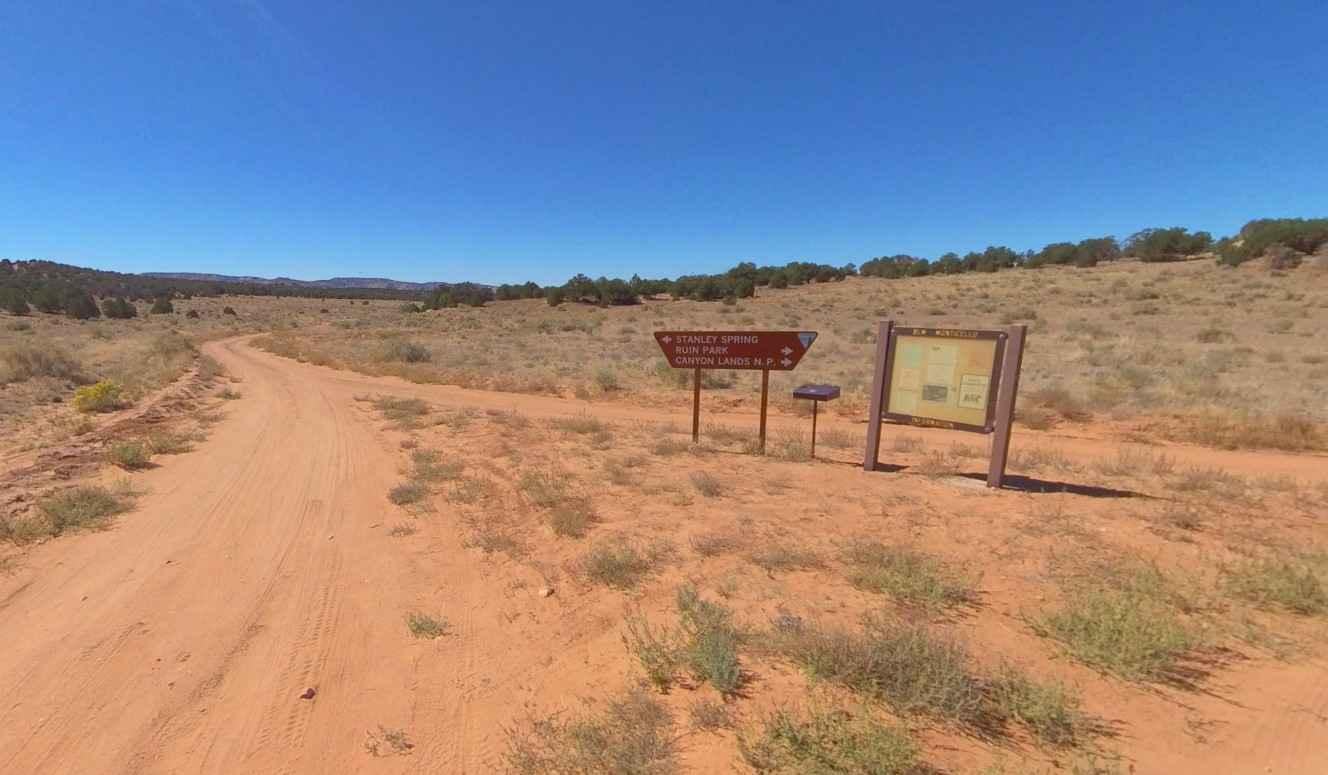
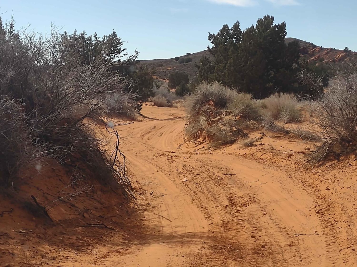
The Beef Basin Road Loop starts at the information kiosk at the intersection of Beef Basin and Ruin Park Road (San Juan County Road 119) and is described here in a clockwise route. The trail is a 12-mile loop rated 3 of 10 located within the Bears Ears National Monument and managed by the BLM. This area is rich in ancient native dwellings, ruins, and rock art. In addition to the major points of interest described on this trail, nearly every side trail leads to an area that can be explored. The route is along an unimproved dirt track with no real obstacles to negotiate. Just keep an eye out for ruts as this trail is above 6000' elevation so rain and snow can create muddy conditions. Many of the points of interest are located within 100 yards of the trail along the ridge of the bench (rise in the ground). The first set of ruins is located at the 5-mile mark on the south side of the road at 37.94653, -109.92952. Continuing west on the trail about a half-mile there will be a dirt track leading to the base of the bench. Above are the two Bench Ruins (37.94838, -109.93809 and 37.94846, -109.93871). Heading further west to the intersection at South Canyon, park on the southern trail and head back east along the bench to the South Canyon Pueblo (37.94858, -109.94731). At this point, the trail turns north. In approximately 1 mile the Granary and Hidden Ruins can be found along the base of the ridge on the east side of the road (37.96348, -109.94945 and 37.96359, -109.94923). From here follow the trail back around and go enjoy the other trails. There is no cellular coverage in the area and the nearest services are located in Monticello (the shortest route is approximately 65 miles).
Photos of Beef Basin Road Loop - San Juan County B104

Difficulty
This trail consists of loose rocks, dirt, and sand with some slick rock surfaces, mud holes possible, and no steps higher than 12". 4WD may be required and aggressive tires are a plus.
History
Beef Basin, one of the more remote places in southern Utah, is a region of grassy parkland separated by red and white mesas, on the south side of the Needles District of Canyonlands National Park, bordered to the south by the foothills of the Abajo Mountains. The elevation is around 6,500 feet, high enough for significant snow in winter that makes access routes impassable, typically until April, though in summer the basin can be rather hot. The name of this area was bestowed in the mid-19th century when the grassland was used for cattle grazing. Since 2016, all this region is within Bears Ears National Monument.
Status Reports
Beef Basin Road Loop - San Juan County B104 can be accessed by the following ride types:
- High-Clearance 4x4
- SUV
- SxS (60")
- ATV (50")
- Dirt Bike
Beef Basin Road Loop - San Juan County B104 Map
Popular Trails
Northeast Access Red Cliffs Rec Area
Heber Mtn (FR 70096)

Bullion Creek Falls

Lockhart Canyon - CR122
The onX Offroad Difference
onX Offroad combines trail photos, descriptions, difficulty ratings, width restrictions, seasonality, and more in a user-friendly interface. Available on all devices, with offline access and full compatibility with CarPlay and Android Auto. Discover what you’re missing today!