BLM B0057 - Lime Butte Ruins
Total Miles
1.3
Technical Rating
Best Time
Spring, Summer, Fall, Winter
Trail Type
Full-Width Road
Accessible By
Trail Overview
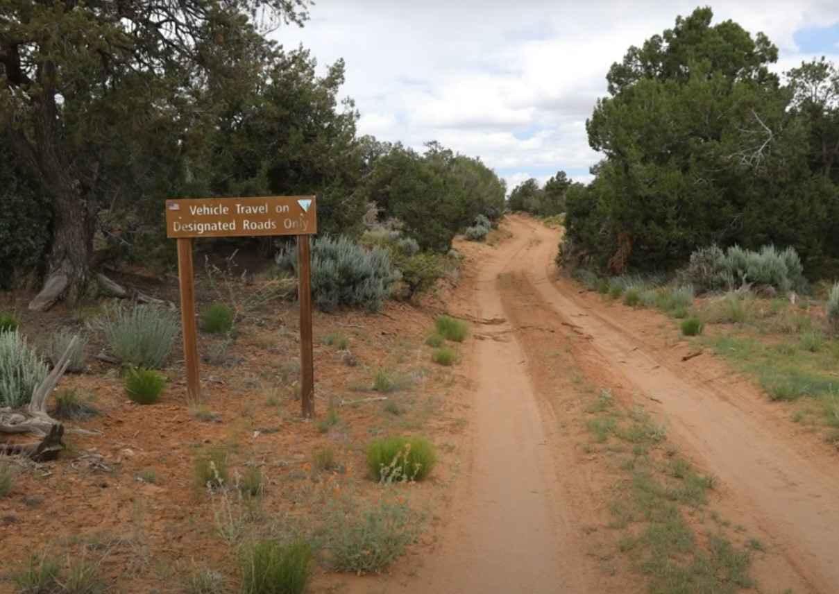
BLM B0057 is a 1.3-mile out-and-back (2.6-mile round trip) trail rated 3 of 10 located in San Juan County. This is a destination trail to the Lime Butte Ruins located on Cedar Mesa and within the Bear Ears National Monument. The trail is a single-width sand track that leads to the boundary of the Road Canyon Wilderness Study Area. This is an easy track that can become more difficult if it rains or snows. A 4WD vehicle is recommended due to the potential for deep sand on the trail. At the 1.3-mile point, there is an intersection. The road that continues straight is closed at the present time. The road to the left may be followed and will link up with Cigarette Spring Road. Park at the intersection and follow the no Motorized Use track on the map which will lead to the ruins located on the mesa above (37.3729, -109.89605). The butte can be seen about 600 feet away sticking up above the trees. After heading in the direction of the butte a faint trail should become apparent. The trail almost disappears in a couple of spots but being able to see the butte up ahead makes route finding easy enough. The easiest route up to the top of the butte is to hike around to the east side where very little, if any, scrambling is needed. There are several circular ruins that may be found in this area. Interestingly there are several other tower sites to the east that might have a line of sight with this one. Using binoculars there are several ruins that are visible in the nearby branch of Lime Canyon. This area does require a day permit to hike to the mesa. Passes are valid for day hiking in the canyons of Cedar Mesa and Comb Ridge at Bears Ears National Monument. Passes currently cost $5. (http://www.recreation.gov/permits/273374). There is no cell service in the area and the nearest service are located in Mexican Hat to the south, Blanding to the east, and Hanksville to the north.
Photos of BLM B0057 - Lime Butte Ruins

Difficulty
This trail consists of loose rocks, dirt, and sand with some slick rock surfaces, mud holes possible, and no steps higher than 12". 4WD may be required, aggressive tires are a plus.
Status Reports
Popular Trails
Arapeen Ephraim Canyon to Joes Valley
Murdock Basin
Backdoor to Babylon
The onX Offroad Difference
onX Offroad combines trail photos, descriptions, difficulty ratings, width restrictions, seasonality, and more in a user-friendly interface. Available on all devices, with offline access and full compatibility with CarPlay and Android Auto. Discover what you’re missing today!