BLM D0148 - Ruin Canyon
Total Miles
2.3
Elevation
1,962.97 ft
Duration
1 Hours
Technical Rating
Best Time
Spring, Summer, Fall
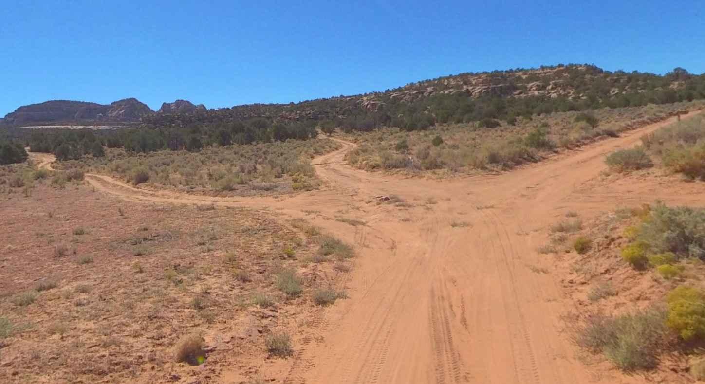
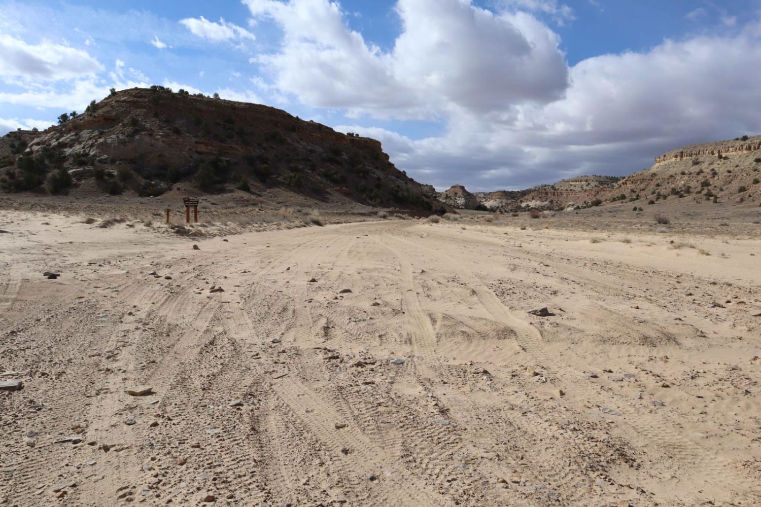
Trail Overview
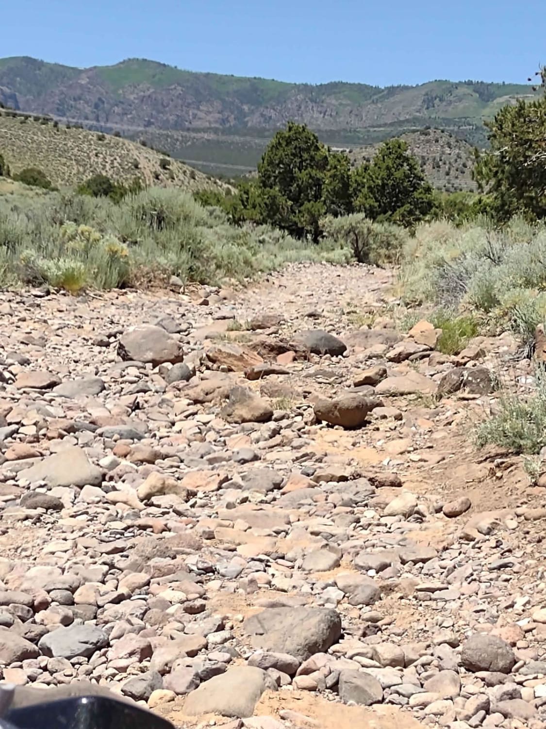
Ruin Canyon is a 2.1-mile out-and-back (4.2-mile round trip) destination trail rated 3 of 10 located within the Bears Ears National Monument and managed by the BLM. The trail starts at a 5-way intersection on Beef Basin Road. This single-width road is listed as open to all, but would recommend as a minimum a high clearance AWD or 4WD vehicle. The trail may be overgrown in spots but the track is very visible. Starting down the trail there are several collection corrals, as this area is also BLM-leased grazing land. This area is rich in ancient native dwellings, ruins, and rock art. In addition to the major points of interest described on this trail, nearly every side trail leads to an area that can be explored. And careful observation several other sites can be seen higher on the cliff line. Traveling south on the trail the first destination is the Ruin Canyon Granary (37.93781, -109.90009) at the 0.7-mile mark. The granary is on the east side of the trail and is visible from several spots. Continuing south on the trail travel past the gate at the 1.2-mile mark leaving it as found. At 2 miles the track deviates off the main trail to the parking area for the Ruin Canyon Castle site. The parking area is roughly 0.2 miles down this side dirt track. The Ruin Canyon Castle is roughly a 0.1-mile hike west (37.92252, -109.89964). A third ruin is located west across the valley at 37.92482, -109.89991. The route is along an unimproved dirt track with no real obstacles to negotiate. Just keep an eye out for ruts as this trail is above 6000' elevation so rain and snow can create muddy conditions. There is no cellular coverage in the area and the nearest services are located in Monticello (the shortest route is approximately 65 miles).
Photos of BLM D0148 - Ruin Canyon

Difficulty
This trail consists of loose rocks, dirt, and sand with some slick rock surfaces, mud holes possible, and no steps higher than 12". 4WD may be required and aggressive tires are a plus.
History
Beef Basin, one of the more remote places in southern Utah, is a region of grassy parkland separated by red and white mesas, on the south side of the Needles District of Canyonlands National Park, bordered to the south by the foothills of the Abajo Mountains. The elevation is around 6,500 feet, high enough for significant snow in winter that makes access routes impassable, typically until April, though in summer the basin can be rather hot. The name of this area was bestowed in the mid-19th century when the grassland was used for cattle grazing. Since 2016, this region has been within Bears Ears National Monument.
Status Reports
Popular Trails
City Creek Canyon (FS# 40133)

Skyline North Trail
Bellevue Flats
The onX Offroad Difference
onX Offroad combines trail photos, descriptions, difficulty ratings, width restrictions, seasonality, and more in a user-friendly interface. Available on all devices, with offline access and full compatibility with CarPlay and Android Auto. Discover what you’re missing today!