Browse Area Guard Station-FSR30037
Total Miles
7.7
Technical Rating
Best Time
Summer, Spring, Fall
Trail Type
Full-Width Road
Accessible By
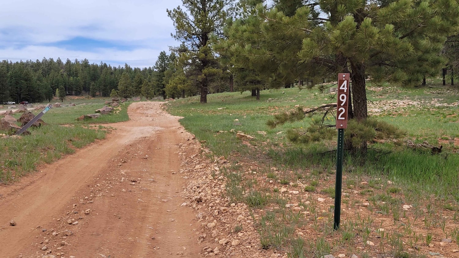
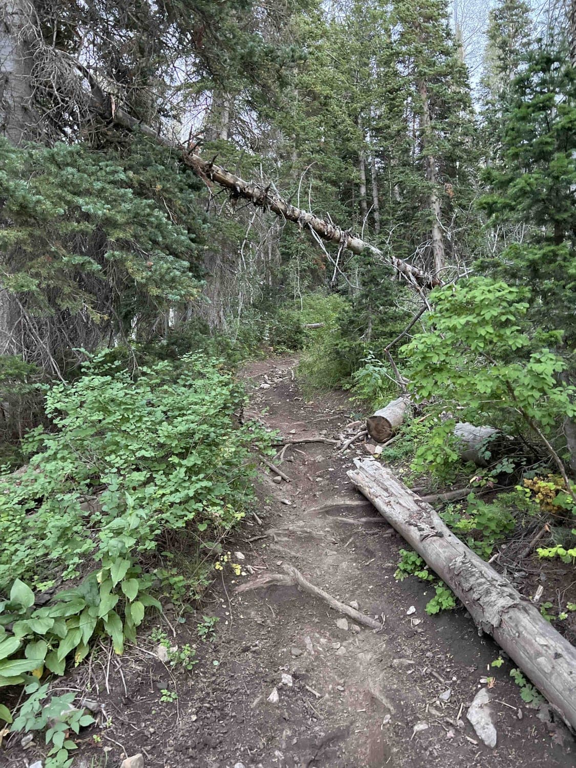
Trail Overview
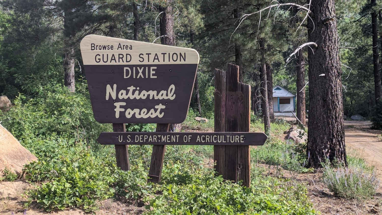
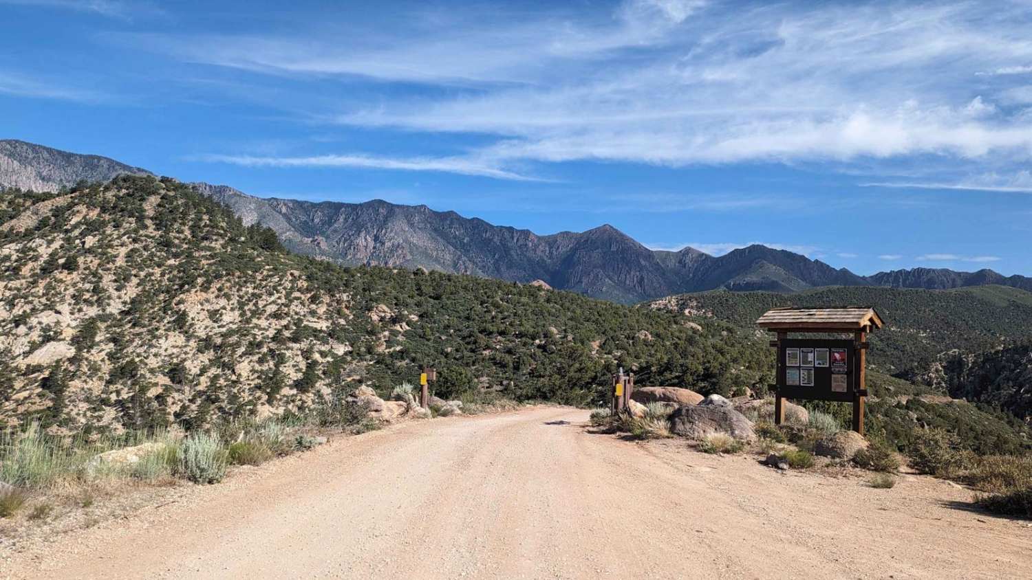
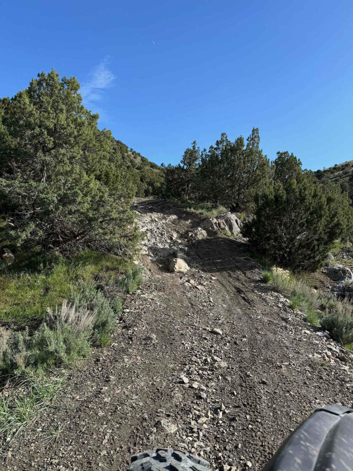
Browse Area Guard Station is a 7.6-mile out-and-back (15.2-mile round-trip) trail rated 3 of 10 located in Washington County. The trailhead is located at Interstate 15, exit 30 (Browse). The first 3.5 miles of the trail is rated 2 and is suitable for most passenger vehicles. At the 3.5-mile point, there is a Forest Service gate (37deg21'14.55"N, 113deg19'41.42"W). This gate is seasonal and open from 30 April to 1 November under normal conditions. The gate may remain locked if there is still significant snow on the trail above the gate. There is adequate parking at the gate area for hikers. The lower portion of the trail is a maintained county gravel road (generally 2 vehicles wide). From the gate up to the guard station, the trail is single-vehicle-wide hard-packed dirt with ruts and embedded rocks. The trail alternates between shelf road and valley transits until it reaches the end at the Browse Area Guard Station. One of several giant sequoia trees is located directly behind the guard station. This site was first developed in 1921 as the 179-acre Mill Creek Browse Experimental Range with an enclosure to study the use of browse vegetation as summer forage for cattle. In 1934, the Civilian Conservation Corps (CCC) built a Plan 5 guard station to replace a smaller cabin built years earlier. Beginning in 1960, the Forest Service shared the guard station with the Utah Fish and Game Department for use as seasonal housing. The site was intact with its three buildings and corral when the Sequoia Fire of 2002 swept through the canyon. Remarkably, everything around the station burned but the buildings were unharmed, thanks to clearing of flammable materials the previous year. The giant sequoia tree is approximately 108 feet tall and 11.25 feet in circumference. This tree is not native to this area. It was planted as a sapling in 1933-34 by Dr. Walter P. Cottam as part of the Browse Experiment Station. Browse Station gets its name from the study that was conducted. Browse plants were planted into 27 plot fenced areas set up as control plots. So, what exactly are browse plants? They are vegetation that will grow in abundance to feed wildlife or ranch animals (in this case, cattle grazing). Generally speaking, plants such as white pine, sumac, dogwood, some birches, viburnums, vines, hawthorns, berry bushes, and beautyberries are all considered browse plants. The project was abandoned in 1953 and the site became overgrown with dense brush. A fire in 2002 uncovered these plot areas, something that hadn't been found previously due to the dense vegetation. Cell phone coverage is good at the trailhead, intermittent during the ascent due to the height of the canyons, but available at the guard station. The nearest services are located in La Verkin, some 10 miles from the trailhead.
Photos of Browse Area Guard Station-FSR30037
Difficulty
The trail consists of loose rocks, dirt, and sand with some slick rock surfaces and mud holes possible. No steps are higher than 12 inches. 4WD may be required, and aggressive tires are a plus.
Status Reports

Popular Trails
Wildlife Excursion
Lake Mountain Trail
Tommy Loop to Henrie Knolls
Forest Lake (2171)
The onX Offroad Difference
onX Offroad combines trail photos, descriptions, difficulty ratings, width restrictions, seasonality, and more in a user-friendly interface. Available on all devices, with offline access and full compatibility with CarPlay and Android Auto. Discover what you’re missing today!