Buttes and Towers-Moab
Total Miles
17.5
Technical Rating
Best Time
Spring, Summer, Fall, Winter
Trail Type
High-Clearance 4x4 Trail
Accessible By
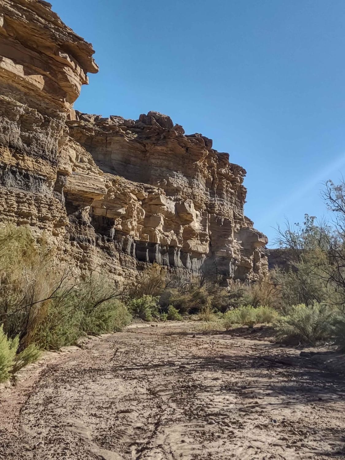
Trail Overview
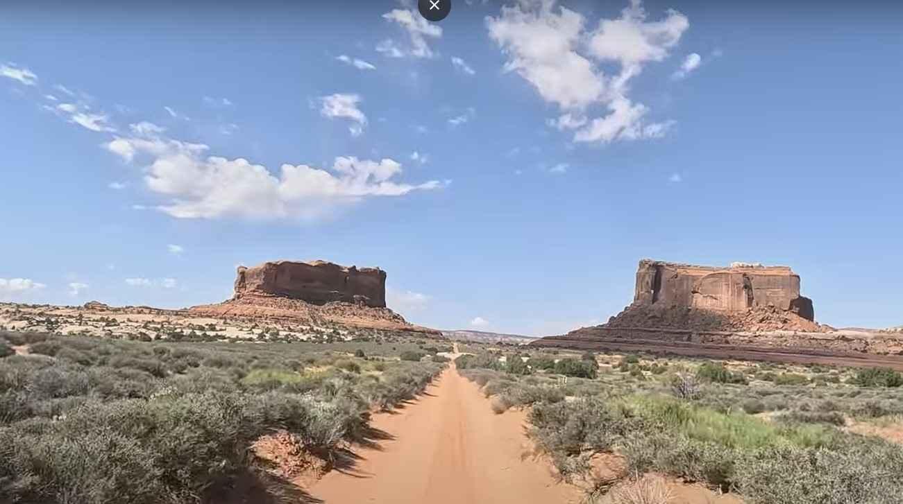
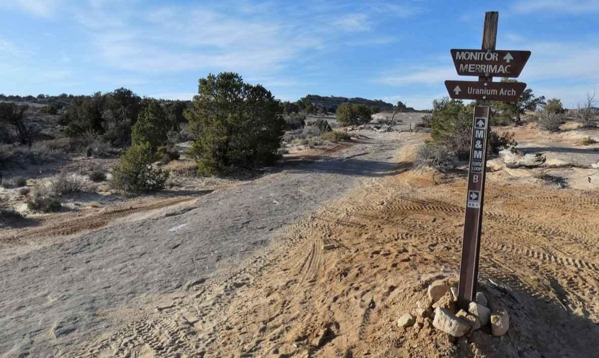
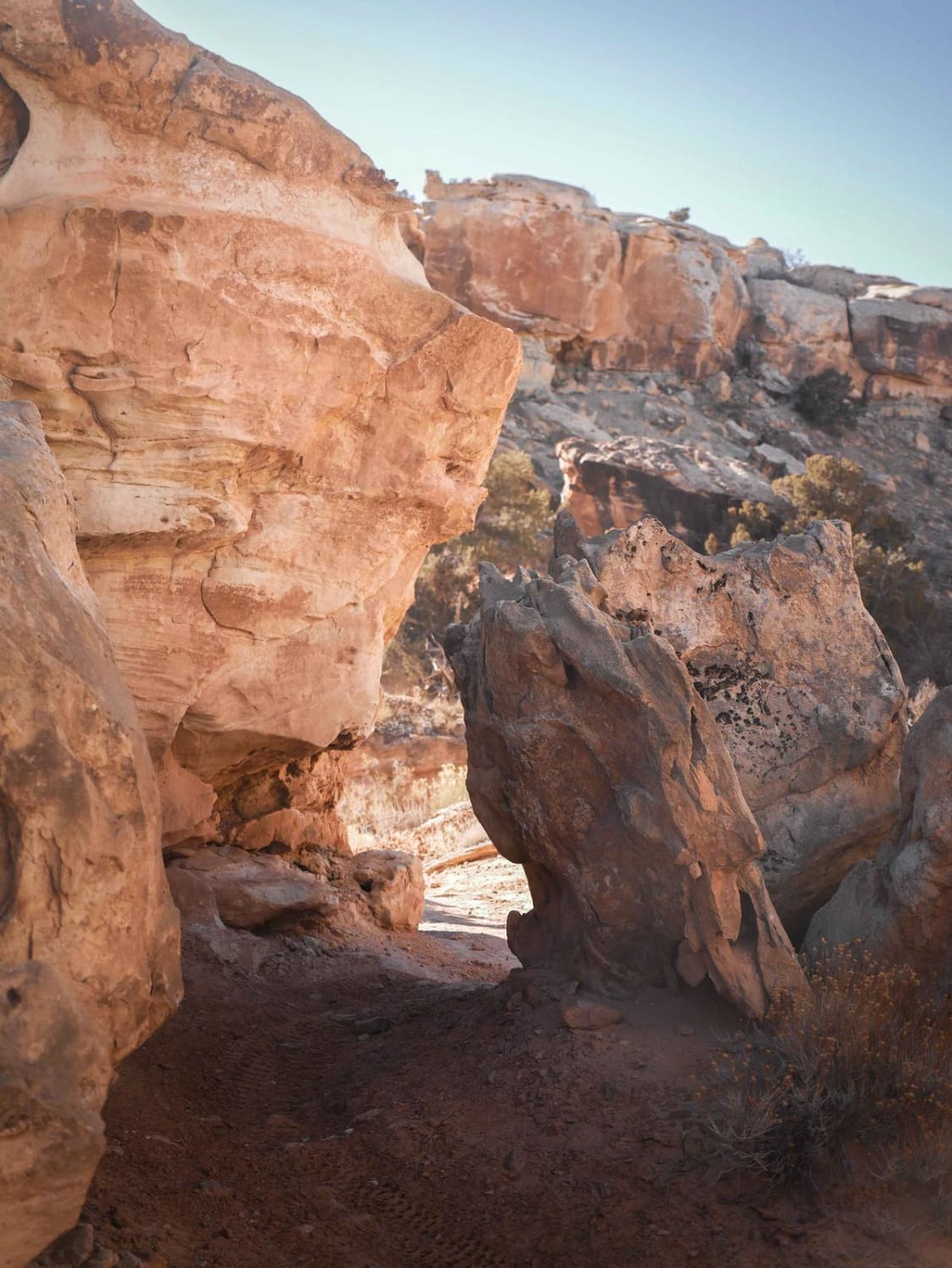
Buttes and Towers trail is an 18-mile point-to-point trail rated 3 of 10 located outside Moab in Grand County, Utah. This trail offers the perfect combination of moderate 4-wheeling with plenty of sightseeing opportunities. Some rougher sections of the trail call for more attention than others but nothing too tough for a stock 4WD to handle. This beautiful trail visits the scenic Courthouse Pasture area northwest of Moab to provide participants with picturesque views and vistas of the beautiful reddish Entrada rock formations that are plentiful in this area. The La Sal Mountain peaks serve as a backdrop. Courthouse Rock dominates the beginning of the trip. The trail passes some of the most famous areas of northern Moab such as Pasture Butte, Monitor and Merrimac Buttes, and Determination Towers. There are no major obstacles along this route. After crossing the ledge section and traveling through Mills Canyon the trail runs straight south out to the buttes. After visiting the buttes, the trail backtracks and then turns west towards the towers thus giving this trail its name. The trail surface varies but stays consistent with the trail rating. It varies from bumpy rock sections to smooth sandy washes. There are two track dirt sections, a lot of fun slickrock driving that includes some sidehill areas (follow the white dashes painted on the slickrock), then sandy creek bottoms, and a lot of sandy pasture area. Sprinkled among all this variety are broken, rubbly rock sections and a few short steps. Cell phone service is intermittent and the nearest services are in Moab.
Photos of Buttes and Towers-Moab
Difficulty
The trail consists of loose rocks, dirt, and sand with some slickrock surfaces. Mud holes are possible and no steps higher than 12". 4WD may be required, aggressive tires are a plus.
Status Reports
Buttes and Towers-Moab can be accessed by the following ride types:
- High-Clearance 4x4
- SxS (60")
- ATV (50")
- Dirt Bike
Buttes and Towers-Moab Map
Popular Trails
Salt Wash Single Track
Piuta - FS 70103
Tusher Wash Left
Great Western Trail - Pine Lake to Torrey, Utah
The onX Offroad Difference
onX Offroad combines trail photos, descriptions, difficulty ratings, width restrictions, seasonality, and more in a user-friendly interface. Available on all devices, with offline access and full compatibility with CarPlay and Android Auto. Discover what you’re missing today!