Hog Canyon 3 - City Loop (BLM HC3)
Total Miles
2.0
Technical Rating
Best Time
Spring, Summer, Fall
Trail Type
Full-Width Road
Accessible By
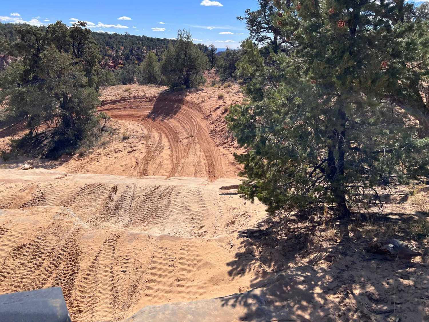
Trail Overview
The western end of this trail is approximately .1 miles east of the entrance to HC2. This is a great trail to test your comfort level on a slightly more difficult trail. The trail has sand, rock ledges, and slick rock areas. At this point, you get another great view to the south over Kanab and out into the Kaibab area. There are also beautiful views of Toms Canyon as you continue along the eastern portion of the trail. Near the western end, there are a couple of optional climbs that can be taken to judge your comfort level with more difficult situations. Please Note: HC is a set of defined trails, AKA a trail park. These defined trails vary in difficulty to provide challenges for all types of vehicles and skill levels. It is also a great area to learn new skills on these trails. HC is NOT an open-riding area. You are expected to stay on the defined trails and, under no circumstances, create new trails. In addition, please do not build upon someone else's desecration of the area by riding on trails or bypasses that have been created by others. Please obey all BLM-posted signs. OnX asks everyone to support the Tread Lightly principles.
Photos of Hog Canyon 3 - City Loop (BLM HC3)

Difficulty
This trail contains some sandy sections, rock ledges, and slick rock areas that will take some skills to navigate successfully. It is a great trail to judge your comfort in off-camber and rock-climbing situations at a level that most off-road high-clearance vehicles should be able to navigate.
Status Reports
Hog Canyon 3 - City Loop (BLM HC3) can be accessed by the following ride types:
- High-Clearance 4x4
- SUV
- SxS (60")
- ATV (50")
- Dirt Bike
Hog Canyon 3 - City Loop (BLM HC3) Map
Popular Trails


Nephi Pasture Road Offshoot

Lost Creek Rex Reservoir- FS 40053
Revenue Gulch - Bullion/Wedge Road
The onX Offroad Difference
onX Offroad combines trail photos, descriptions, difficulty ratings, width restrictions, seasonality, and more in a user-friendly interface. Available on all devices, with offline access and full compatibility with CarPlay and Android Auto. Discover what you’re missing today!