Off-Road Trails in West Virginia

Discover off-road trails in West Virginia

Learn more about 44/1 Bellwood Corporation Mine (Ford Knob Road)
44/1 Bellwood Corporation Mine (Ford Knob Road)

44/1 Bellwood Corporation Mine (Ford Knob Road)

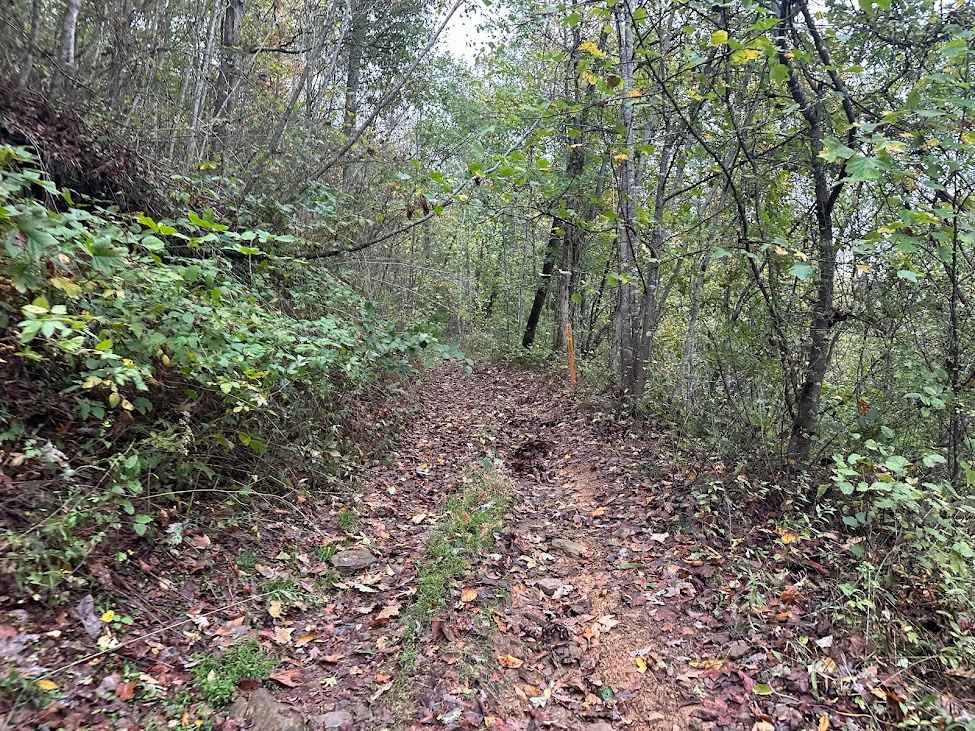
This trail loops the road to Springdale bypass. That sounds like a good name for a road long forgotten. County road 44/1 is a road the locals use for recreation and your constant use will…
Learn more about 44/1 Bellwood Corporation Mine (Ford Knob Road)
Total Miles
4.2
Tech Rating
3 Easy
Best Time
Fall
Learn more about Bald Knob
Bald Knob

Bald Knob

Road is hilly and rocky at first until you hit a water crossing. Then you will be in gravel for awhile and the views are amazing. Great ride in WV Mountains if you want to…
Learn more about Bald Knob
Total Miles
37.3
Tech Rating
4 Moderate
Best Time
Spring, Summer
Learn more about Bearwallow Trail
Bearwallow Trail

Bearwallow Trail

Trails differ in skill level from blue and green to black and double black diamond. Very friendly for beginners/stock enthusiasts after their first badge. The double black diamond look to be a bit rough. I…
Learn more about Bearwallow Trail
Total Miles
4.2
Tech Rating
3 Easy
Best Time
Fall
Learn more about Beech Fork
Beech Fork

Beech Fork

This in probably one of the best adventures we went on in 2021. This trail starts in Nicholas County WV and ends in Clay County WV. There are about 50 creek crossings, mud, ruts, and…
Learn more about Beech Fork
Total Miles
17.2
Tech Rating
4 Moderate
Best Time
Spring, Summer, Fall, Winter
Learn more about Belcher Ridge Run
Belcher Ridge Run

Belcher Ridge Run

This trail has everything you want in an awesome trail with the exception of a water crossing. This trail is best traveled west to east for a few reasons. First: food and drink are on…
Learn more about Belcher Ridge Run
Total Miles
29.6
Tech Rating
7 Difficult
Best Time
Spring, Summer, Fall
Learn more about Brandywine Recreation Area
Brandywine Recreation Area

Brandywine Recreation Area

Brandywine Recreation Area is a national forest fee area located just off Route 33 in West Virginia. The area has a reservoir with a sandy swimming area and is accessible for kayaking and fishing. All…
Learn more about Brandywine Recreation Area
Total Miles
1.2
Tech Rating
1 Easy
Best Time
Spring, Summer, Fall
Learn more about Camp Creek Trail
Camp Creek Trail

Camp Creek Trail

There are a variety of different obstacles on this ride. From gravel to Rock. You will encounter mud and washed out segments and ruts. This trail also has various low hanging limbs and downed trees…
Learn more about Camp Creek Trail
Total Miles
6.3
Tech Rating
6 Moderate
Best Time
Spring, Summer, Fall
Learn more about Canaan Loop
Canaan Loop

Canaan Loop

Canaan Loop is a 2 way trail passing through the Monongahela National Forest entering or exiting from either WV 32 or Black Water Falls State Park. A mix of dense rhododendron, evergreen, and hardwood foliage…
Learn more about Canaan Loop
Total Miles
14.4
Tech Rating
3 Easy
Best Time
Winter, Fall, Summer, Spring
Learn more about Canyon Rim Road
Canyon Rim Road

Canyon Rim Road

This route travels from just outside Thomas, WV connecting back to WV 48. The route is not well maintained and has varying terrain. Mud and natural rock make up the base with some small washes…
Learn more about Canyon Rim Road
Total Miles
8.6
Tech Rating
3 Easy
Best Time
Spring, Summer, Fall, Winter
Learn more about County Route 2 - Wirt County
County Route 2 - Wirt County

County Route 2 - Wirt County

This is a scenic drive that follows part of Goose Creek in Wirt County, West Virginia. The road is mainly gravel with a few dirt sections and some water crossings but nothing too rough. This…
Learn more about County Route 2 - Wirt County
Total Miles
7.2
Tech Rating
2 Easy
Best Time
Spring, Summer, Fall, Winter
Learn more about CR 25/2 - Beury Mountain Road
CR 25/2 - Beury Mountain Road

CR 25/2 - Beury Mountain Road

Enjoy a scenic drive over Beury Mountain. You will have a beautiful view of The New River along with exposed rock faces as you go up the mountain out of Thurmond. As you crest the…
Learn more about CR 25/2 - Beury Mountain Road
Total Miles
11.4
Tech Rating
2 Easy
Best Time
Fall, Winter, Summer, Spring
Learn more about Devils Teacup
Devils Teacup

Devils Teacup

Miles upon miles of trails through Kanawaha County West Virginia. Most of the trails are open to the public and are County Routes, however, there is some private land that is clearly marked so be…
Learn more about Devils Teacup
Total Miles
40.3
Tech Rating
4 Moderate
Best Time
Spring, Summer, Fall, Winter
Learn more about Dry Gap Ridge
Dry Gap Ridge

Dry Gap Ridge

Dry Gap is a short step, out and back trail climbing along a ridge leading to a cell tower. The beginning climb is the most challenging part due to its steep nature; 4WD is recommended.…
Learn more about Dry Gap Ridge
Total Miles
1.5
Tech Rating
2 Easy
Best Time
Spring, Summer, Fall
Learn more about Emily Creek
Emily Creek

Emily Creek

This trail will take you from "mud hole point" down to the "Right Fork of Hell Creek" to gain quick access out of the hills for help or repair. It does not have any side…
Learn more about Emily Creek
Total Miles
1.0
Tech Rating
3 Easy
Best Time
Spring, Summer, Fall, Winter
Learn more about FR 19
FR 19

FR 19

Fire Road 19 connects Route 28 to FR75, the Road Across the Sky. FR19 is a tame gravel road that most cars could easily travel. The road is one-way for the majority of the drive,…
Learn more about FR 19
Total Miles
5.9
Tech Rating
2 Easy
Best Time
Fall, Spring
Learn more about FS304B
FS304B

FS304B

This trail is an offshoot of Stillhouse Run Road (FS304). It is poorly, if at all maintained, and downed trees and overgrown limbs cut the trail short of what is shown as available on the…
Learn more about FS304B
Total Miles
1.3
Tech Rating
3 Easy
Best Time
Spring, Summer, Fall, Winter
Learn more about Glady Durbin
Glady Durbin

Glady Durbin

Glady Durbin is a scenic access road that runs right along the West Fork Greenbriar River and offers stunning picnic, fishing, and camping opportunities along the trail. This trail connects the towns of Durbin and…
Learn more about Glady Durbin
Total Miles
20.2
Tech Rating
1 Easy
Best Time
Spring, Summer, Fall, Winter
Learn more about Hawk
Hawk

Hawk

Hawk Run is a meandering forest road that crosses through some private property as it climbs Spring Mountain along the border of Virginia and West Virginia. The road is mostly gravel with some dirt and…
Learn more about Hawk
Total Miles
6.5
Tech Rating
2 Easy
Best Time
Spring, Summer, Fall
Learn more about Highland Scenic Highway
Highland Scenic Highway

Highland Scenic Highway

The Highland Scenic Highway is a beautiful corridor through Monongahela National Forest. This designated National Scenic Byway extends 43 miles from Richwood to US Route 219, north of Marlinton, WV. It has four developed scenic…
Learn more about Highland Scenic Highway
Total Miles
28.9
Tech Rating
1 Easy
Best Time
Spring, Fall, Winter, Summer
Learn more about Hornet
Hornet

Hornet

Hornet descends out the back forest of George Washington National Forest to Hawk Campground. Many dispersed campsites can also be found past the Hawk Recreation and Picnic area. The road down is mostly gravel with…
Learn more about Hornet
Total Miles
2.7
Tech Rating
2 Easy
Best Time
Spring, Summer, Fall
1 2 3

The onX Offroad Difference

onX Offroad combines trail photos, descriptions, difficulty ratings, width restrictions, seasonality, and more in a user-friendly interface. Available on all devices, with offline access and full compatibility with CarPlay and Android Auto. Discover what you’re missing today!