Powerline to Red Rim
Total Miles
1.2
Technical Rating
Best Time
Winter, Fall, Spring
Trail Type
Full-Width Road
Accessible By
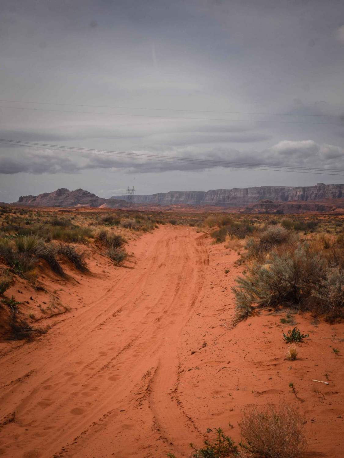
Trail Overview
This trail of just over a mile long goes through the red sandy desert on City of Page land. It cuts through the desert from northwest to southeast starting from the perimeter powerline road. It's sandy, whooped, and easy. Then it turns south towards the red sandstone mesa. It crosses lots of other tracks, all of which are unmarked. The track continues through the intersection as the Red Rim trail, climbing up the mesa, and going over some bigger ledges on top of the mesa.
Photos of Powerline to Red Rim

Difficulty
This trail is very easy through whoops and sand with no obstacles.
Status Reports
Powerline to Red Rim can be accessed by the following ride types:
- High-Clearance 4x4
- SUV
- SxS (60")
- ATV (50")
- Dirt Bike
Powerline to Red Rim Map
Popular Trails
A1 Mountain Road - FS 506

Section5Alive
Badger Springs Trailhead
The onX Offroad Difference
onX Offroad combines trail photos, descriptions, difficulty ratings, width restrictions, seasonality, and more in a user-friendly interface. Available on all devices, with offline access and full compatibility with CarPlay and Android Auto. Discover what you’re missing today!