Curry Road - FS 311
Total Miles
1.6
Technical Rating
Best Time
Spring, Summer, Fall, Winter
Trail Type
Full-Width Road
Accessible By
Trail Overview
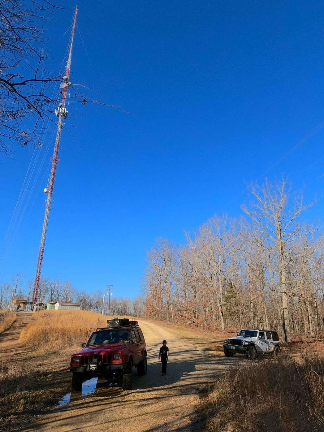
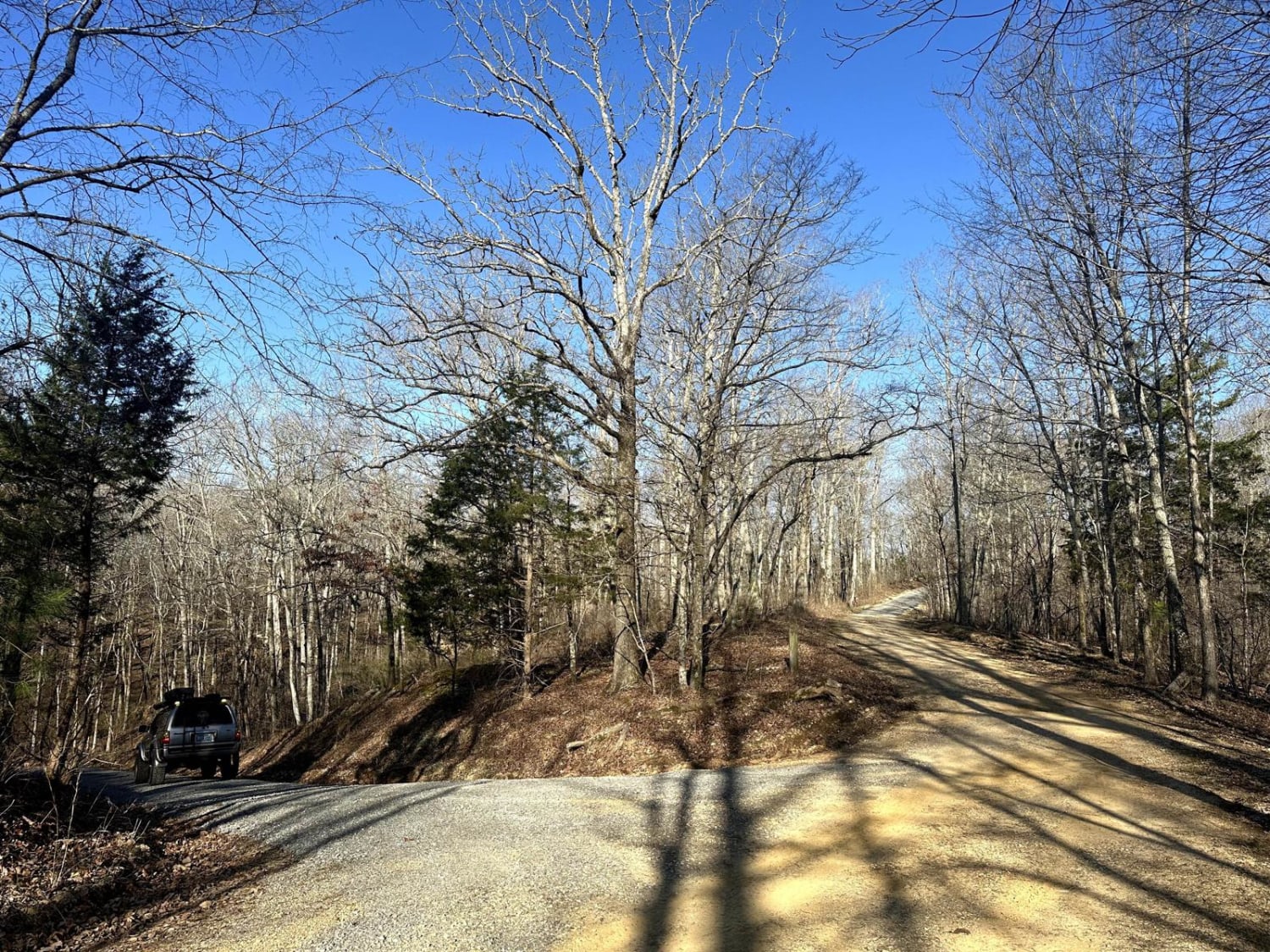
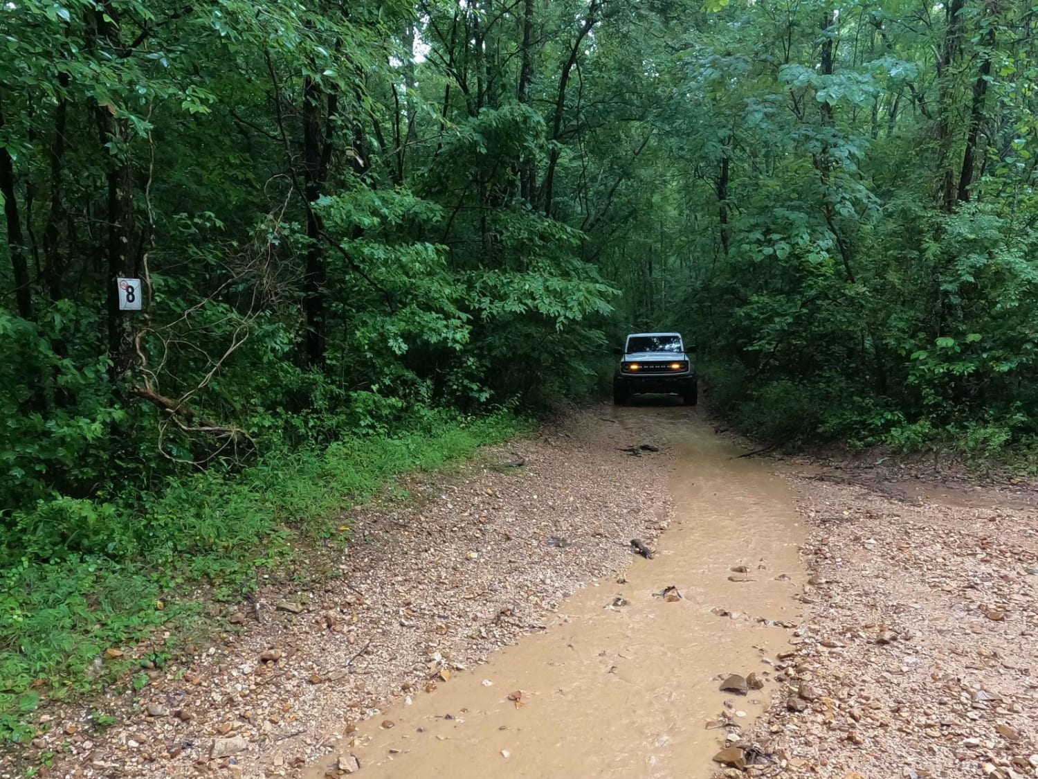
Curry Road FS 311 is a dirt forest service road through the inland center portion of the Kentucky section, of the Land Between the Lakes National Recreation Area. The road begins on the ridge tops at the Hematite fire tower and heads east, shortly after passing the WKMS FM radio tower. The trail past these two points of interest starts to fall apart and deteriorate quickly, featuring the gravel surface changing to mostly dirt, with water collection spots, foot-deep erosion, moderate grades, and surface mud. Once to the midway point, at 36.9275, -88.08922, the trail rapidly changes dynamics, from being in the dense forest on a hill to following the valley bottom agriculture fields, along the way crossing Fulton Creek, but mostly consistent of riding on the perimeter of the fields to the MVUM legal endpoint found at a feeder creek crossing, at 36.92638, -88.0779. Please note when there are crops on the field section of the trail it is best to turn around at the midway point and head back uphill to not cause damage or disturbance to the resources, don't get between a farmer and their crop, it ain't worth it. Is it a hilltop ridge, or is it a valley bottom? Both, and it's a cornfield trail.
Photos of Curry Road - FS 311

Difficulty
The Curry Road is given a medium demanding 3/10 base rating for the combo of a steep grade, foot-deep erosion, and surface mud found on the center hill in the trail, it's a little slick, featuring low traction with potential slight off-camber feeling taversing the hill, this may require some momentum to make it uphill, especially if wet. The 3/10 is also backed up by several water splash crossings within the 6" to foot-deep range through the bottoms. In the field bottoms, be leary of how soft the dirt perimeter trail is, momentum is good in this area, but do consider how to get moving again if a vehicle were to become stuck, winch worthy trees are a good distance away from the main dirt road in this area, please stay out of the obvious parts of the field and on the dirt road.
History
The original use of this trail surrounds the Hematite Tower, also known as Curry Hollow or Wildland Tower #1. The tower was built by the CCC around 1937, on the then Kentucky Woodlands National Wildlife Refuge, to be managed by a state forestry division. The Tower is an 80-foot Aermotor tower with a 7-foot x 7-foot metal cab. On November 3rd, 2009, the tower was registered in the National Historic Lookout Register, as US 833, KY 8.
Status Reports
Curry Road - FS 311 can be accessed by the following ride types:
- High-Clearance 4x4
- SUV
Curry Road - FS 311 Map
Popular Trails

Child's Play
Bogard Cemetery Road
8 to E Road
The onX Offroad Difference
onX Offroad combines trail photos, descriptions, difficulty ratings, width restrictions, seasonality, and more in a user-friendly interface. Available on all devices, with offline access and full compatibility with CarPlay and Android Auto. Discover what you’re missing today!