Central Riverside Connector
Total Miles
0.2
Technical Rating
Best Time
Spring, Summer, Fall, Winter
Trail Type
Full-Width Road
Accessible By
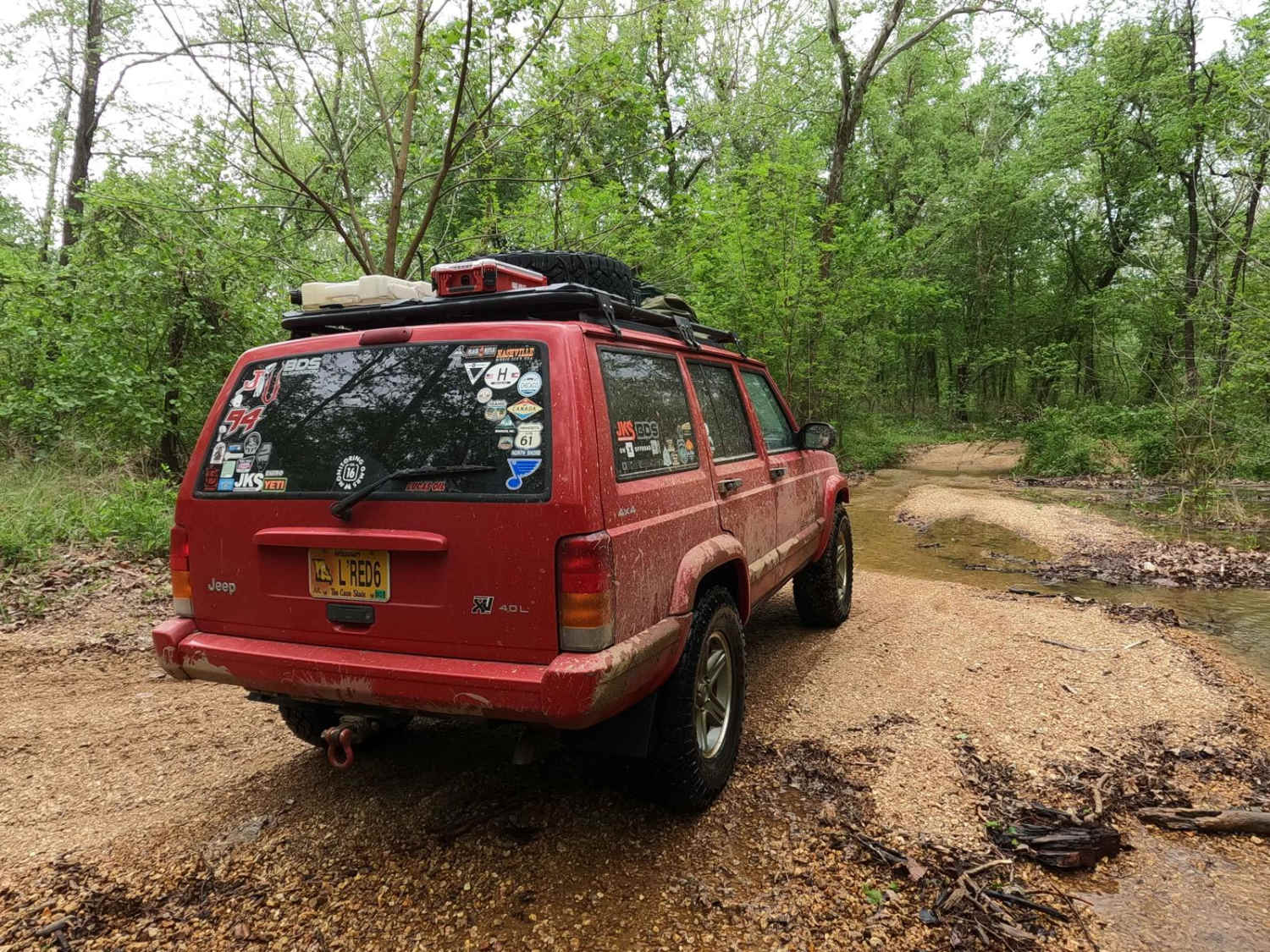
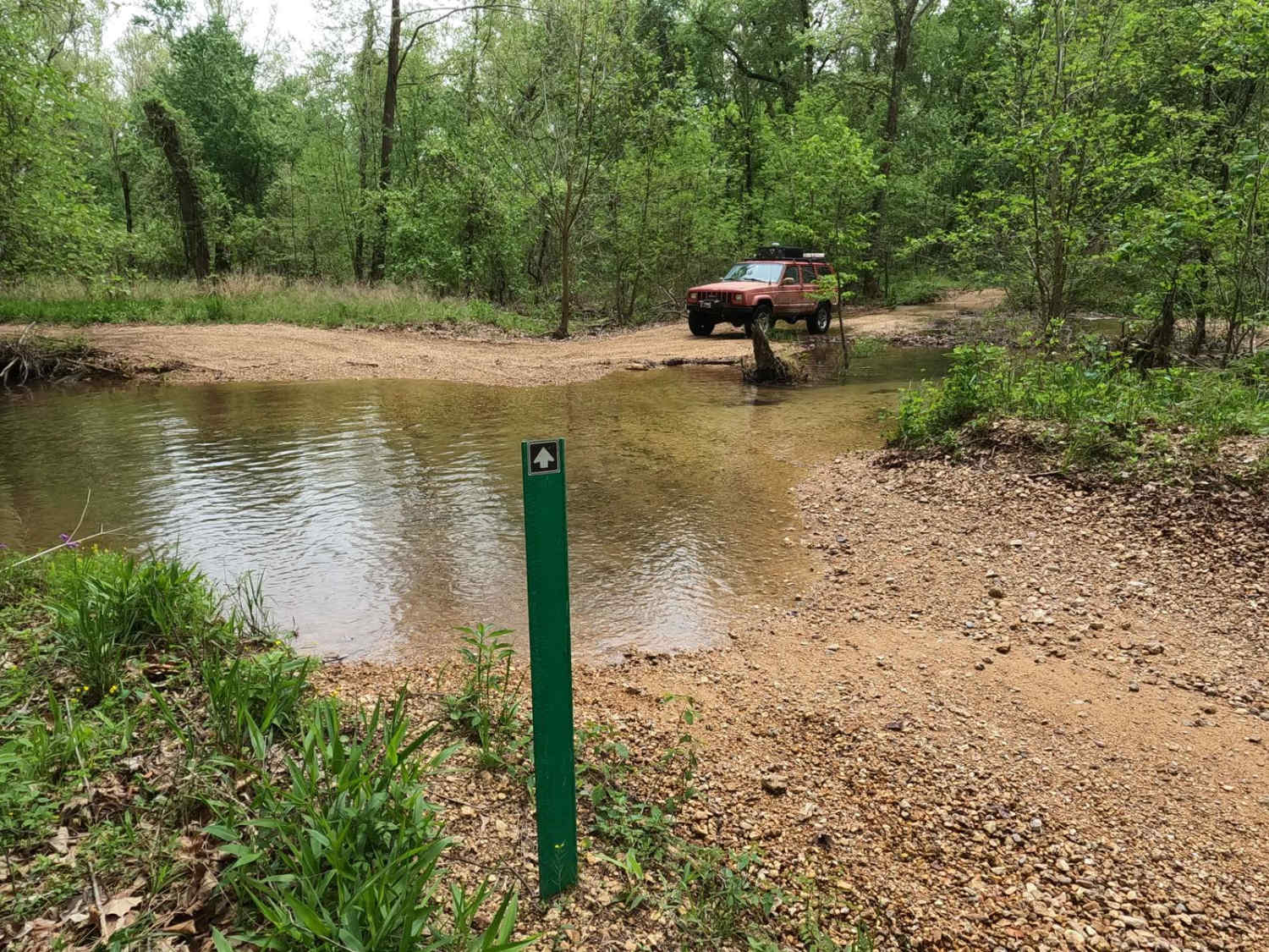
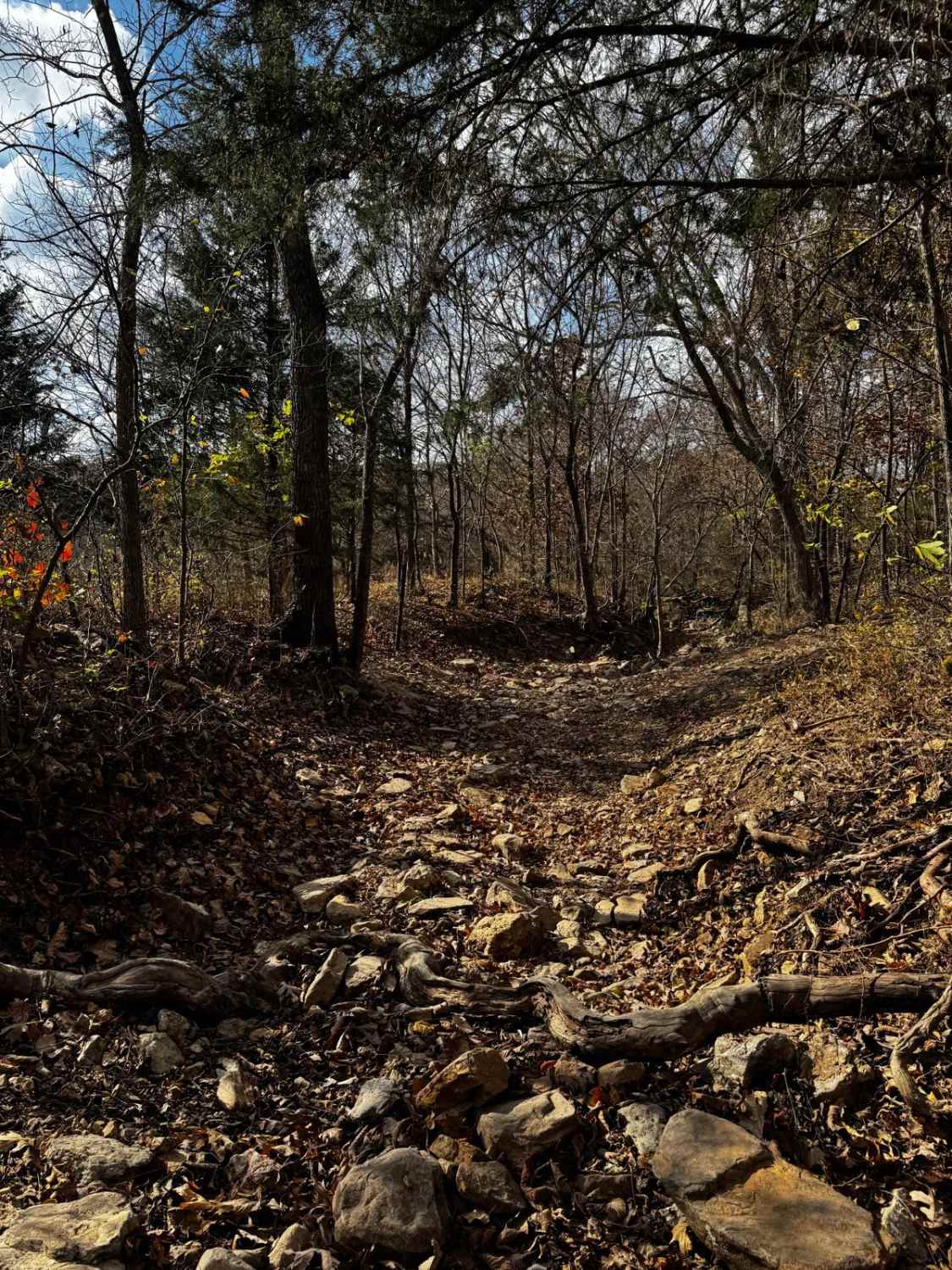
Trail Overview
Central Riverside Connector is a coarse gravel and natural dirt/mud trail through the center portion of the Black River Bottoms area within the Clearwater Lake U.S. Army Corps of Engineer Land. The Central Riverside Connector is so named because it connects the midway points of the North Riverside Trail and the Central Bluffs Trail, giving the riders an avenue to pick and choose parts of each trail to hit in a single pass through, versus hitting them in their entirety. The connector starts at the west end of the creek bottom section of the Central Bluffs Trail and heads southwest, leading through some treelines with mild water collection spots and mudholes, before hitting a fork going to the right and then hitting the opening void of trees where it meets the North Riverside Trail along the river's edge. Watch for major flash flooding in the area, and if the trail is flooding, don't enter the water, as the terrain and depth would become unpredictable. This is a logistically relevant trail to the area, especially to find a way around the harder riverside trails to the south but still get some good views of the river. It can also add more thrill by bypassing the easier northern portion of the Central Bluffs Trail via the North Riverside trail and Connector together, or be used as a loop with other trails to head back in the way the bottoms were approached.
Photos of Central Riverside Connector
Difficulty
The connector trail gets its 3/10 base rating from the soft bottom mud and hard bottom water holes on the trail. These are easily in the 12-inch-depth ballpark and could be more when the bottoms are flooded or heavily used and beaten. If in doubt, probe them out for depth and softness. Also, expect some loose coarse gravel and up to 12 inches in depth of the Dafron Branch creek water at the east entry where it meets the Central Bluff Trail. The difficulty could decrease if the mudholes and creek were to dry out or be mended, but the difficulty can increase in times of wet conditions and heavy use. There is also the potential for flash flooding. For reference, the trail should be still completely open when the Annapolis water level gauge is reading at under 6 feet. With a flash flood event, the river can increase several feet in minutes, putting water over the trail and yielding extreme rating changes. If any flood water is over the trail, it is best to consider it closed as it would be unpredictable. Be prepared ahead of time and look up the Annapolis Black River water level gauge; for reference and forecast, 6 feet and up on this gauge is in Flood Stage. Simply put, the difficulty does fluctuate significantly in wet seasons and heavy rain.
History
The history surrounding the bottoms is one of fighting for public access. This is an example where the presence and public use of Reynolds County Roads 464, 462, 460, 458, 456, 446A, and more have been the driving force keeping these trails open. Locals refuse to let their historic roads be taken away, yielding a place we all can enjoy and use. Please do your part in keeping this place alive; pack it in/pack it out, follow the green and red route markers as marked, and don't drive in the Black River or form new trails.
Status Reports
Central Riverside Connector can be accessed by the following ride types:
- High-Clearance 4x4
- SUV
- SxS (60")
- ATV (50")
- Dirt Bike
Central Riverside Connector Map
Popular Trails

Yellow 225
Moose Foot
The onX Offroad Difference
onX Offroad combines trail photos, descriptions, difficulty ratings, width restrictions, seasonality, and more in a user-friendly interface. Available on all devices, with offline access and full compatibility with CarPlay and Android Auto. Discover what you’re missing today!