Well Hollow
Total Miles
0.5
Technical Rating
Best Time
Spring, Summer, Fall, Winter
Trail Type
Full-Width Road
Accessible By
Trail Overview
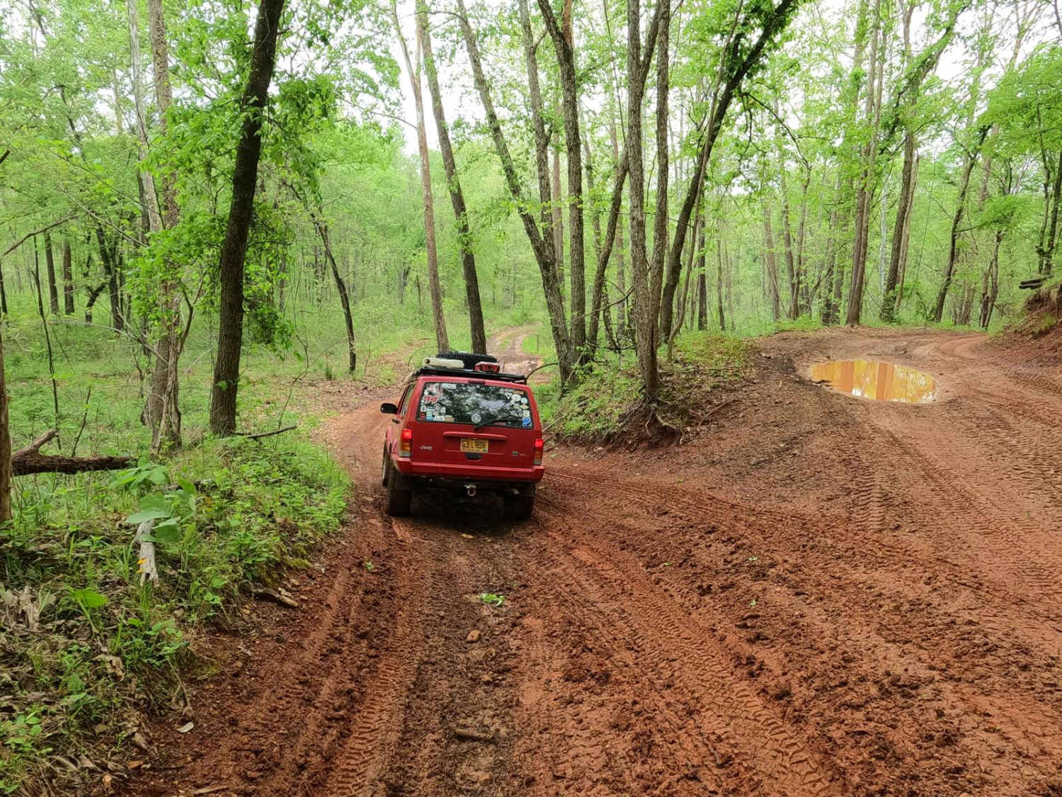
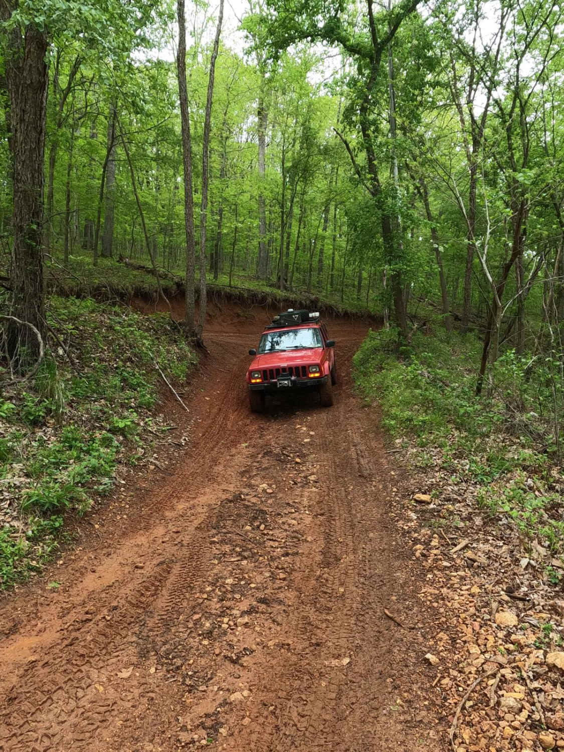
Well Hollow Trail is a coarse gravel and natural dirt/mud/clay trail through the southern portion of the Black River Bottoms area within the Clearwater Lake U.S. Army Corps of Engineer Land. This is the southern gateway to the Riverside Depths of the area, starting off leaving the Dafron Hollow Trail via a red clay hill, leading into the swampy lowland dirt bottoms that have little struggle turning into a wet muddy mess. It features deep water collection holes, and mudholes at every stretch of the trail, some being mild and graceful, misleading drivers from the sudden drop-off at the next hole or deep ruts hidden in the middle of 30-foot-wide water pools. Ultimately, the trail leads to the intersection with the South Riverside Trail and the North Riverside Trail, both of which follow closely to the Black River banks to the limits of the drivable land south or back to more trails north. Watch for major flash flooding in the area, and if the trail is flooding, don't enter the water as the terrain and depth would become unpredictable. If desiring to tackle the harder portion of the Riverside Depths route, start here in combination with the South Riverside, then North Riverside, and finish with easier riding at Whizenhunt Bottoms, the southern gateway trail to the Riverside Depths of Black River Bottoms.
Photos of Well Hollow
Difficulty
The Well Hollow Trail features a solid 5/10 given rating, based on the depth of the mudholes in the bottoms, one being every bit of 2 feet in depth, several closely behind, meeting the 18-inch mark. Some of the holes are water-based and hard-bottomed, others are soft-bottomed with 6-12 inches of true silty mud featuring harder drop-offs. At the east endpoint of the trail off Dafron Hollow, there's a clay hybrid dirt surface on a moderate grade. This variant of dirt/clay is common in small pockets around the area and could pose a decent low traction challenge when freshly rained on, either sliding down or spinning going up. The spot also is gradually showing signs of erosion, forming a notched rut in the pathway. If desiring a bypass, there is an alternate fork to the north with a mild grade in comparison. The trail could yield an easier rating if the deep mudholes were to be mended or drained, or when the area gets mostly dry in deep summer. If in doubt, probe the holes out to confirm depth and softness. Difficulty can also increase in heavy use, overly wet seasons, or rainy conditions. The trail could be closed on the northern end at the Dafron Hollow Trail entry at a moderate and higher flood stage and with potential flash flooding. For reference, the trail should be still completely open when the Annapolis water level gauge is reading at under 6 feet. With a flash flood event, the river can increase several feet in minutes, putting water over the trail and yielding extreme rating changes. If any flood water is over the trail, it is best to consider it closed as it would be unpredictable. Be prepared ahead of time and look up the Annapolis Black River water level gauge; for reference and forecast, 6 feet and up on this gauge is in Flood Stage.
History
The history surrounding the bottoms is one of fighting for public access. This is an example where the presence and public use of Reynolds County Roads 464, 462, 460, 458, 456, 446A, and more have been the driving force keeping these trails open. Locals refuse to let their historic roads be taken away, yielding a place we all can enjoy and use. Please do your part in keeping this place alive; pack it in/pack it out, follow the green and red route markers as marked, and don't drive in the Black River or form new trails.
Status Reports
Well Hollow can be accessed by the following ride types:
- High-Clearance 4x4
- SUV
- SxS (60")
- ATV (50")
- Dirt Bike
Well Hollow Map
Popular Trails

Cistern Ridge - FS 2478

Brixey Road

Wayne - CR 207
The onX Offroad Difference
onX Offroad combines trail photos, descriptions, difficulty ratings, width restrictions, seasonality, and more in a user-friendly interface. Available on all devices, with offline access and full compatibility with CarPlay and Android Auto. Discover what you’re missing today!