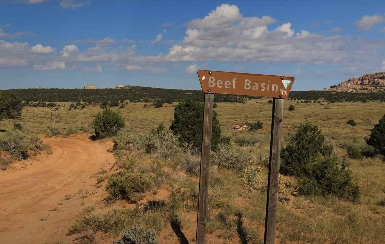
Beef Basin Wash - San Juan County B199
Total Miles
3.1
Elevation
2,012.35 ft
Duration
1 Hours
Technical Rating
Best Time
Spring, Summer, Fall
Trail Overview
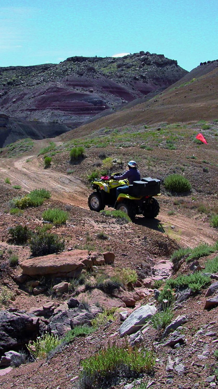
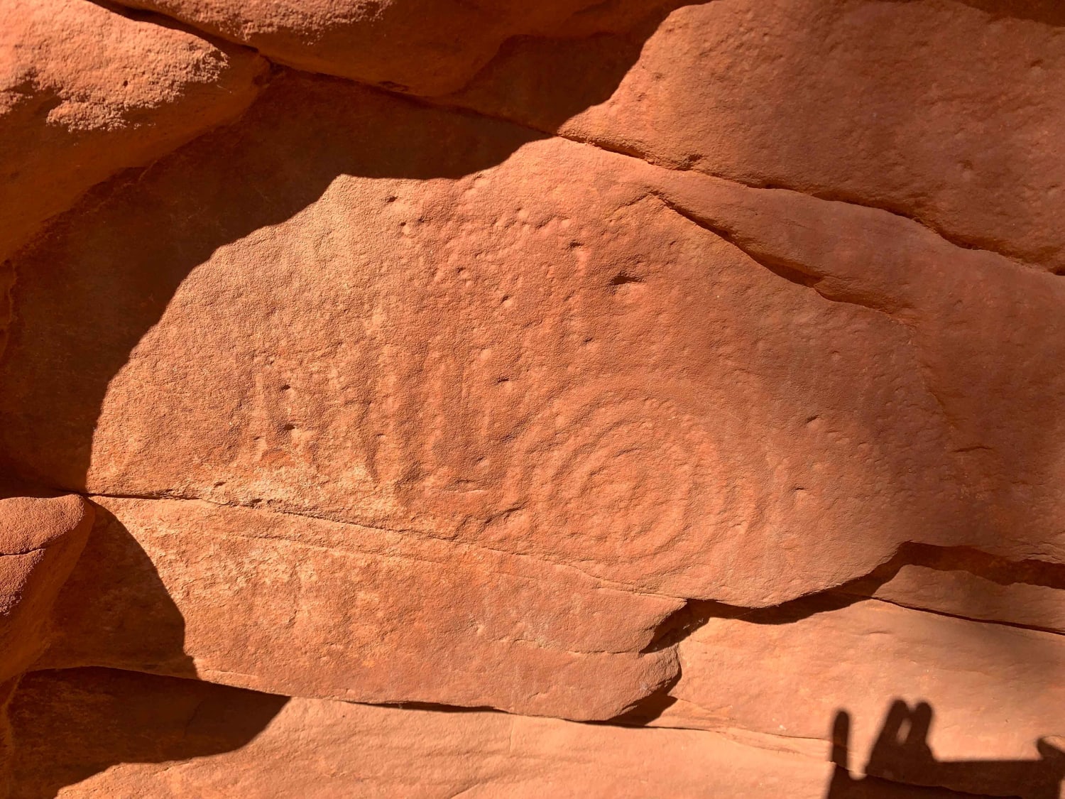
Beef Basin Wash is a 3.1-mile out-and-back (6.2-mile round trip) destination trail rated 3 of 10 located within the Bears Ears National Monument and managed by the BLM. Although this trail is listed as open to all the condition of this trail limits vehicle to high clearance 4WD. This area is rich in ancient native dwellings, ruins, and rock art. In addition to the major points of interest described on this trail, nearly every side trail leads to an area that can be explored. This trail leads to one of the best-preserved cliff dwellings within the Beef Basin area (37.94626, -109.84836). Visible from the end of the trail, the adventurous can climb to and explore the dwelling. The trail to the site crosses several dry streams that can be a bit more difficult depending on the year's watershed. At the time of mapping, there were several areas where the brush had encroached on the trail. The route is along an unimproved dirt track with no real obstacles to negotiate. Just keep an eye out for ruts as this trail is above 6000' elevation so rain and snow can create muddy conditions. There is no cellular coverage in the area and the nearest services are located in Monticello (the shortest route is approximately 65 miles).
Photos of Beef Basin Wash - San Juan County B199

Difficulty
This is a trail consisting of loose rocks, dirt, and sand with some slick rock surfaces, mud holes possible, and no steps higher than 12". 4WD may be required and aggressive tires are a plus.
History
Beef Basin, one of the more remote places in southern Utah, is a region of grassy parkland separated by red and white mesas, on the south side of the Needles District of Canyonlands National Park, bordered to the south by the foothills of the Abajo Mountains. The elevation is around 6,500 feet, high enough for significant snow in winter that makes access routes impassable, typically until April, though in summer the basin can be rather hot. The name of this area was bestowed in the mid-19th century when the grassland was used for cattle grazing. Since 2016, all this region is within Bears Ears National Monument.
Status Reports
Popular Trails
Crystal Geyser

Stone Figures
Poverty Gulch Slick Rock/Petroglyphs
The onX Offroad Difference
onX Offroad combines trail photos, descriptions, difficulty ratings, width restrictions, seasonality, and more in a user-friendly interface. Available on all devices, with offline access and full compatibility with CarPlay and Android Auto. Discover what you’re missing today!