Waterglyph Lane (BLM 101)
Total Miles
5.5
Technical Rating
Best Time
Spring, Summer, Fall, Winter
Trail Type
Full-Width Road
Accessible By
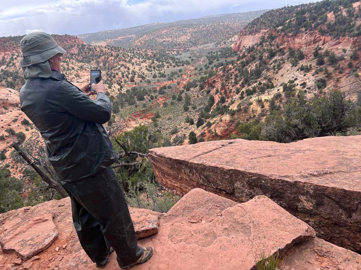
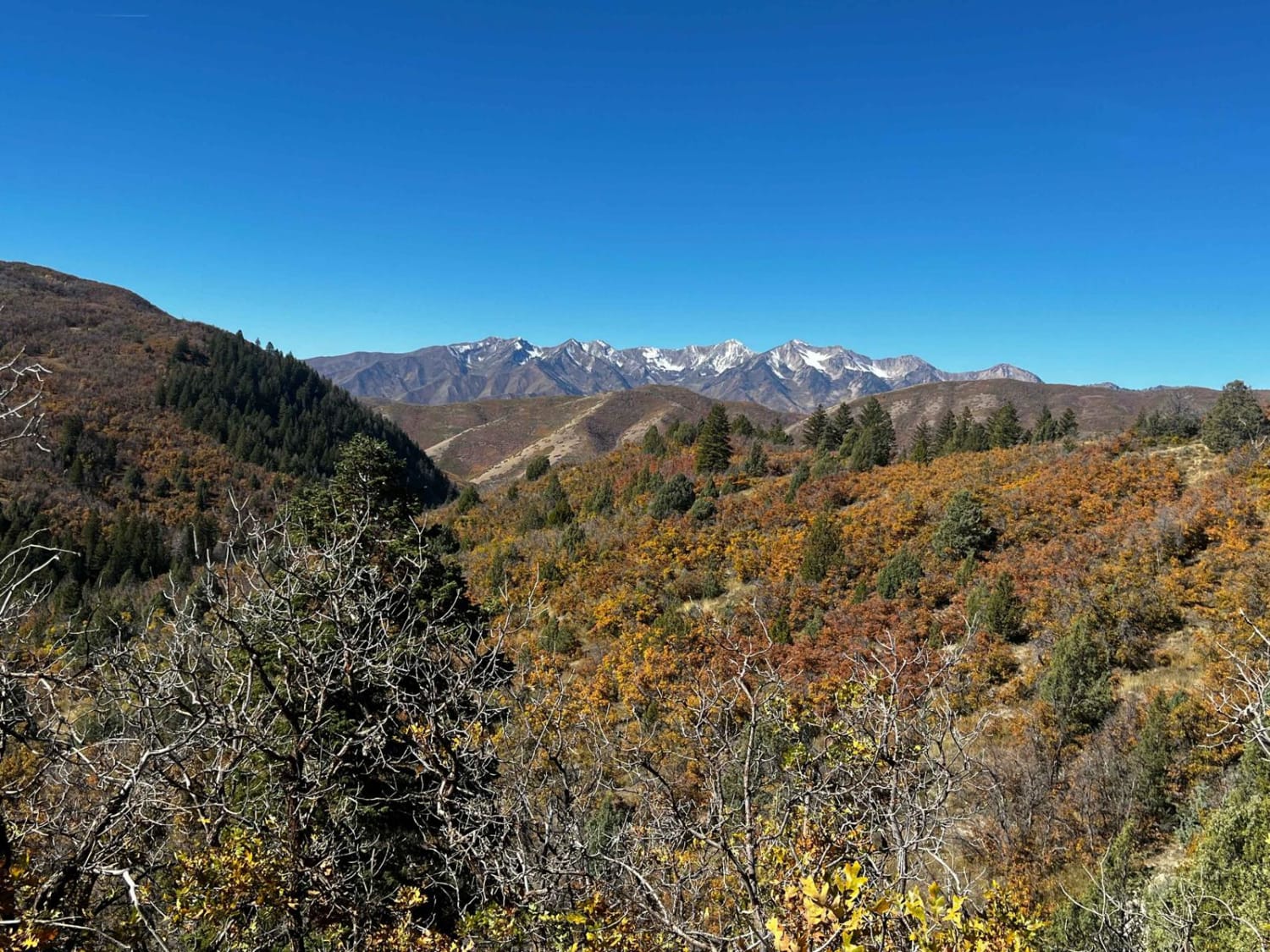
Trail Overview
This is a great opportunity to view two water glyphs. One of the water glyphs is relatively famous, as you see pictures of it in many of the articles that talk about water glyphs. The trail takes you along a beautiful canyon as well as through some cedar trees. There is also a small technical area where you will climb up a rock area while traversing a wash. While the trail is not extremely difficult, care must be taken to navigate the area. As you travel from the west to the east, you will climb up a ridge that provides spectacular views of the area before dropping back down into the valley.
Photos of Waterglyph Lane (BLM 101)
Difficulty
There is a technical area through a wash that has a turn into a short steep drop to the bottom of the wash, and a climb up a rock area that also has a sharp turn at the top. Neither are exceptionally difficult, but care in traversing the area needs to be taken.
History
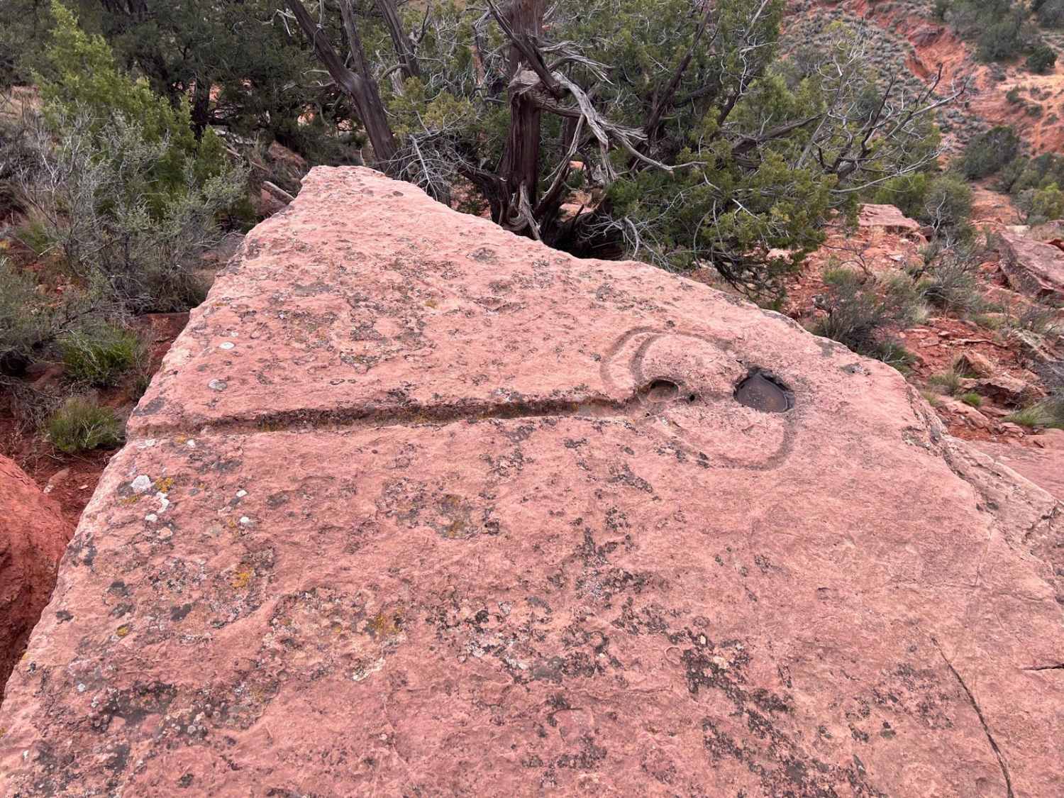
Water Glyphs: These symbols typically lie along cliff edges, carved directly into the horizontal rock surface. These symbols are usually 48 inches long by 24 inches wide, with grooves nearly an inch deep. They consist of a circle cut in half by a single straight line. The line usually extends a distance beyond the edge of the circle, sometimes dropping off the edge of the rock. The last component is a dot. Sometimes the dot is inside the circle, sometimes outside the circle, and occasionally there's more than one dot. These bespeckle the Utah, Colorado, and New Mexico regions. What are they? No one knows for sure. Some theories include: 1. Solstice markers for ancient people. After research, that's generally not believed, however. Fun fact: of the 370+ total found, 120 lie on the 37N Latitude line within 20 miles spread over 5,000 square miles--negligible deviation for an ancient culture. 2. Prayer Shrine Theory: A Native American story describes the emergence from the underworld by climbing through reeds in the Grand Canyon. They were commanded to go forth and make marks upon the rocks to show where they had traveled and lived. The tribes were also commanded to make shrines along the edge of the cliff tops to offer prayers to Massaau. 3. Bird of Prey Theory: Many of the glyphs are near cliffs, or mesa edges, and great hunting spots. They are positioned to provide a hiding spot for a man. They would place a snare bait to catch birds of prey. The Hopi have demanded, by legal action, their religious right to trap eagles and hawks from "traditional locations on lands that are now used by Navajos and other tribes. 4. Identify the next water source. Major John Wesley Powell's writings describing his Paiute Indian guides. The guides were leading him and the Mormon Missionary, Jacob Hamblin, from Pipe Springs to an area below Mt. Trumbull. There, they hoped to learn the fate of his three missing crewmembers from the 1869 voyage down the Colorado River. Powell's written description of the route would have taken him and his party very near this ridge. Looking to the east, you can see Pipe Springs, and far off to the southwest, Mt. Trumbull, hidden by the ledge of chocolate cliffs which Powell described as they rode beneath. Perhaps as they were passing by, his guides climbed this ridge to study these marks before leading their guests on into a dangerous and unfamiliar country.
Status Reports

Popular Trails
Salamander Flat (2150)

Enduro Loop Trail
Right Fork Hobble Creek Road
The onX Offroad Difference
onX Offroad combines trail photos, descriptions, difficulty ratings, width restrictions, seasonality, and more in a user-friendly interface. Available on all devices, with offline access and full compatibility with CarPlay and Android Auto. Discover what you’re missing today!