CC Craigin (Blue Ridge) Reservoir
Total Miles
5.8
Technical Rating
Best Time
Summer, Spring, Fall
Trail Type
Full-Width Road
Accessible By
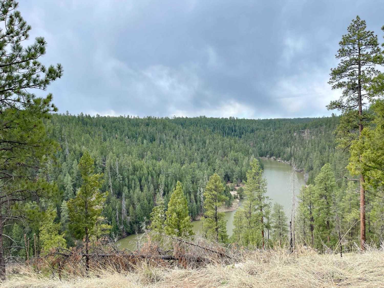
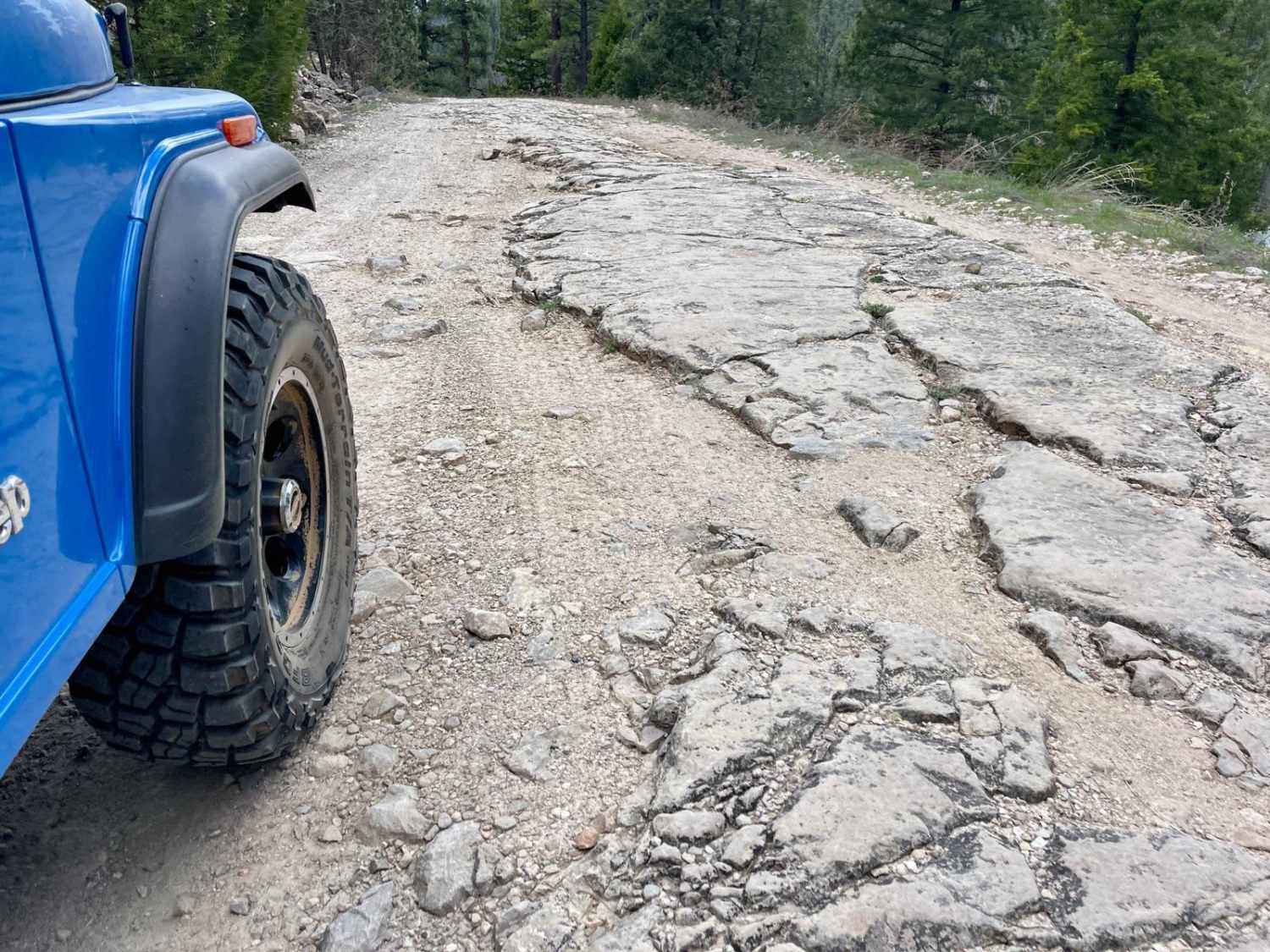
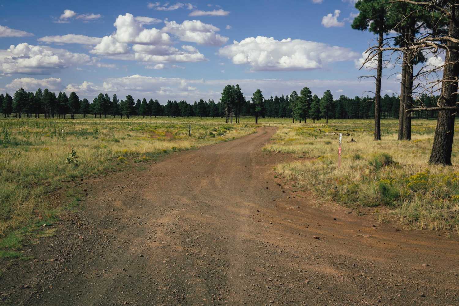
Trail Overview
This is the main route to access the Blue Ridge Reservoir. The main road from Highway 87 is smooth, wide, and well-graded. There are lots of campsites for dispersed camping along both sides. Many spots are big enough for large RVs and fifth wheels. The wide road ends at the seasonally open Rock Crossings Campground. Vehicle length restrictions are from here to the reservoir. The trail is still smooth and graded until you reach the loading ramp. Past that, you'll climb a steep hill to a parking area and pit toilets. Continuing from here, it becomes a bumpy one-lane road with lots of boulders to navigate around. Luckily, as the trail weaves around, there are stunning views of the water to enjoy. At the end is a small parking turnaround area with an informational kiosk near the locked gate. Only employees are allowed the rest of the way to the dam, but you can see it from here. One bar of Verizon LTE closer to the highway fades to none over by the dam.
Photos of CC Craigin (Blue Ridge) Reservoir
Difficulty
This trail is rated a 2 for the narrow section past the campground and the bumpy, rocky section the rest of the way to the dam. You will need to pick your way through carefully so as not to incur sidewall damage. Be aware it will be seasonally closed, and they do get snow up here in the winter.
History
The Mogollon Rim is a rugged escarpment that forms the southern limit of the Colorado Plateau. It extends across the entire forest, approximately 200 miles in total, and provides excellent views within plateau country and desert canyon country as well. Dropping as much as 2,000 feet in some areas, the Rim offers some of the most far-reaching scenery in Arizona. Views stretch from its rocky precipice to Four Peaks of the Mazatzals northeast of Phoenix. Sightseeing is a favorite activity along the Rim. Still, this forest area also boasts a historic system of hiking and horseback trails, a couple of picturesque lakes for boating and fishing, and backcountry skiing for wilderness adventurers. The Mogollon Rim is a topographical and geological feature cutting across the northern half of Arizona. It extends diagonally approximately 200 miles, starting in northern Yavapai County and running eastward, ending near the New Mexico border. It forms the southern edge of the Colorado Plateau in Arizona. The Rim is an escarpment defining the southwestern edge of the Colorado Plateau. Its central and most spectacular portions are characterized by high cliffs of limestone and sand, namely the Kaibab limestone and Coconino sandstone cliffs. This escarpment was created by erosion, faulting, and cutting dramatic canyons into it, including the Fossil Creek Canyon and Pine Canyon. The name Mogollon comes from Don Juan Ignacio Flores Mogollon, the Spanish governor of New Mexico from 1712 to 1715. The Mogollon Rim's limestones and sandstones were formed from sediments deposited in the Carboniferous and Permian Periods. Several of the Rim's rock formations are also seen on the walls of the Grand Canyon. The extensive basaltic lava flows cap or even bury the Rim in many places. Be sure to keep your eyes peeled for the endangered Mexican spotted owl. Other wildlife present on the Rim will be herds of elk and deer. You may see black bears, mountain lions, and even the occasional red-tailed hawk or peregrine falcon. There are also coyotes, horned toads, and rattlesnakes. This area frequently has fire restrictions early in the season. Be sure to contact the local ranger station for information about the current campfire restrictions. Or, at the minimum, check the Coconino Fire webpage. https://www.coconino.az.gov/2595/Fire-Restriction-Information
Status Reports

Popular Trails
Northern Last Chance Canyon Road
Jupiter Mine
Black Hills Back Country Byway
The onX Offroad Difference
onX Offroad combines trail photos, descriptions, difficulty ratings, width restrictions, seasonality, and more in a user-friendly interface. Available on all devices, with offline access and full compatibility with CarPlay and Android Auto. Discover what you’re missing today!