Long Valley Point
Total Miles
1.9
Elevation
2,088.59 ft
Duration
0.5 Hours
Technical Rating
Best Time
Spring, Summer, Fall
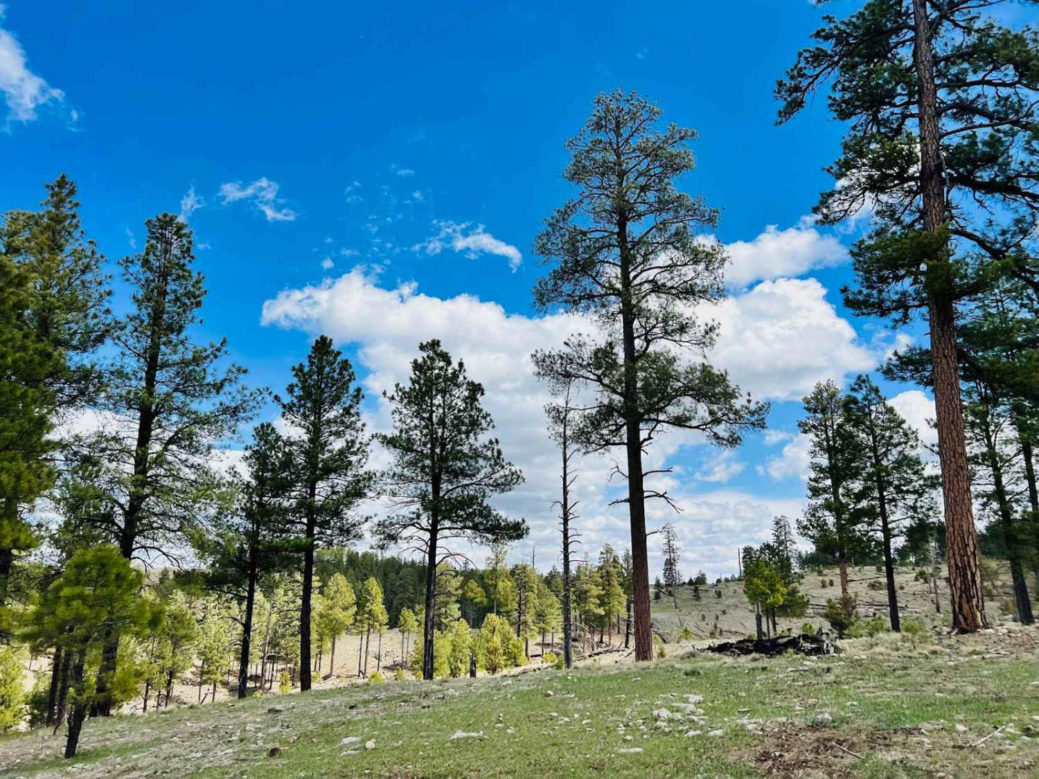
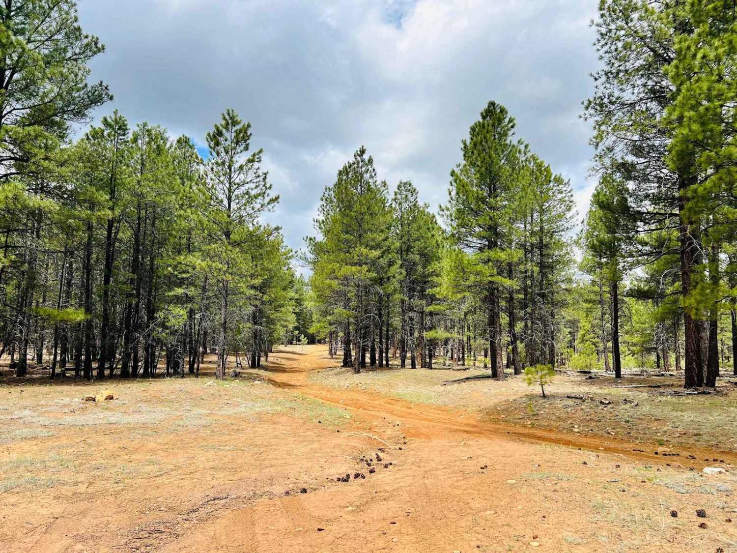
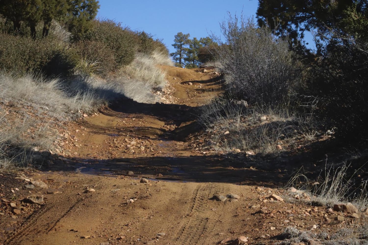
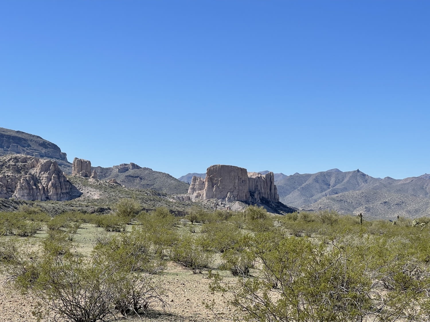
Trail Overview
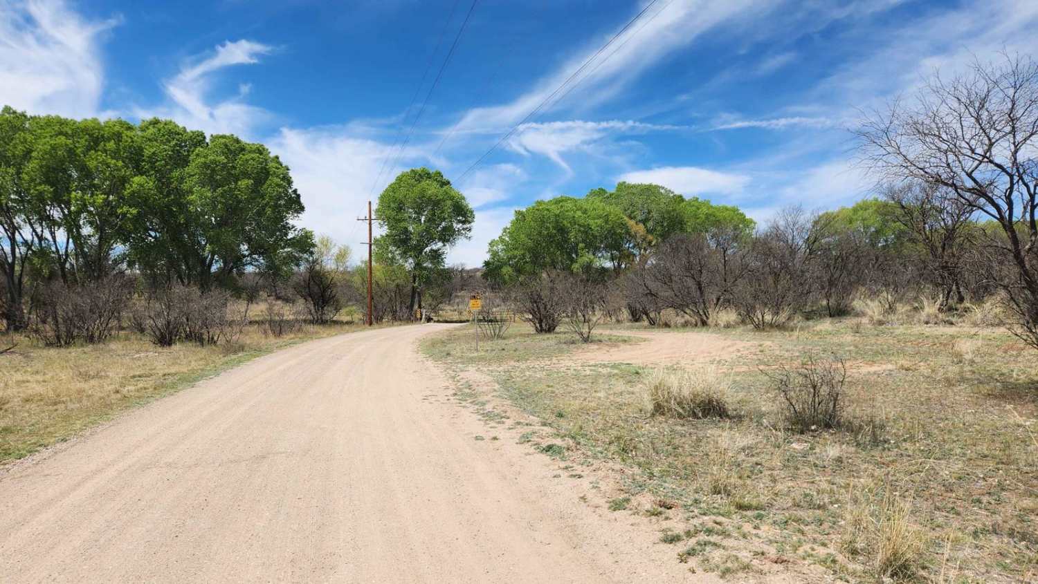
This is an out-and-back trail to the Long Valley Point. There is one bar of LTE cell service intermittently on the trail. This route is one of the many out-and-back trails in this area that run out to a lookout point with a view of the canyon below. This one especially has outstanding views all around. It could be windy out here. There are some rocky sections along the trail, but nothing crazy. The end has a few little downhills with some rocks. There are also a few areas where the trees are narrower; some smaller trees may have fallen across the trail and need clearing. Some wide-open grassy areas on this trail create a free feeling, so you're not just driving in the dense forest all day.
Photos of Long Valley Point
Difficulty
The trail rating is for the narrow sections between the trees and the rocky hill climbs and descents near the trail's end. Clearing trees may be required after a heavy storm or in the springtime.
History
The Mogollon Rim is a rugged escarpment that forms the southern limit of the Colorado Plateau. It extends across the entire forest, approximately 200 miles in total, and provides excellent views within plateau country and desert canyon country as well. Dropping as much as 2,000 feet in some areas, the Rim offers some of the most far-reaching scenery in Arizona. Views stretch from its rocky precipice to Four Peaks of the Mazatzals northeast of Phoenix. Sightseeing is a favorite activity along the Rim. Still, this forest area also boasts a historic system of hiking and horseback trails, a couple of picturesque lakes for boating and fishing, and backcountry skiing for wilderness adventurers. The Mogollon Rim is a topographical and geological feature cutting across the northern half of Arizona. It extends diagonally approximately 200 miles, starting in northern Yavapai County and running eastward, ending near the New Mexico border. It forms the southern edge of the Colorado Plateau in Arizona. The Rim is an escarpment defining the southwestern edge of the Colorado Plateau. Its central and most spectacular portions are characterized by high cliffs of limestone and sand, namely the Kaibab limestone and Coconino sandstone cliffs. This escarpment was created by erosion, faulting, and cutting dramatic canyons into it, including the Fossil Creek Canyon and Pine Canyon. The name Mogollon comes from Don Juan Ignacio Flores Mogollon, the Spanish governor of New Mexico from 1712 to 1715. The Mogollon Rim's limestones and sandstones were formed from sediments deposited in the Carboniferous and Permian Periods. Several of the Rim's rock formations are also seen on the walls of the Grand Canyon. The extensive basaltic lava flows cap or even bury the Rim in many places. Be sure to keep your eyes peeled for the endangered Mexican spotted owl. Other wildlife present on the Rim will be herds of elk and deer. You may see black bears, mountain lions, and even the occasional red-tailed hawk or peregrine falcon. There are also coyotes, horned toads, and rattlesnakes. This area frequently has fire restrictions early in the season. Be sure to contact the local ranger station for information about the current campfire restrictions. Or, at the minimum, check the Coconino Fire webpage. https://www.coconino.az.gov/2595/Fire-Restriction-Information
Status Reports
Popular Trails

Sprikler's Choice
FDR 64/Marapai Road
Keeping Out of the Wash
East Empire Ranch Road
The onX Offroad Difference
onX Offroad combines trail photos, descriptions, difficulty ratings, width restrictions, seasonality, and more in a user-friendly interface. Available on all devices, with offline access and full compatibility with CarPlay and Android Auto. Discover what you’re missing today!