EC 282 Yuha Desert
Total Miles
2.7
Technical Rating
Best Time
Spring, Summer, Fall, Winter
Trail Type
Full-Width Road
Accessible By
Trail Overview
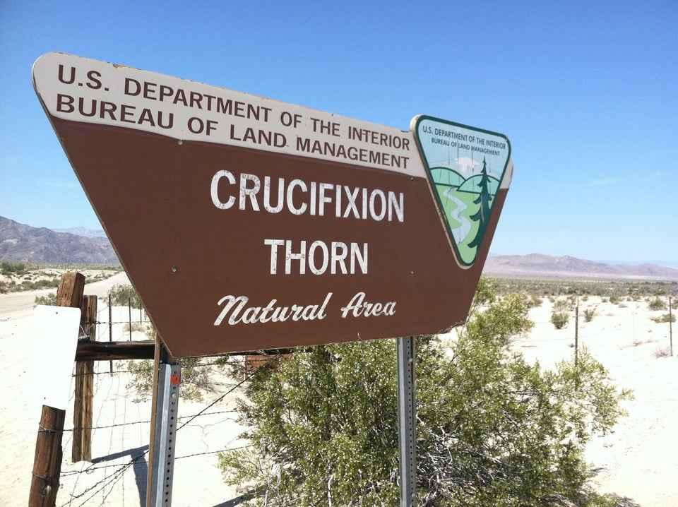
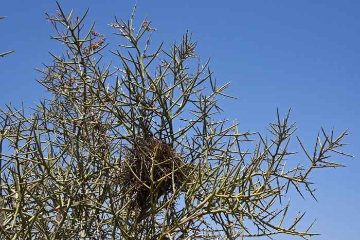
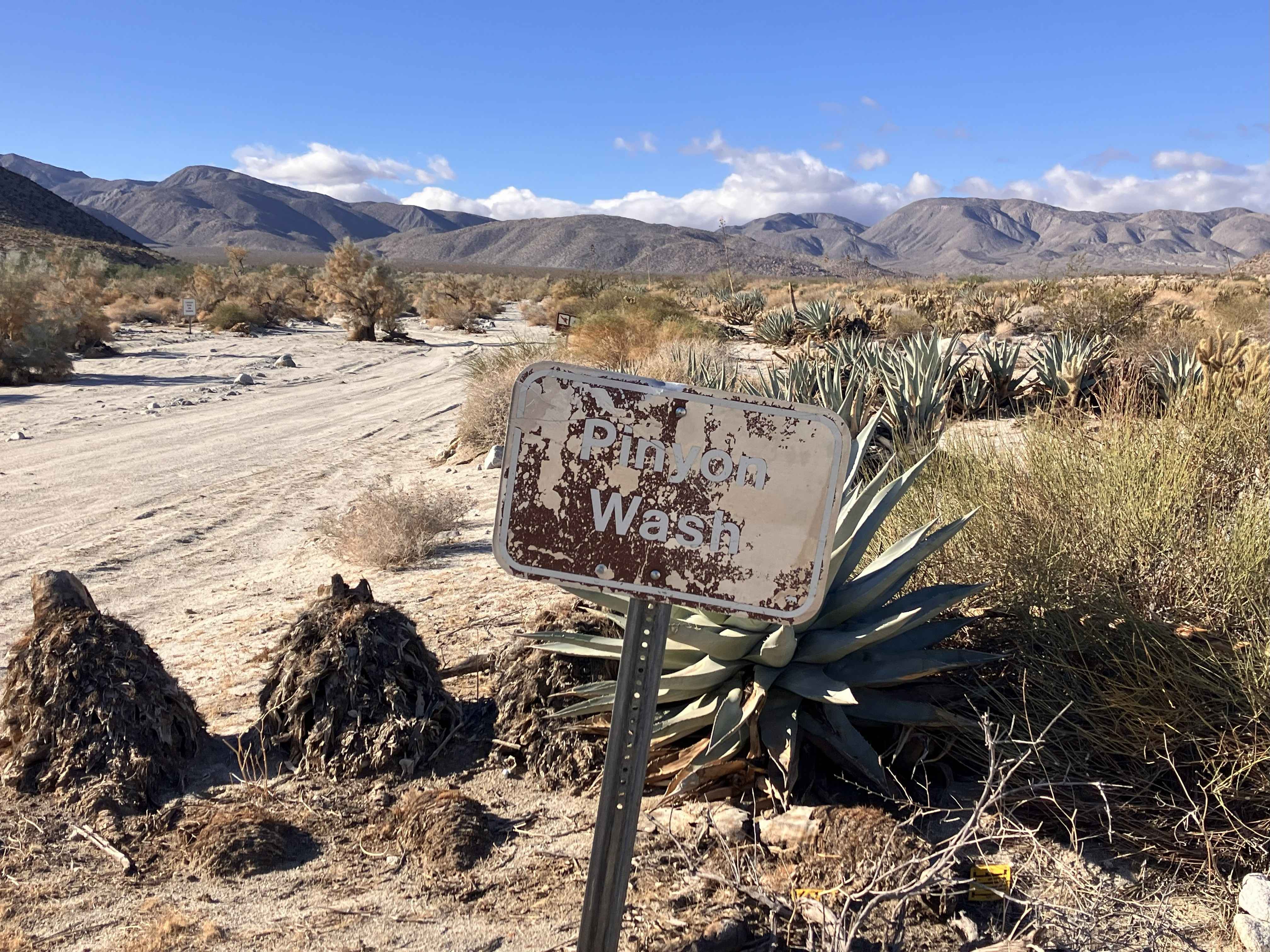
EC 282 Yuha Desert is a 2.7-mile point-to-point trail rated 3 of 10 in Imperial County. EC 282 is a BLM-designated "Limited Use" trail and can only be used by street-legal vehicles. The trail can be accessed from Highway 98. EC 282 is primarily hard-packed desert crossing sandy washes. The highlight along EC 282 is a Crucifixion Thorn Natural Area, located adjacent to the trail on the north side. The fence area (please do not cross the fence) is located at 32deg40'12.05"N, 115deg53'29.39"W. The Crucifixion Thorn Natural Area is an interesting place to view desert plants and wildflowers. Located southwest of the Yuha Desert on Highway 98 in Imperial County, this fenced area has excellent stands of Crucifixion Thorn, Ironwood, Palo Verde, Ocotillo, Mesquite, and Creosote. Spring is usually the best time of year to visit the area. When nature provides sufficient winter rains, an abundance of wildflowers and blooms from a variety of desert plants can be seen. EC 282 extends to the west until it reaches the Jacumba Wilderness Area (no motorized vehicles within the area). Along Highway 98 and at other access points to the Yuha, you'll see Limited Use Area signs. This means that motorized vehicle travel is allowed, but that it is limited to approved routes of travel. No cross-country travel is allowed, including off-road hill climbs and construction or use of three- and four-wheeler play loops. The area is accessible year-round but summer temperatures can exceed 115 degrees. Cell phone service is intermittent. All major services are located 23 miles east in El Centro.
Photos of EC 282 Yuha Desert
Difficulty
The trail consists of loose rocks, dirt, and sand with some slickrock surfaces and possible mud holes, but no steps higher than 12 inches. 4WD may be required, and aggressive tires are a plus.
History
The Yuha Desert is a section of the Sonoran Desert located in the Imperial Valley of California, south of Interstate 8, west of El Centro, and north of the international border. Unique aspects of the Yuha Desert include the Oyster Shell Beds, De Anza Historical Monument, Crucifixion Thorn Natural Area, and the Yuha geoglyph. It is the homeland of the Kamia, also spelled Kumeyaay, and may have been used by other Native American groups such as the Cahuilla, Quechan, and Cocopah Native American people. The Yuha Desert is a BLM area of critical environmental concern (ACEC). It is home to sensitive plants and animals as well as historic and prehistoric cultural sites. It is a limited-use area, meaning that travel is limited to designated routes of travel to protect these resources, so please observe all posted signs. An audio tour describing several points of interest in the area is available from BLM's El Centro Field Office. The Yuha Desert can be accessed from State Highway 98 and from the Dunaway Road exit off Interstate 8.
Status Reports
EC 282 Yuha Desert can be accessed by the following ride types:
- High-Clearance 4x4
- SUV
EC 282 Yuha Desert Map
Popular Trails
Candy Rock Road
Sandstone Canyon Trail

Chalk Bluff Road
The onX Offroad Difference
onX Offroad combines trail photos, descriptions, difficulty ratings, width restrictions, seasonality, and more in a user-friendly interface. Available on all devices, with offline access and full compatibility with CarPlay and Android Auto. Discover what you’re missing today!