6102E
Total Miles
0.6
Technical Rating
Best Time
Spring, Summer, Fall, Winter
Trail Type
50" Trail
Accessible By
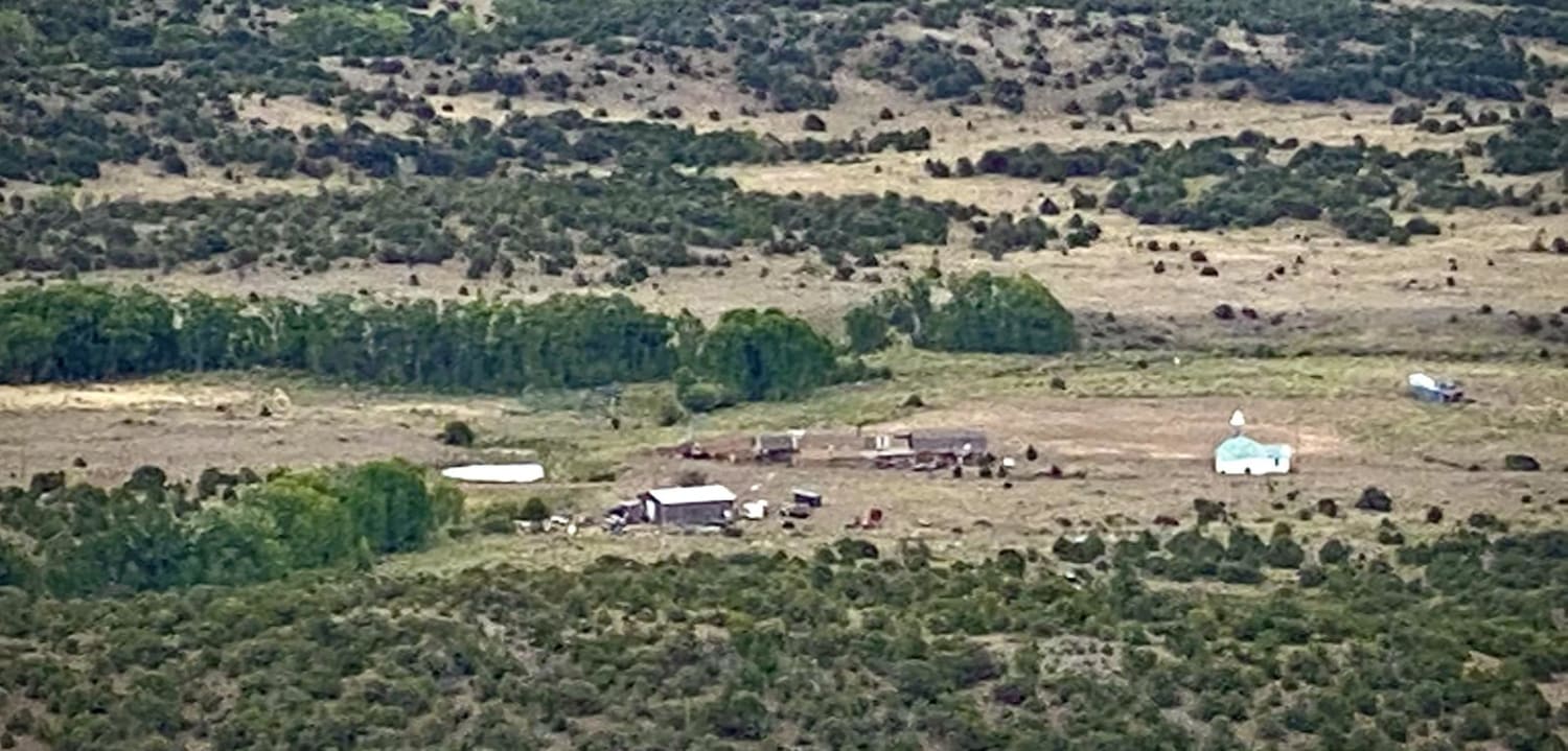
Trail Overview
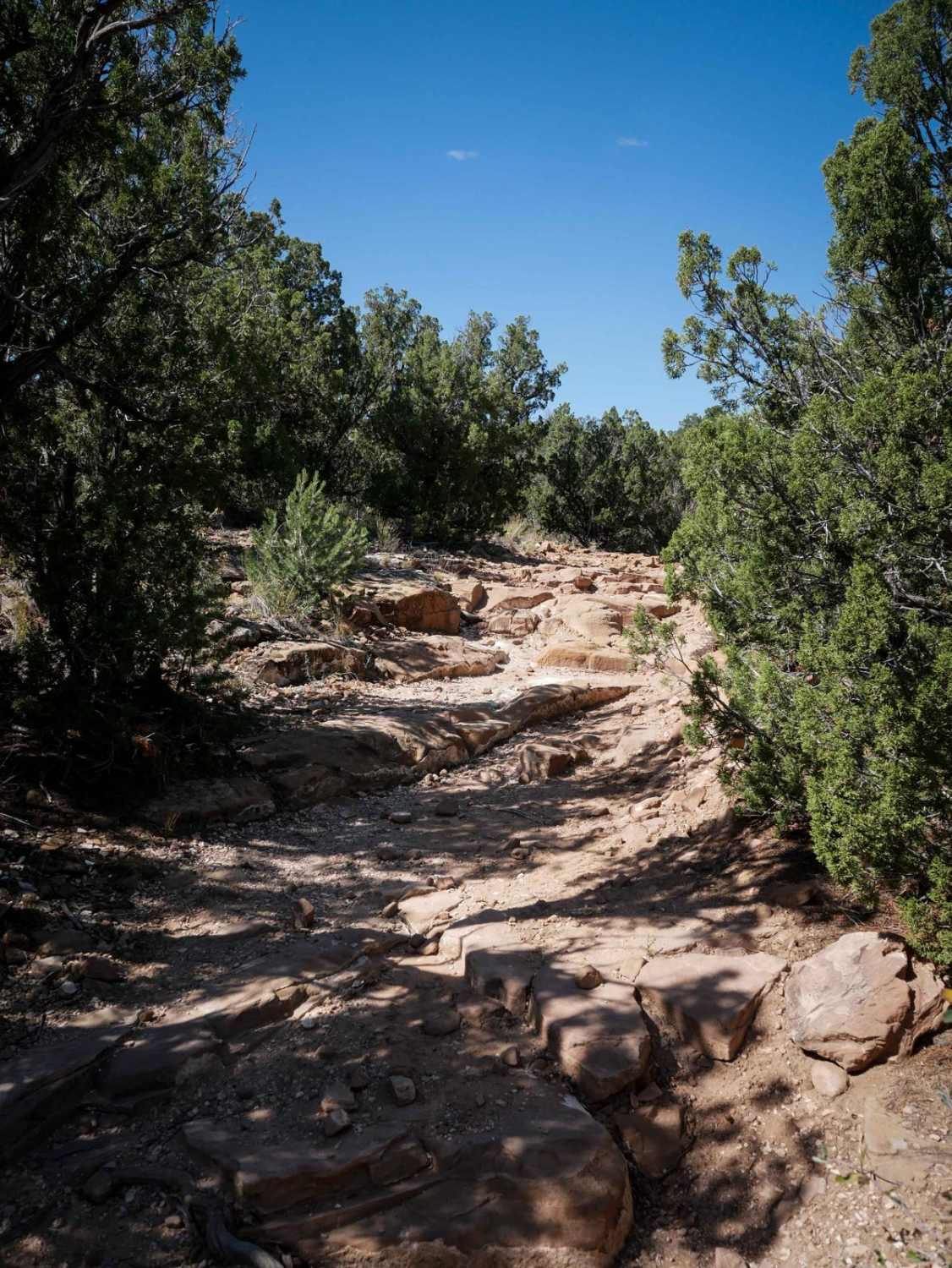
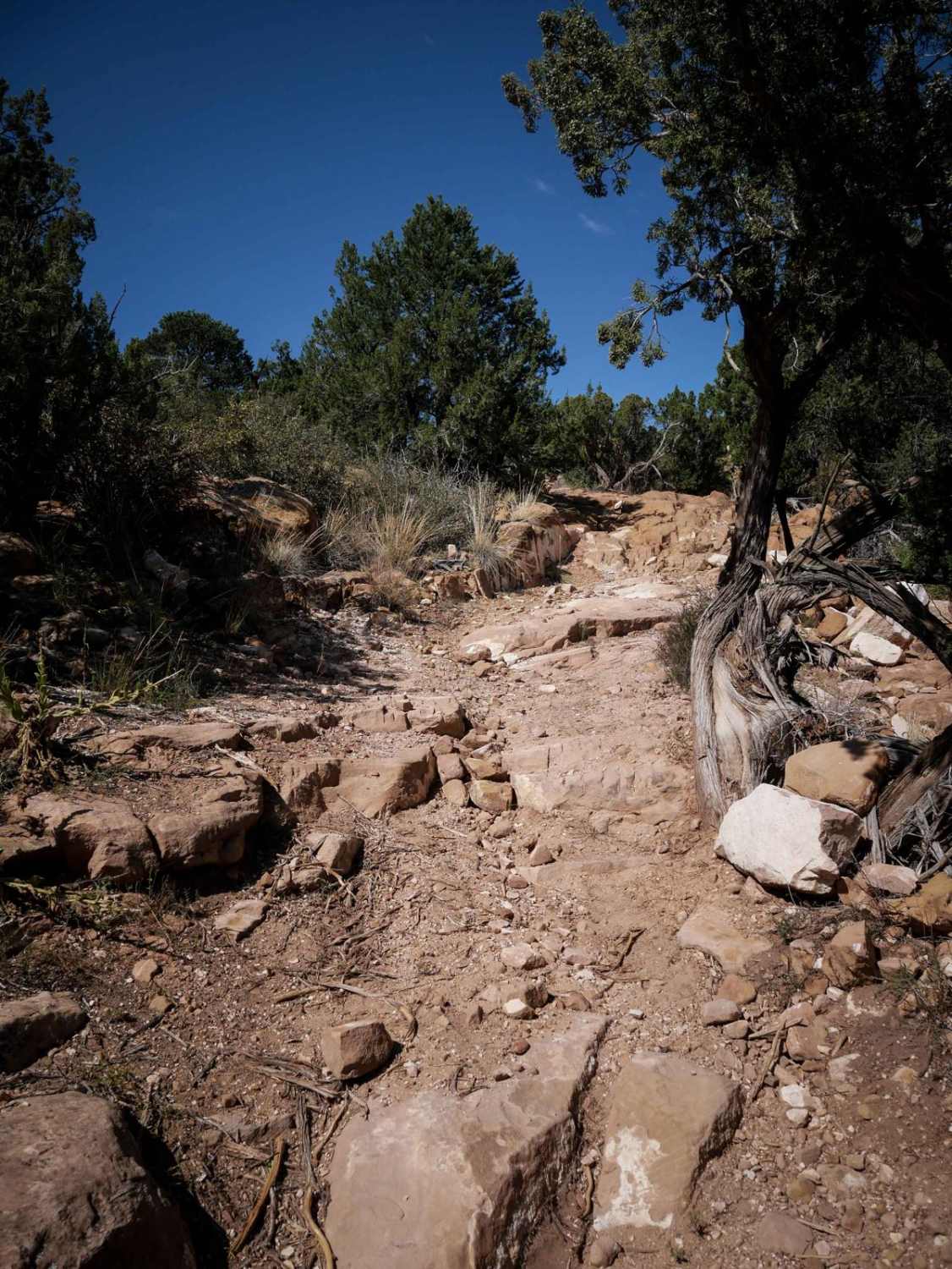
The south end of 6102E starts out as a wide dirt two-track tight between the pinyon pine and comes up to several small 6" rock ledges right away. The rock ledges are like a series of step-ups with a bunch of small ledges in a row. It continues to ride over long layers of slab rock and has several bigger rock features that are more chunky uneven layers of rock diagonally across the trail. There's a right turn at the top of one of the obstacles that's easy to miss. It's kind of a maze up here, so it's helpful to have an offline map. It goes very straight and fast through a grassy meadow, crossing a road that you can take to bail out sooner. There are another couple of rock ledges as you go north that are similar in difficulty and size. It ends on BLM Route 6102h.
Photos of 6102E
Difficulty
This is an intermediate ATV trail as there are 5 or so big rock features within the 0.6-mile distance that are moderately challenging due to their size and shape. It will be a good challenge for ATVs, and a bit easier for dirt bikes that can pick their line better.
Status Reports
6102E can be accessed by the following ride types:
- ATV (50")
- Dirt Bike
6102E Map
Popular Trails
677 Log Jumper ATV Trail
Agua Ramon Mountain - Fr 630
Capitol Creek Road
The onX Offroad Difference
onX Offroad combines trail photos, descriptions, difficulty ratings, width restrictions, seasonality, and more in a user-friendly interface. Available on all devices, with offline access and full compatibility with CarPlay and Android Auto. Discover what you’re missing today!