Dafron Branch Trail
Total Miles
0.8
Technical Rating
Best Time
Spring, Summer, Fall, Winter
Trail Type
Full-Width Road
Accessible By
Trail Overview
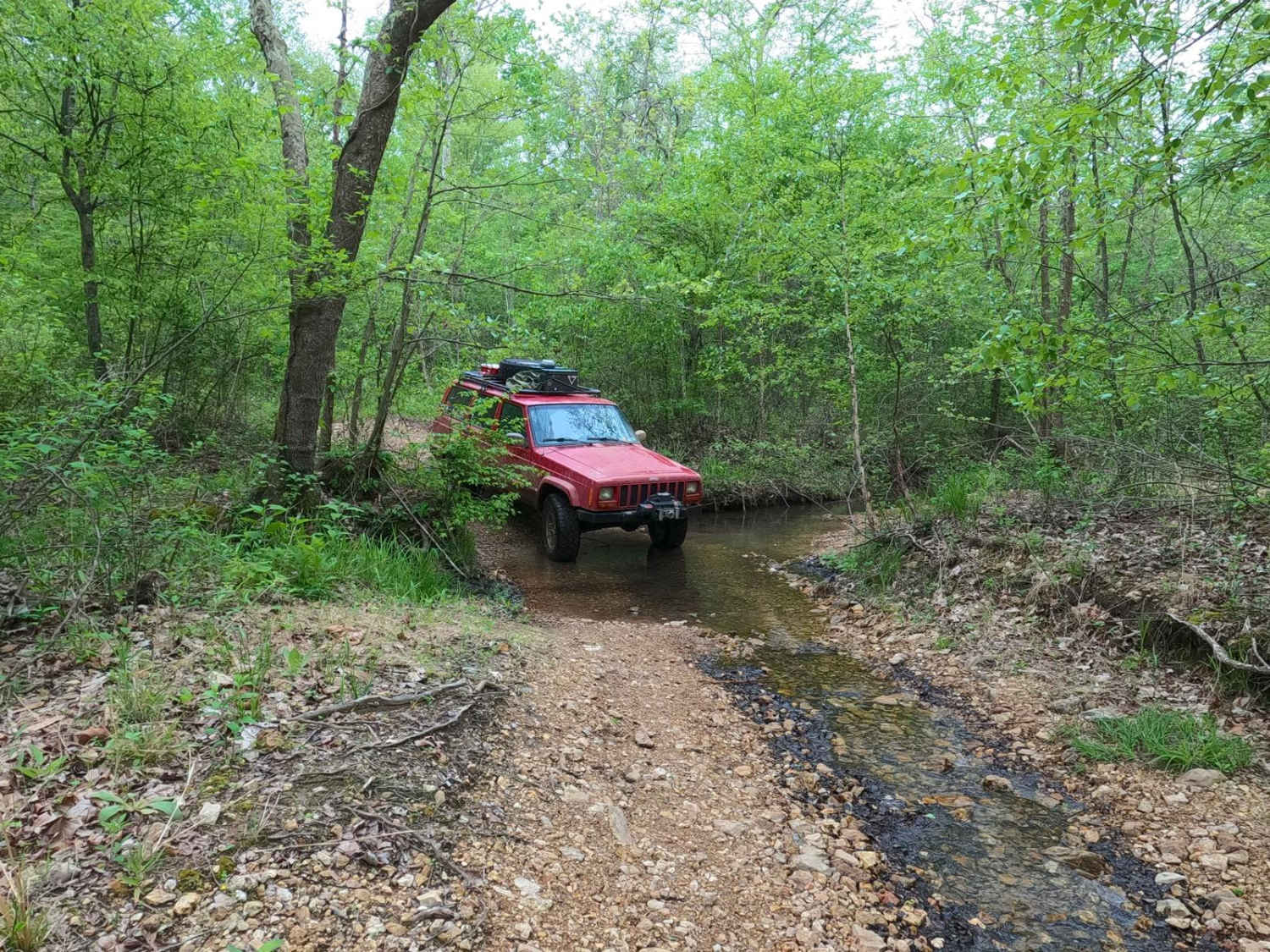
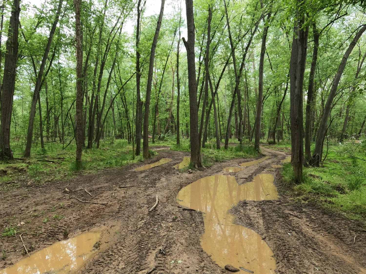
Dafron Branch Trail (Reynolds County Road 462) is a dirt mixed with natural rock trail that transforms into a coarse gravel creek bottom trail, tracking through the center portion of the Black River Bottoms area within the Clearwater Lake U.S. Army Corps of Engineer Land. The trail has a diversity of terrain and conditions, featuring dirt, erosion ruts, scattered trees in the pathway, and natural gravel when dry. When wet, it poses mud, water collection spots, and creek crossings. From the starting point at 37.26562, -90.76740 where it meets the southern end of the Central Bluffs Trail, just north of the Dafron Hollow bluffs, the trail heads east and parallels the nearby Dafron Branch Creek, thus giving its name and being the main source of water and influence in this trail's shape, filling water holes, adding creek rock, erosion, mud, and sand to the trail. Along the western section of the trail are the Rock Block House ruins at 37.26729, -90.76239, an old cellar or a small housing structure along the hillside. After the Rock Block House, the trail slowly gravitates towards a smoother natural dirt and rock mixed road, before passing the Corps Boundary line at 37.27053, -90.75879. Shortly after passing the boundary line, the trail drops into the Dafron Branch creek bottoms and crosses the water at two points, after which the trail turns into a creek rock road to its endpoint where it meets the Singer Road at 37.27233, -90.75756. A fun thrilling trail to use logistically either going in or out (eastward) from the center of the bottoms versus the typically used Spool Ridge Trail (northward) or Dafron Hollow Trail (southward), this definitely will make a rider question and reevaluate the term "county road".
Photos of Dafron Branch Trail
Difficulty
The Dafron Branch Trail features a consistent 3/10 rating through most of the western part of the trail, featuring foot-deep erosion, ruts, water collection spots, and mud holes. The 4/10 given rating comes from the mudholes that have more depth in the western section but is mostly due to the deeper water 12-inch crossings and 18-inch erosion rutting found at the Dafron Branch crossing on the east portion of the trail. When dry, the trail can lessen to a 3/10 difficulty and provide an easier ride, but when wet can also lean even more 4/10 throughout. With enough water present, it will experience extremely difficult changes or even close due to flooding. If the trail's track can't be determined due to water being over the trail, consider it closed, as the terrain underwater would be unpredictable. Be alert of rain in the area and potential flooding, prepare ahead of time, and look up the Annapolis Black River water level gauge. For reference and forecast, 6 feet and up on this gauge is in the Flood Stage. Simply put, the difficulty does fluctuate significantly in wet seasons and heavy rain.
History
The history surrounding the bottoms is one of fighting for public access. This is an example where the presence and public use of Reynolds County Roads 464, 462, 460, 458, 456, 446A, and more have been the driving force keeping these trails open. Locals refuse to let their historic roads be taken away, yielding a place we all can enjoy and use. Please do your part in keeping this place alive; pack it in/pack it out, follow the green and red route markers as marked, and don't drive in the Black River or form new trails.
Status Reports
Dafron Branch Trail can be accessed by the following ride types:
- High-Clearance 4x4
- SUV
- SxS (60")
- ATV (50")
- Dirt Bike
Dafron Branch Trail Map
Popular Trails

Yellow 332

Yellow 169

The onX Offroad Difference
onX Offroad combines trail photos, descriptions, difficulty ratings, width restrictions, seasonality, and more in a user-friendly interface. Available on all devices, with offline access and full compatibility with CarPlay and Android Auto. Discover what you’re missing today!