Funk Branch Delta
Total Miles
0.5
Elevation
166.67 ft
Duration
0.25 Hours
Technical Rating
Best Time
Spring, Summer, Fall, Winter
Trail Overview
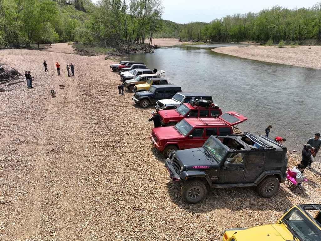
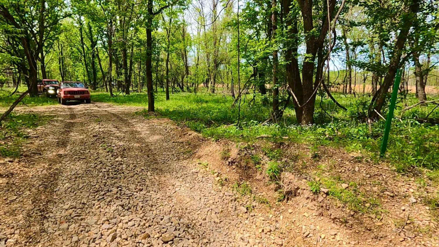
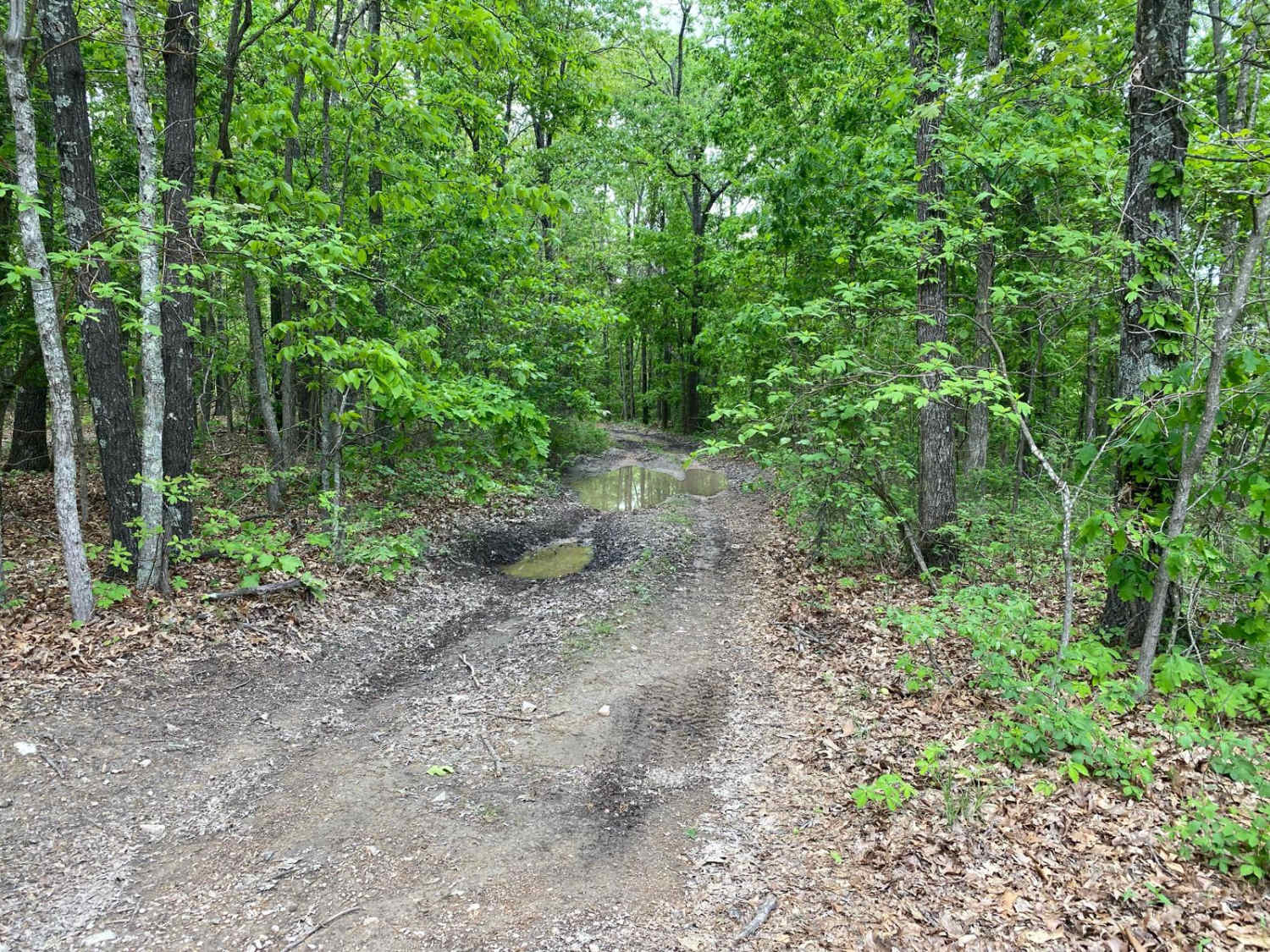
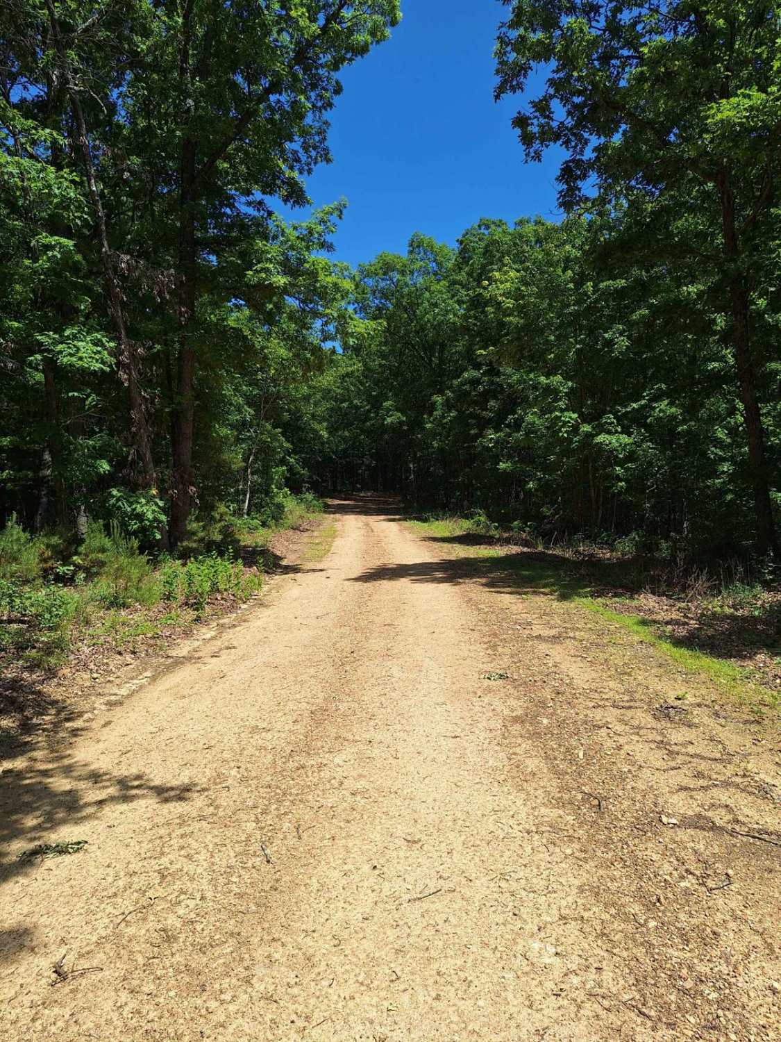
Funk Branch Delta Trail, or Funk Shore Access, is a coarse creek gravel and dirt/mud trail through the northern portion of the Black River Bottoms area within the Clearwater Lake U.S. Army Corps of Engineer Land. The trail is an in/out track that features an entry point off the creek bottom section of Hackworth Hollow Trail at 37.29418, -90.76902. The trail first heads west, navigating groomed treelines on a dirt and rock trail with the potential for water holes and mud, before meeting the open Black River shoreline at 37.29387, -90.77146. Here, the trail becomes predominantly creek/river gravel and heads south anywhere between the west treelines to the water's edge. This riverside portion of the trail features a small bar on the north end, then narrows at another small treeline separating the river and trail to open up again to the larger southern gravel bar, ending at the Funk Branch and Black River delta at the trail's southern endpoint, 37.28956, -90.77038. At the Funk Branch, you can see some scenic bluffs and small caves in the hillside. This is also where the trail used to track and loop back to the Hackworth Hollow Trail via the Funk Branch creek bottom but has since been closed via red markers in the winter of 2023/2024. It is now required to turn around and go out the way you came. This trail is locally loved and historic, and is worthy to know about when wanting to stop for lunch, a swim break, a full day in/along the water, or a spot to pitch camp for the night, with the Black River whispering by in the background on any occasion. Be mindful of when the area is at flood stage, which is 6-foot and higher water level on the Annapolis Black River level gauge. Above this mark will yield flooding, shrinking the trail as the Black River begins to overflow past its normal shorelines and claim the gravel bars. Don't enter the water, as it is illegal to do so and unpredictable.
Photos of Funk Branch Delta
Difficulty
The Funk Branch Delta Trail can have a spread of terrain depending on the season. At its easiest, it can be dried out and rated at 2/10, only having small unpacked creek gravel mounds on the gravel bars and short whoops in the treeline section of the trail. The given 3/10 rating comes from the average state between dry and wet conditions. With average rain, rainwater comes downhill into the bottoms, the water holes fill with up to a foot of water, and dirt turns to surface mud. In heavier rains and flooding, the river unpacks and rearranges the gravel bars to have newly formed sudden mounds, dips, and dives up to a foot tall or deeper, with the potential of taller dune-like creek gravel mounds to crawl over. Just enough momentum is key to keep moving forward. There is also the potential of flash flooding. For reference, the trail should be still completely open when the Annapolis water level gauge is reading at under 6 feet. With a flash flood event, the river can increase several feet in minutes, putting water over the trail and yielding extreme rating changes. If any flood water is over the trail, it is best to consider it closed as it would be unpredictable. Be prepared ahead of time and look up the Annapolis Black River water level gauge; for reference and forecast, 6 feet and up on this gauge is in Flood Stage. Simply put, the difficulty does fluctuate significantly in wet seasons and heavy rain.
History
The history surrounding the bottoms is one of fighting for public access. This is an example where the presence and public use of Reynolds County Roads 464, 462, 460, 458, 456, 446A, and more have been the driving force keeping these trails open. Locals refuse to let their historic roads be taken away, yielding a place we all can enjoy and use. Please do your part in keeping this place alive; pack it in/pack it out, follow the green and red route markers as marked, and don't drive in the Black River or form new trails.
Status Reports
Popular Trails

Black Mamba
Bollinger Mill Road
Miller Chapel FSR 2501
The onX Offroad Difference
onX Offroad combines trail photos, descriptions, difficulty ratings, width restrictions, seasonality, and more in a user-friendly interface. Available on all devices, with offline access and full compatibility with CarPlay and Android Auto. Discover what you’re missing today!