South Riverside
Total Miles
1.3
Technical Rating
Best Time
Spring, Summer, Fall, Winter
Trail Type
Full-Width Road
Accessible By
Trail Overview
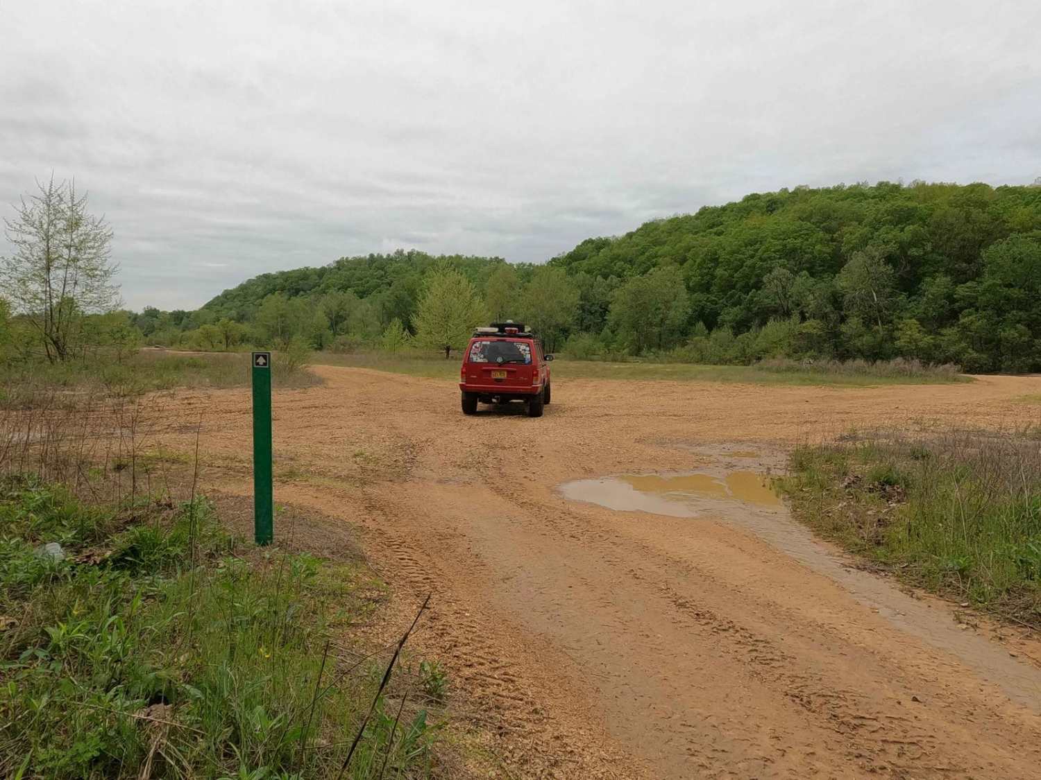
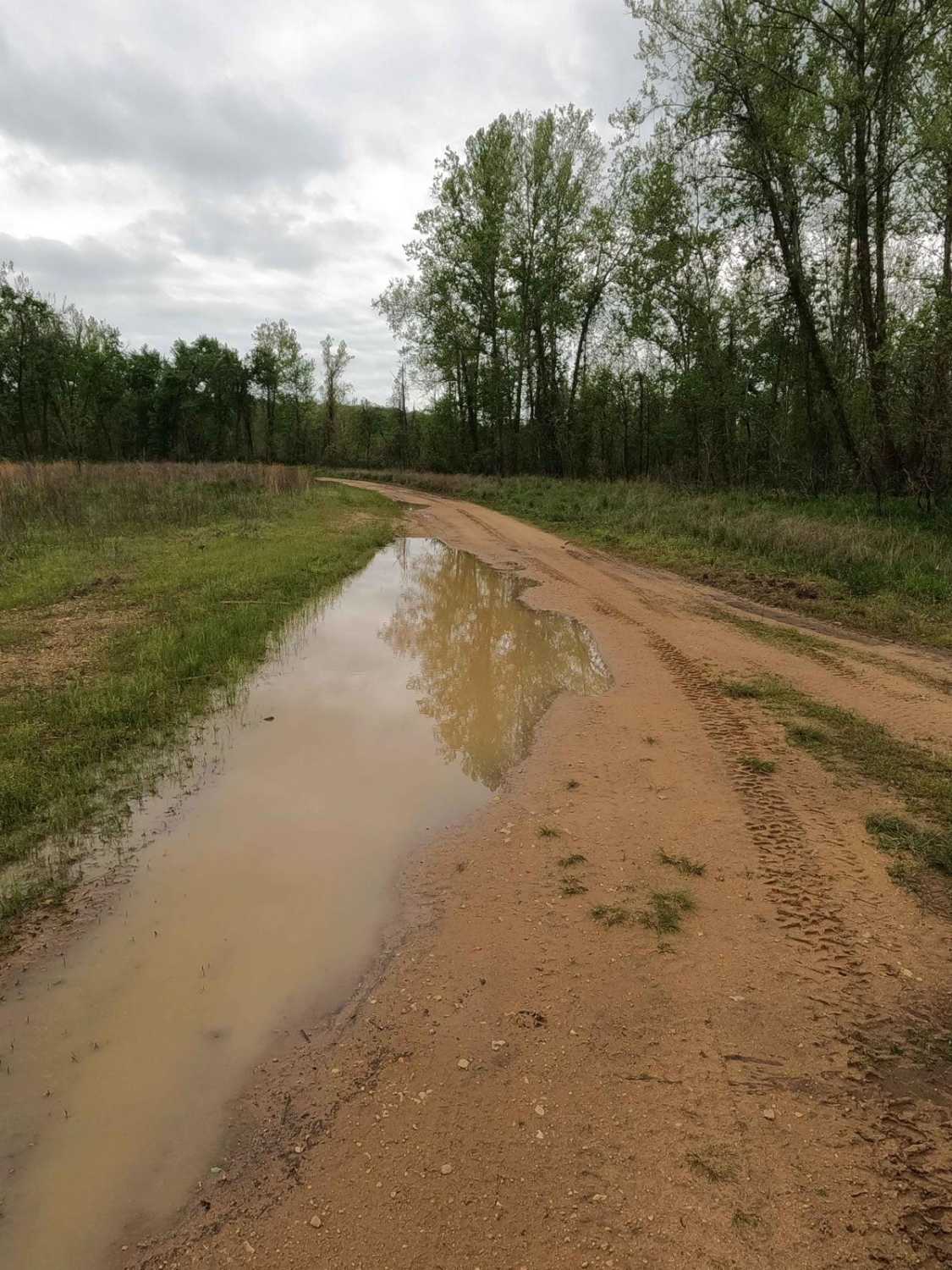
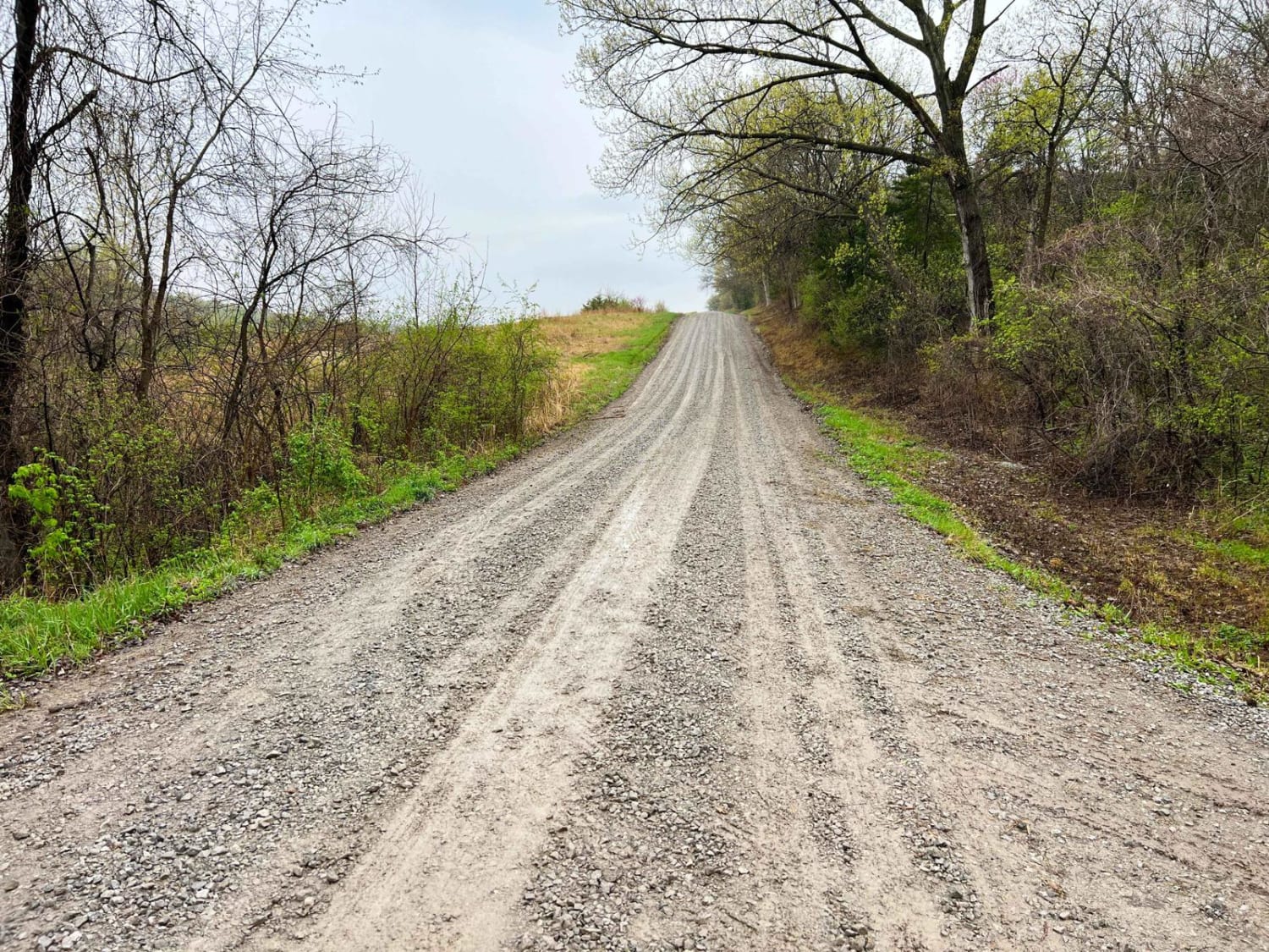
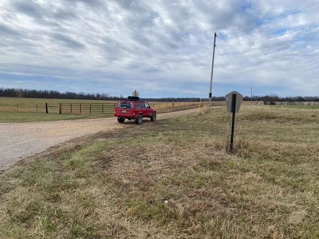
South Riverside Trail is a natural dirt, mud, sand, and small rock trail through the southern portion of the Black River Bottoms area within the Clearwater Lake U.S. Army Corps of Engineer Land. The name "South Riverside Trail" is due to the proximity to the Black River, being within feet of the water in several spots, but compared to the North Riverside, it has more of an inland swamp feel. Despite not being right on the shoreline, there is still a great influence of water, yielding swampy deep mudholes and water collection holes, with rocky gravel bars and tight treeline sections to add diversity. To add more distinction from the North Riverside Trail, the South Riverside is a lasso route, being an in-and-out trail with a loop. It has a wooded inland portion that loops into a riverside section on the gravel bars. The trail starts from the intersection with the North Riverside and Well Hollow trails heading south to the intersection where the loop begins at 37.25130, -90.77158. At this loop, the trail can be driven both ways but is a one-car-width track in several spots--watch for other vehicles. Note that several gravel bar access trails come off the main trail to add to the exploration depth of this area, such as the one at 37.25346, -90.77009. The rule of thumb of the area as a whole is the same here: don't drive in the direct Black River water, follow the green and red markers the Corps puts out, and it will show the sanctioned path to the Bottoms. only cross water at the obvious and sanctioned points; don't create new or modify trails and watch for major flooding in the area. If it is flooding, don't enter the water, as the terrain and depth would become unpredictable. This trail is geographically and legally as far as you can go south in the Riverside Depths of the Black River Bottoms, a network of trails that will test a driver's discernment and the rig's capabilities in mud, muck, and silty sand amongst the riverside wetlands.
Photos of South Riverside
Difficulty
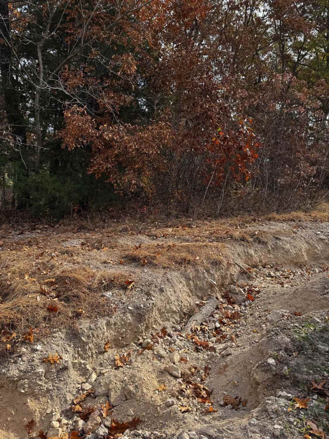
The South Riverside is given a 5/10 base rating due to the featured 2-foot-deep plus mudholes and water collection holes, some being hard-bottomed and some being soft. Momentum is key in the muddy sections, as some holes have steep drop-offs or deep ruts that will suddenly add even more depth to a hole than what was originally expected or even probed. Other terrain includes loose coarse rock and sand collection spots at the gravel bars sections of the trail. In heavier rains and flooding, the river unpacks and rearranges the gravel bars to have newly formed sudden mounds, dips, and dives up to 2 feet tall or deeper, with the potential of taller dune-like creek gravel mounds to crawl over. Just enough momentum is key to keep moving forward. There is also the potential of flash flooding. For reference, the trail should be still completely open when the Annapolis water level gauge is reading at under 6 feet. With a flash flood event, the river can increase several feet in minutes, putting water over the trail and yielding extreme rating changes. If any flood water is over the trail, it is best to consider it closed as it would be unpredictable. Be prepared ahead of time and look up the Annapolis Black River water level gauge; for reference and forecast, 6 feet and up on this gauge is in Flood Stage. Simply put, difficulty does fluctuate significantly in wet seasons and heavy rain, and only in severely dry seasons would the trail ever see a drop in difficulty, with the holes lacking water, yet still being soft below the surface due to proximity to the river.
History
The history surrounding the bottoms is one of fighting for public access. This is an example where the presence and public use of Reynolds County Roads 464, 462, 460, 458, 456, 446A, and more have been the driving force keeping these trails open. Locals refuse to let their historic roads be taken away, yielding a place we all can enjoy and use. Please do your part in keeping this place alive; pack it in/pack it out, follow the green and red route markers as marked, and don't drive in the Black River or form new trails.
South Riverside can be accessed by the following ride types:
- High-Clearance 4x4
- SUV
- SxS (60")
- ATV (50")
- Dirt Bike
South Riverside Map
Popular Trails

LOTO Racetrack
Monkey Mountain
Bird Loop
Whitewater Presbyterian Church Road
The onX Offroad Difference
onX Offroad combines trail photos, descriptions, difficulty ratings, width restrictions, seasonality, and more in a user-friendly interface. Available on all devices, with offline access and full compatibility with CarPlay and Android Auto. Discover what you’re missing today!