Rug Road to Klondyke
Total Miles
59.4
Elevation
1,648.61 ft
Duration
8 Hours
Technical Rating
Best Time
Summer, Fall
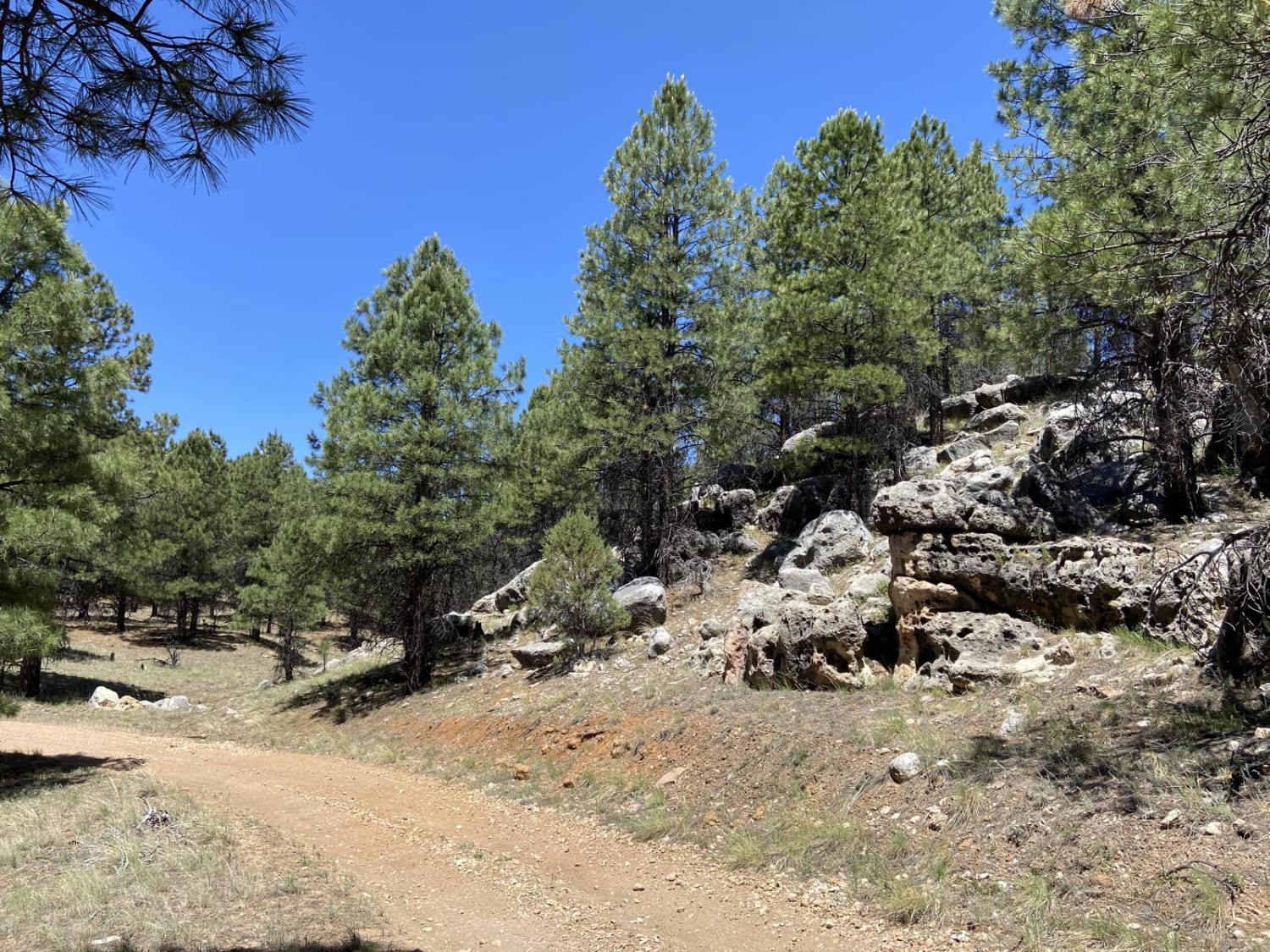
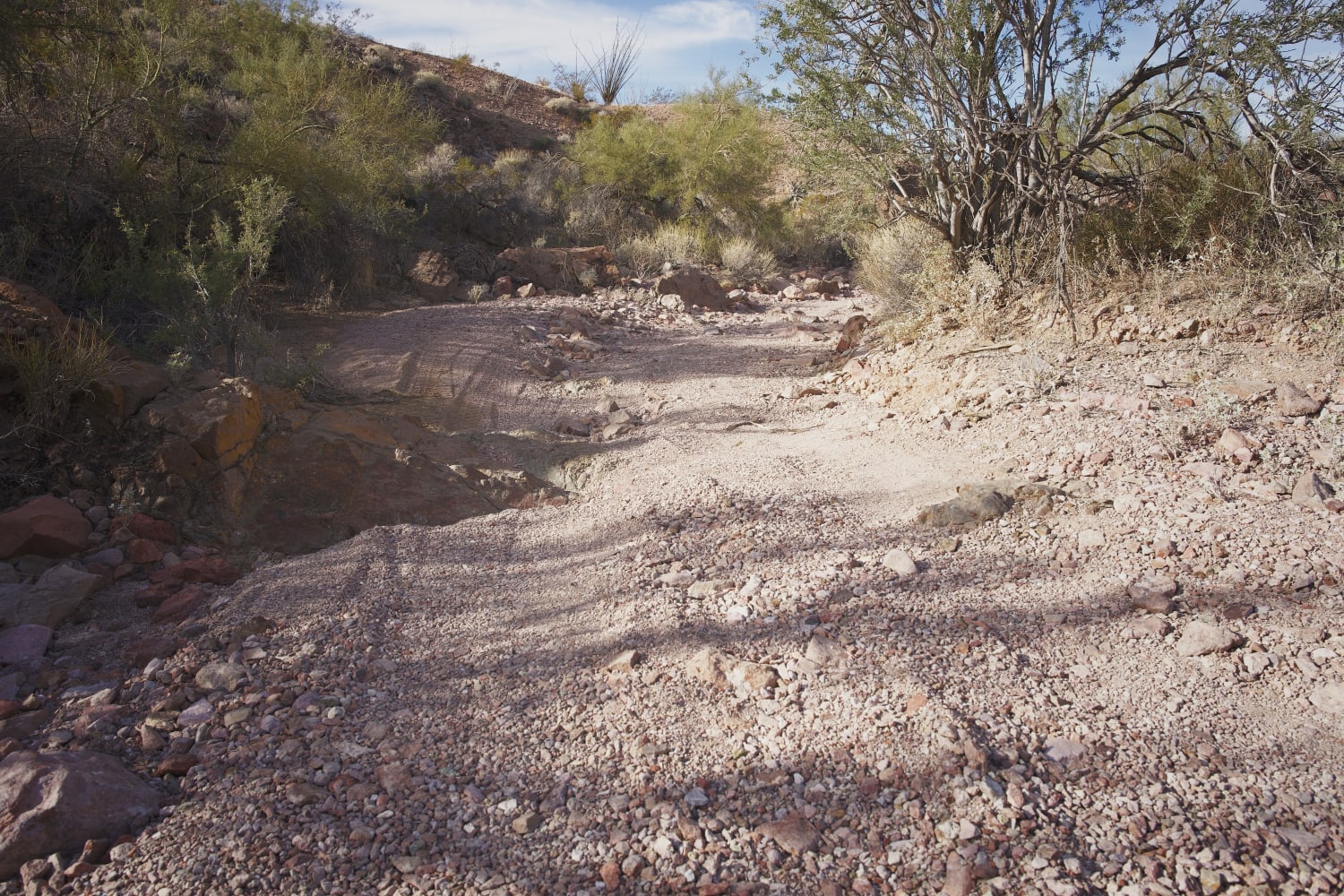
Trail Overview
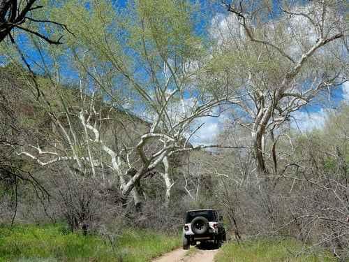
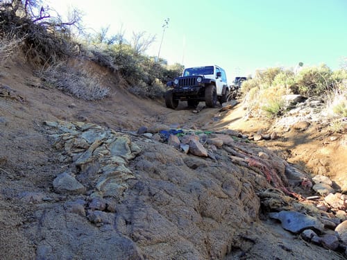
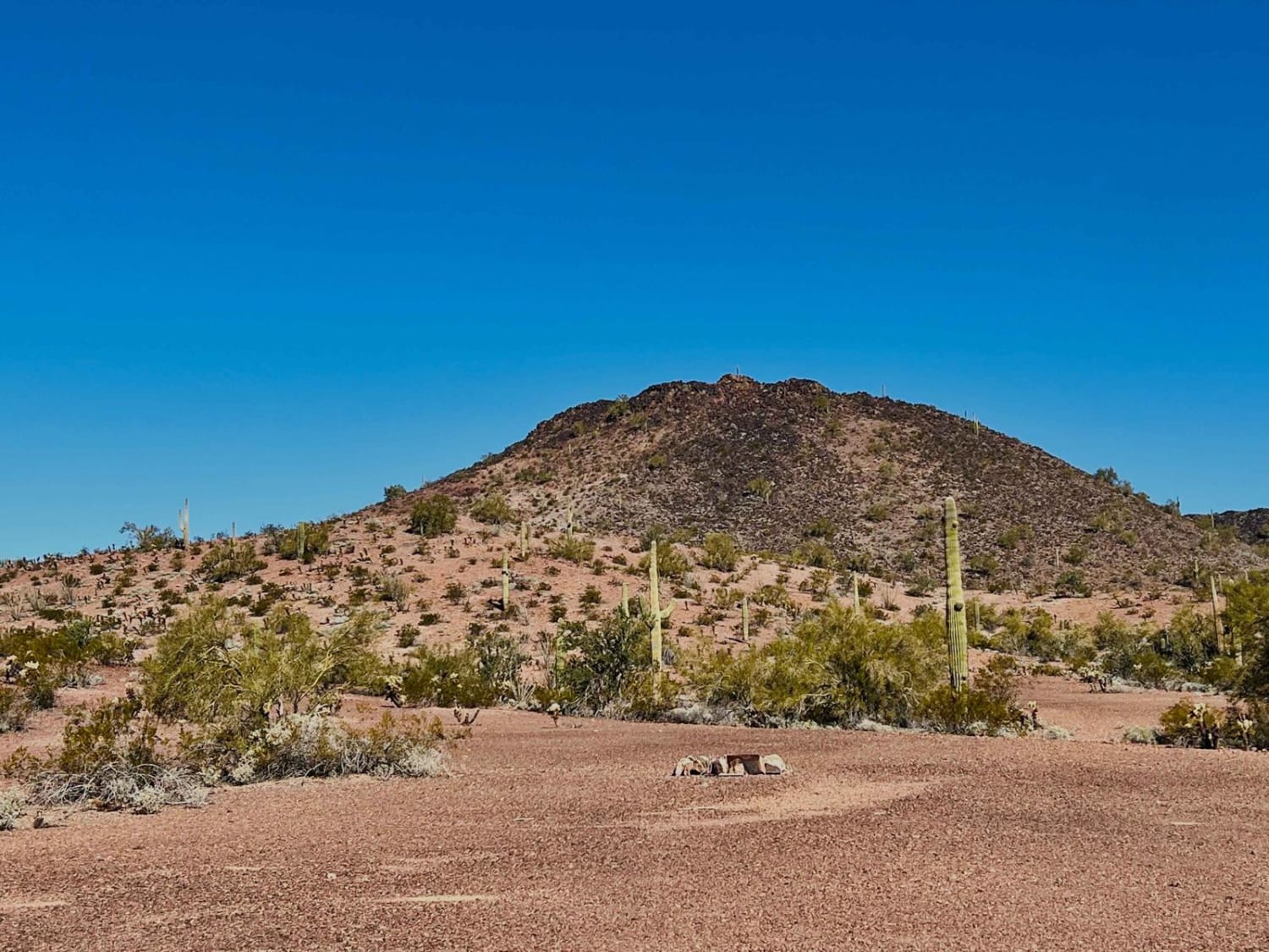
Rug Road is a 4x4 trail that begins in Mammoth, traverses the famous "Carpet Hill" and then climbs to Table Mountain Pass in the Zapata Mountains. It then drops down into the Aravaipa watershed, passes through Klondyke, and then either east to Fort Thomas on US 70 (this track) or south to Willcox on I-10. Carpet Hill, wild horses, a cliff dwelling, and great scenery. Legend has it the road was first built to service the Salazar Ranch. Old man Salazar was driving back and forth to Mammoth regularly in his 2WD pickup in the early 1950s and got nervous about the way the road was eroding. So he went down to Tucson and gathered a truckload of old carpet remnants. On his way back home he stuffed those remnants into rough spots along the road to smooth out the road, give him better traction and slow down the damage from erosion. That part of the road is now known as "Carpet Hill," and it's a nasty, loose-rock, deeply rutted, steep slope that rises 650 feet in about 3/4 of a mile. This trail can be driven in either direction but is described here as starting in Mammoth. The initial 8 miles follow the Copper Creek Road, a wide graded road. Carpet Hill is about 4 miles after turning off Copper Creek Road. Carpet Hill is easiest if traveled downhill (south to north) because gravity will take you over ledges and boulders. We rate this direction a strong 6. Uphill is rated 7. The 12 miles from the bottom of Carpet Hill to Turkey Creek is a grueling stretch of road with a strong 5 rating. It is almost continuous rocks and ledges that never give you a break. Plan on this 12 miles taking between 5 and 6 hours, and that is only to Turkey Creek. In spite of that! - it is a very scenic trip with several points of interest. You may even see wild horses.Travel over Table Mountain Pass and drop down to Table Mountain Mine. Remnants of the Table Mountain Mine office are along the main trail. Rumor has it that the safe was blown open.Most people will turn around here, go back over Table Mountain Pass and then take the mostly graded Carpet Hill Bypass (Cowboy Miller Road) back to Mammoth. This will be a full day and will get you back to civilization for dinner.If you want to do the remainder of the trail we strongly suggest you do it another day by skipping Carpet Hill and beginning your trip on Carpet Hill Bypass. This thru run to Fort Thomas will take most people 8-9 hours, plus time to and from the trip. Nice camping spots are available in Turkey Creek to make it a 2-day expedition.Turkey Creek drains into Aravaipa Creek. You will be in and out of Aravaipa creek for several miles before climbing out to an even better-graded road that will take you through Klondyke to your final destination. We ended our trip on US 70 near Fort Thomas, but you can also turn south and end at Willcox on I-10.
Photos of Rug Road to Klondyke
Difficulty
Off-camber trail with deep holes and large rocks that may exceed axle height. Expect erosion, loose rocks, sand, washes, shelves, and deep mud holes. Obstacles and ledges up to 6 feet, and near-vertical grades 12-14 feet tall. Potential for deep water crossings with strong currents. Caution: Vehicle damage and roll-overs are very possible.
Popular Trails
Squeeze Me Gently
Fancher Mine Loop
Water Draw Loop
King Road to Pipeline
The onX Offroad Difference
onX Offroad combines trail photos, descriptions, difficulty ratings, width restrictions, seasonality, and more in a user-friendly interface. Available on all devices, with offline access and full compatibility with CarPlay and Android Auto. Discover what you’re missing today!