Off-Road Trails in Florida

Discover off-road trails in Florida
Trail Length
Best Time of Year
Sort By
We can’t find any trails
Learn more about Blackwater North Bypass Route

Blackwater North Bypass Route
Total Miles
3.1
Tech Rating
Moderate
Best Time
Spring, Summer, Fall, Winter
Learn more about Blackwater River Route 1
Blackwater River Route 1
Total Miles
19.2
Tech Rating
Moderate
Best Time
Spring, Summer, Fall, Winter
Learn more about Blackwater River Route 2
Blackwater River Route 2
Total Miles
10.7
Tech Rating
Easy
Best Time
Spring, Summer, Fall, Winter
Learn more about Blue Horse Trail - Osceola NF 232

Blue Horse Trail - Osceola NF 232
Total Miles
5.1
Tech Rating
Easy
Best Time
Spring, Fall, Winter
Learn more about Blue Trail

Blue Trail
Total Miles
7.1
Tech Rating
Moderate
Best Time
Winter, Fall, Spring
Learn more about Bluff Landing Loop

Bluff Landing Loop
Total Miles
2.6
Tech Rating
Easy
Best Time
Summer, Fall
Learn more about Boundary Road

Boundary Road
Total Miles
7.4
Tech Rating
Easy
Best Time
Spring, Fall, Winter
Learn more about Boundary Trail

Boundary Trail
Total Miles
6.7
Tech Rating
Difficult
Best Time
Winter
Learn more about Buck Siding Road
Buck Siding Road
Total Miles
17.1
Tech Rating
Moderate
Best Time
Spring, Fall, Winter
Learn more about Burned Out Bridge Road

Burned Out Bridge Road
Total Miles
4.2
Tech Rating
Easy
Best Time
Spring, Summer, Fall, Winter
Learn more about Burnt Bridge Road

Burnt Bridge Road
Total Miles
11.4
Tech Rating
Easy
Best Time
Spring, Fall, Winter
Learn more about Burnt Island Loop

Burnt Island Loop
Total Miles
2.6
Tech Rating
Moderate
Best Time
Fall, Winter, Spring
Learn more about Burnt Island Trail
Burnt Island Trail
Total Miles
2.4
Tech Rating
Easy
Best Time
Spring, Fall, Winter
Learn more about Camp Loop Road

Camp Loop Road
Total Miles
3.6
Tech Rating
Easy
Best Time
Spring, Fall, Winter
Learn more about Cary State Forest - Cary Tract
Cary State Forest - Cary Tract
Total Miles
6.1
Tech Rating
Easy
Best Time
Spring, Summer
Learn more about Cary State Forest - Thomas Creek Tract
Cary State Forest - Thomas Creek Tract
Total Miles
4.8
Tech Rating
Easy
Best Time
Spring, Summer
Learn more about Catface Swamp Road - North
Catface Swamp Road - North
Total Miles
0.8
Tech Rating
Easy
Best Time
Spring, Summer, Fall, Winter
Learn more about Centennial Trail - ONF 14-9.8

Centennial Trail - ONF 14-9.8
Total Miles
7.3
Tech Rating
Moderate
Best Time
Spring, Fall, Winter
Learn more about Church Grade Trail - Osceola NF 237

Church Grade Trail - Osceola NF 237
Total Miles
6.5
Tech Rating
Moderate
Best Time
Spring, Fall, Winter
Learn more about Citrus Wildlife Management | 11B
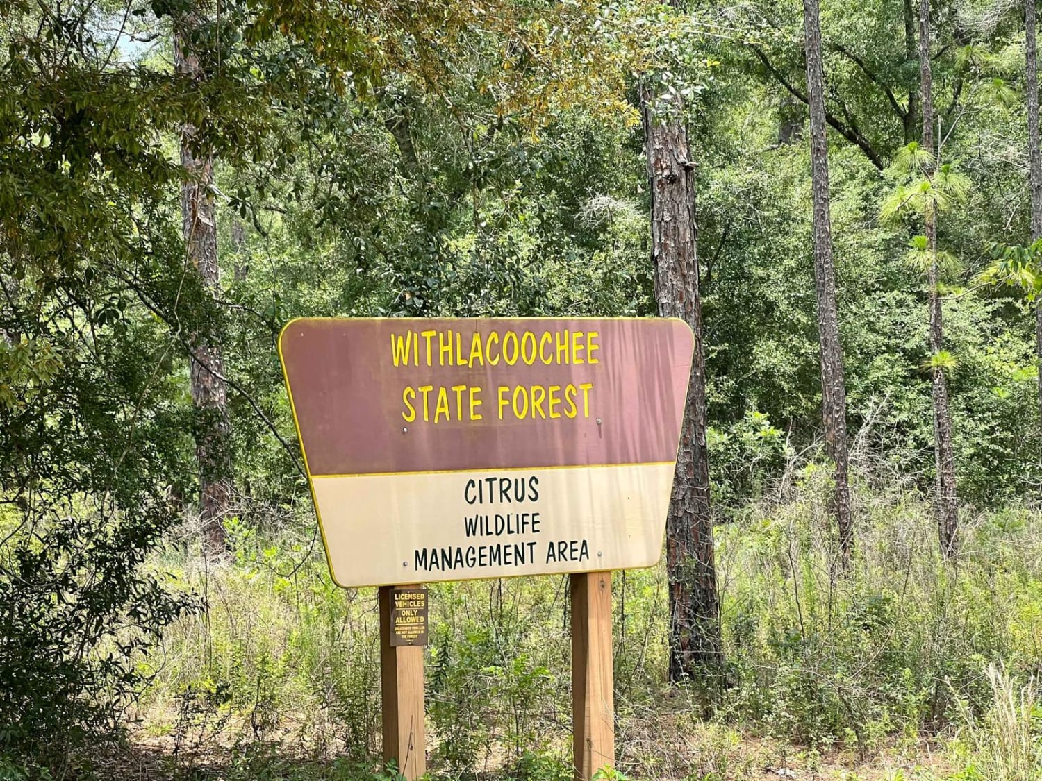
Citrus Wildlife Management | 11B
Total Miles
2.6
Tech Rating
Easy
Best Time
Summer, Spring, Fall, Winter
The onX Offroad Difference
onX Offroad combines trail photos, descriptions, difficulty ratings, width restrictions, seasonality, and more in a user-friendly interface. Available on all devices, with offline access and full compatibility with CarPlay and Android Auto. Discover what you’re missing today!