Off-Road Trails in California

Discover off-road trails in California
Trail Length
Best Time of Year
Sort By
We can’t find any trails
Learn more about Tobacco Flats

Tobacco Flats
Total Miles
3.4
Tech Rating
Easy
Best Time
Spring, Fall, Summer
Learn more about Tolumne Road/120 Bypass

Tolumne Road/120 Bypass
Total Miles
5.0
Tech Rating
Easy
Best Time
Summer, Fall
Learn more about Trail 1 Georgetown OHV
Trail 1 Georgetown OHV
Total Miles
15.5
Tech Rating
Moderate
Best Time
Fall, Spring
Learn more about Trail 30
Trail 30
Total Miles
8.2
Tech Rating
Difficult
Best Time
Spring, Fall, Winter
Learn more about Trail 71
Trail 71
Total Miles
1.8
Tech Rating
Difficult
Best Time
Spring, Fall, Winter
Learn more about Trans-Ocotillo Connector
Trans-Ocotillo Connector
Total Miles
6.3
Tech Rating
Easy
Best Time
Winter
Learn more about Trona Pinnacles Scenic Loop East (Easy)
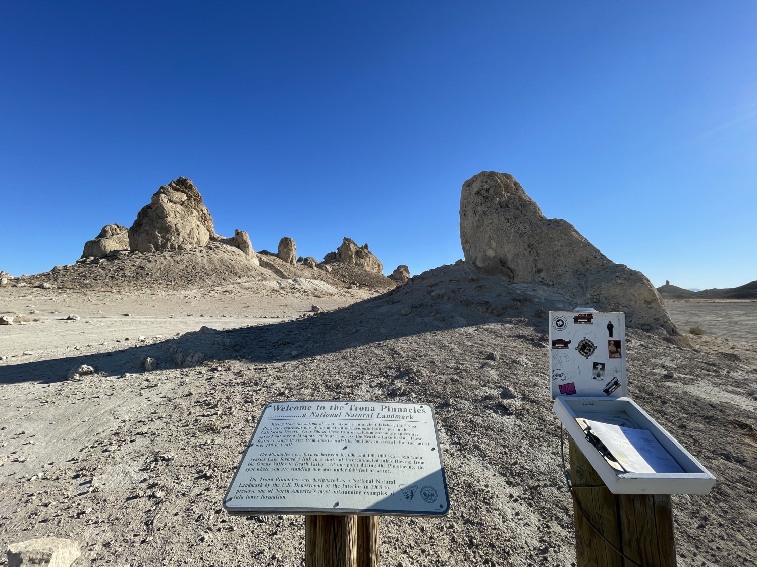
Trona Pinnacles Scenic Loop East (Easy)
Total Miles
1.8
Tech Rating
Easy
Best Time
Spring, Fall, Winter
Learn more about Trona Pinnacles Scenic Route West

Trona Pinnacles Scenic Route West
Total Miles
1.1
Tech Rating
Easy
Best Time
Spring, Fall, Winter
Learn more about Trona Road to Randsburg Wash Road
Trona Road to Randsburg Wash Road
Total Miles
9.5
Tech Rating
Moderate
Best Time
Winter, Fall, Spring
Learn more about Trout Creek
Trout Creek
Total Miles
3.0
Tech Rating
Easy
Best Time
Spring, Summer, Fall
Learn more about Trout Creek Trail

Trout Creek Trail
Total Miles
4.3
Tech Rating
Moderate
Best Time
Summer
Learn more about Truckhaven Trail
Truckhaven Trail
Total Miles
2.7
Tech Rating
Easy
Best Time
Spring, Summer, Fall, Winter
Learn more about Truckhaven Trail Side Loop

Truckhaven Trail Side Loop
Total Miles
1.9
Tech Rating
Easy
Best Time
Spring, Fall, Winter
Learn more about Trumbull Peak
Trumbull Peak
Total Miles
18.5
Tech Rating
Easy
Best Time
Spring, Summer, Fall
Learn more about Tule Divide
Tule Divide
Total Miles
14.0
Tech Rating
Easy
Best Time
Spring, Summer, Fall, Winter
Learn more about Tule Wash

Tule Wash
Total Miles
13.1
Tech Rating
Easy
Best Time
Spring, Fall, Winter, Summer
Learn more about Tumco Townsite Loop
Tumco Townsite Loop
Total Miles
2.8
Tech Rating
Moderate
Best Time
Spring
Learn more about Turkey Claw
Turkey Claw
Total Miles
0.5
Tech Rating
Difficult
Best Time
Spring, Summer, Fall, Winter
Learn more about Turtle Mountain Road
Turtle Mountain Road
Total Miles
10.0
Tech Rating
Easy
Best Time
Spring, Fall
The onX Offroad Difference
onX Offroad combines trail photos, descriptions, difficulty ratings, width restrictions, seasonality, and more in a user-friendly interface. Available on all devices, with offline access and full compatibility with CarPlay and Android Auto. Discover what you’re missing today!